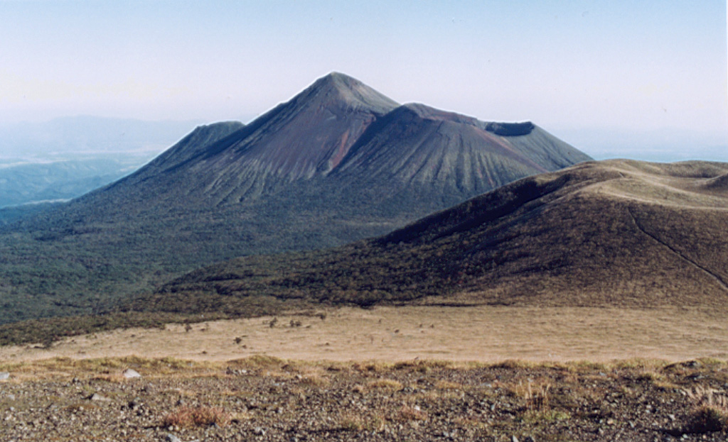
Aira (Japan) | 27 August-2 September 2025 | Continuing Activity Cite this Report Cite this Report |
 Aira Aira
Ryukyu Volcanic Arc
|
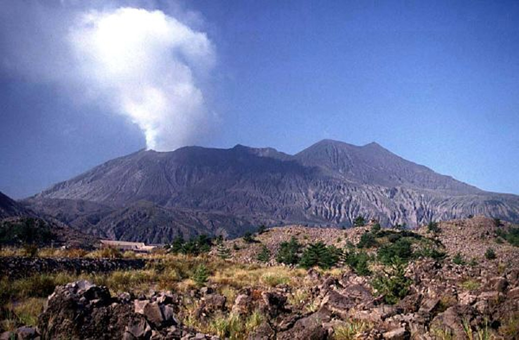
The Japan Meteorological Agency (JMA) reported ongoing eruptive activity at Minamidake Crater (Aira Caldera’s Sakurajima volcano) during 26 August-2 September. Nightly crater incandescence was visible in webcam images. There were 10 eruptive events recorded during 26-30 August that produced either discrete ash-and-gas plumes or periods of continuous ash-and-gas emissions. Ash plumes from the events rose as high as 2.4 km above the crater rim and drifted in multiple directions. Periods of continuous emissions occurred during 1602-1715 and 1917-2045 on 27 August, from 2256 on 28 August to 0430 on 29 August, and during 1300-1437, 1522-1730, and 1825-2125 on 30 August. The Alert Level remained at 3 (on a 5-level scale), and the public was warned to be cautious within 2 km of both the Minimadake and Showa craters.
Source: Japan Meteorological Agency (JMA)
|
Ambae (Vanuatu) | 27 August-2 September 2025 | Continuing ActivityCite this Report |
 Ambae Ambae
Vanuatu Volcanic Arc
|
The Vanuatu Meteorology and Geohazards Department (VMGD) reported ongoing unrest at Ambae during the month of August based on seismic and satellite data, webcam images, and field observations. Sulfur dioxide emissions were identified in satellite images during 1, 3-9, 11-14, and 16-25 August. A low-level thermal anomaly was also detected in satellite images during 3, 7, 9-11, 13, and 16 August. Steam and/or gas emissions were visible in satellite and webcam observations during 5, 10-11, and 15 August. The Alert Level remained at 2 (on a scale of 0-5), and the public was warned to stay outside of Danger Zone A, defined as a 2-km radius around the active vents in Lake Voui, and to stay away from drainages during heavy rains.
Source: Vanuatu Meteorology and Geohazards Department (VMGD)
|
Ambrym (Vanuatu) | 27 August-2 September 2025 | Continuing ActivityCite this Report |
 Ambrym Ambrym
Vanuatu Volcanic Arc
|
The Vanuatu Meteorology and Geohazards Department (VMGD) reported ongoing unrest at Ambrym during August. A weak thermal anomaly was detected in satellite images on 2 August. Steam emissions rising from Marum Crater on 5 August were reported based on field observations and webcam images. Seismic data confirmed ongoing unrest. The Alert Level remained at 2 (on a scale of 0-5). VMGD warned the public to stay outside of Permanent Danger Zone A, defined as a 1-km radius around Benbow Crater and a 2-km radius around Marum Crater, and to stay 500 m away from the ground cracks created by the December 2018 eruption.
Source: Vanuatu Meteorology and Geohazards Department (VMGD)
|
Dukono (Indonesia) | 27 August-2 September 2025 | Continuing ActivityCite this Report |
 Dukono Dukono
Halmahera Volcanic Arc
|
The Pusat Vulkanologi dan Mitigasi Bencana Geologi (PVMBG) reported that eruptive activity at Dukono continued during 27 August-2 September. Daily white-and-gray gas-and-ash plumes rose 100-600 m above the summit and drifted NW and E. The Alert Level remained at Level 2 (on a scale of 1-4) and the public was warned to stay 4 km away from the Malupang Warirang Crater.
Source: Pusat Vulkanologi dan Mitigasi Bencana Geologi (PVMBG, also known as CVGHM)
|
Etna (Italy) | 27 August-2 September 2025 | Continuing ActivityCite this Report |
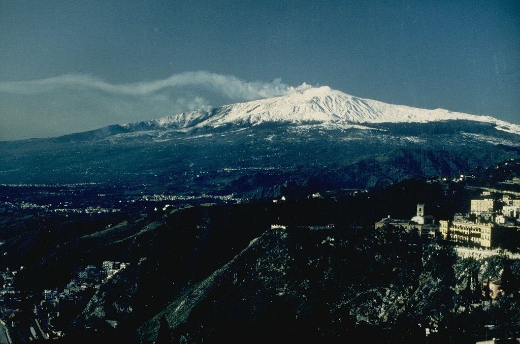 Etna Etna
Sicily Volcanic Province
|
The Sezione di Catania - Osservatorio Etneo (INGV) reported that eruptive activity at Etna’s summit craters during 25-31 August was characterized by decreasing lava effusion at multiple vents. Strombolian activity and ash emissions occurred from SE Crater, and there were gas emissions at NE, Bocca Nuova, and Voragine craters. Strombolian activity of varying intensity at two vents at SE Crater ejected lava fragments that fell back into the crater and onto the flanks of the cone. The activity generated diffuse ash emissions that quickly dispersed around the summit area. Activity was observed through webcams and by observatory staff doing daily fieldwork in the summit area.
Lava effusion continued at a vent around 2,980 m elevation located along the N-S-trending fissure between Bocca Nuova and SE Crater. The flow field was complex with overlapping lava flows, lava tunnels, and ephemeral vents that produced secondary lava flows. The distal end of the flow field reached 2,250 m elevation and the longest flow was about 2 km. The flow field was estimated to be 560,000 square meters in area with a volume of about 1,700,000 cubic meters.
The vent located at 3,100 m elevation at the base of the saddle between Bocca Nuova Crater and SE Crater continued to effuse lava but at a slower rate by 27 August. Two lava flows reached at least 2,950 m elevation. During a field visit and drone overflight the morning of 29 August the vent was no longer effusing lava, and the flow field was cooling. The flow field was 840 m long, had an estimated area of 93,000 square meters, and erupted about 140,000 cubic meters of lava.
The vent on the S flank of SE Crater, at 3,200 m elevation, was active during most of the week with multiple lava flows advancing SW and S. On 27 August three aligned vents fed lava flows that branched into several small flows at the distal end of the flow field. On 29 August the most advanced flow front was traveling SE and reached 2,870 m elevation. The vents were inactive on 31 August and the lava flows were cooling. The flow field was 780 m long, had an estimated area of 150,000 square meters, and erupted about 310,000 cubic meters of lava.
Source: Sezione di Catania - Osservatorio Etneo (INGV)
|
Fuego (Guatemala) | 27 August-2 September 2025 | Continuing ActivityCite this Report |
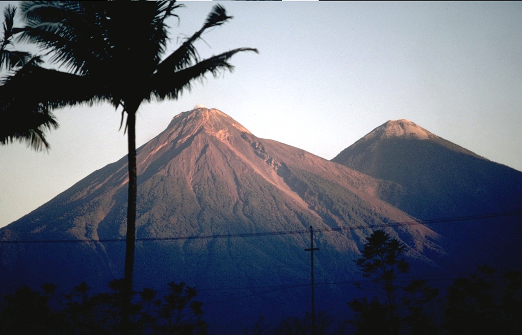 Fuego Fuego
Central America Volcanic Arc
|
The Instituto Nacional de Sismología, Vulcanologia, Meteorologia e Hidrología (INSIVUMEH) reported that eruptive activity at Fuego continued during 26 August-2 September. Daily Strombolian explosions were recorded by the seismic network at rates of 5-13 per hour when reported. The explosions generated daily gas-and-ash plumes that rose as high as 1.1 km above the summit and drifted 10-30 km NW, W, and SW. Rumbling sounds, shock waves, and/or sound associated with gas emissions were reported daily. On most days, explosions ejected incandescent material 150-300 m above the summit and occasionally showered the upper flanks with incandescent material. Block avalanches descended the flanks, sometimes reaching vegetated areas. Ashfall was reported in areas downwind including Panimache I and II (8 km SW), Finca Palo Verde (10 km WSW), Yepocapa (12 km SW), and Sangre de Cristo (8 km W) during 28-29 August and in Yepocapa during 31 August-1 September.
Source: Instituto Nacional de Sismologia, Vulcanologia, Meteorologia, e Hidrologia (INSIVUMEH)
|
Gaua (Vanuatu) | 27 August-2 September 2025 | Continuing ActivityCite this Report |
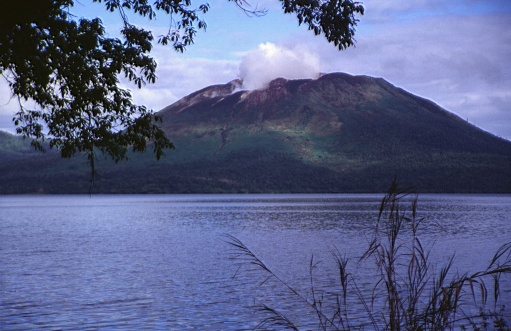 Gaua Gaua
Vanuatu Volcanic Arc
|
The Vanuatu Meteorology and Geohazards (VMGD) reported that unrest continued at Gaua during August. Sulfur dioxide emissions were identified in satellite images on 3 August and steam and/or gas emissions were visible in satellite images rising from the vent during 3-5 and 12 August. The Alert Level remained at 2 (on a scale of 0-5) and the public was warned to stay away from the main cone.
Source: Vanuatu Meteorology and Geohazards Department (VMGD)
|
Great Sitkin (United States) | 27 August-2 September 2025 | Continuing ActivityCite this Report |
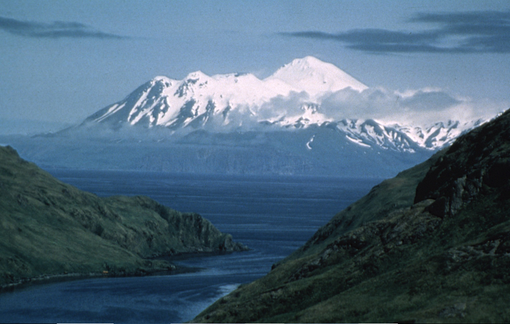 Great Sitkin Great Sitkin
Aleutian Ridge Volcanic Arc
|
The Alaska Volcano Observatory (AVO) reported that slow lava effusion continued to feed a thick flow in Great Sitkin’s summit crater during 27 August-2 September. Satellite data indicated that the flow was advancing S, with some rockfalls occurring along the S and E margins. Small daily earthquakes were detected by the seismic network, including signals probably caused by the small rockfalls. Weather clouds mostly obscured satellite and webcam views; elevated surface temperatures were identified in satellite data during 27-28 August and 1-2 September. The Volcano Alert Level remained at Watch (the third level on a four-level scale) and the Aviation Color Code remained at Orange (the third color on a four-color scale).
Source: US Geological Survey Alaska Volcano Observatory (AVO)
|
Ibu (Indonesia) | 27 August-2 September 2025 | Continuing ActivityCite this Report |
 Ibu Ibu
Halmahera Volcanic Arc
|
The Pusat Vulkanologi dan Mitigasi Bencana Geologi (PVMBG) reported that the eruption at Ibu continued during 20-26 August. Daily dense gray or white-and-gray ash plumes rose 300-700 m above the summit and drifted NE and E. Incandescence at the summit was visible in a few nighttime webcam images. The Alert Level remained at 2 (the second lowest level on a four-level scale) and the public was advised to stay 2 km away from the active crater and 3.5 km away from the N crater wall opening.
Source: Pusat Vulkanologi dan Mitigasi Bencana Geologi (PVMBG, also known as CVGHM)
|
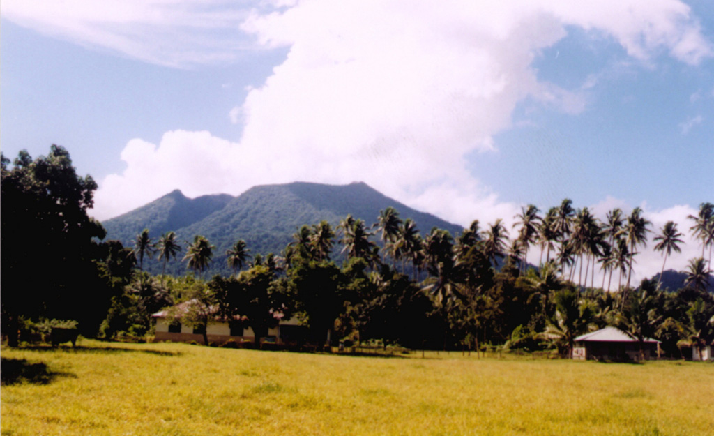
Kelimutu (Indonesia) | 27 August-2 September 2025 | Continuing ActivityCite this Report |
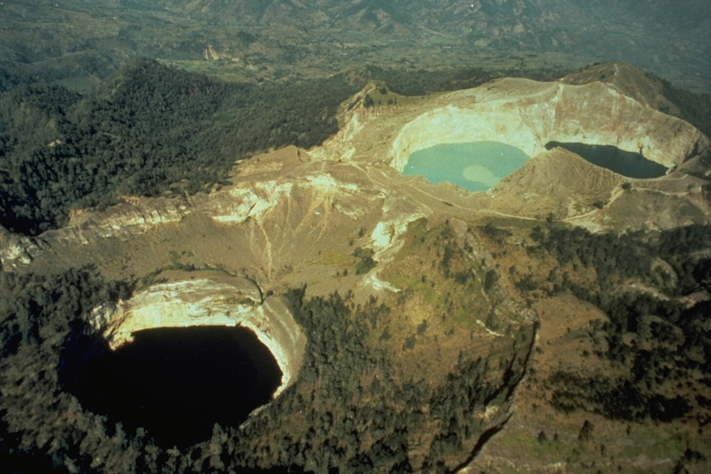 Kelimutu Kelimutu
Sunda Volcanic Arc
|
Pusat Vulkanologi dan Mitigasi Bencana Geologi (PVMBG) reported another significant increase in the lake water temperature at Kelimutu’s Crater II (Tiwu Koofai Nuwamuri). The temperature of the lake water rose from 34.2 degrees Celsius (C) on 26 August to 36.4 degrees C on 29 August. A strong sulfur odor accompanied the temperature increase along with the appearance of gas-and-steam on the lake’s surface. The color of the lake water had not changed, remaining light blue. There was no significant change in seismicity. The Alert Level remained at 1 (on a scale of 1-4) and the public was advised to limit activities near the craters, not approach the lake water, and to not spend the night in the craters.
Source: Pusat Vulkanologi dan Mitigasi Bencana Geologi (PVMBG, also known as CVGHM)
|
Kick 'em Jenny (Grenada) | 27 August-2 September 2025 | Continuing ActivityCite this Report |
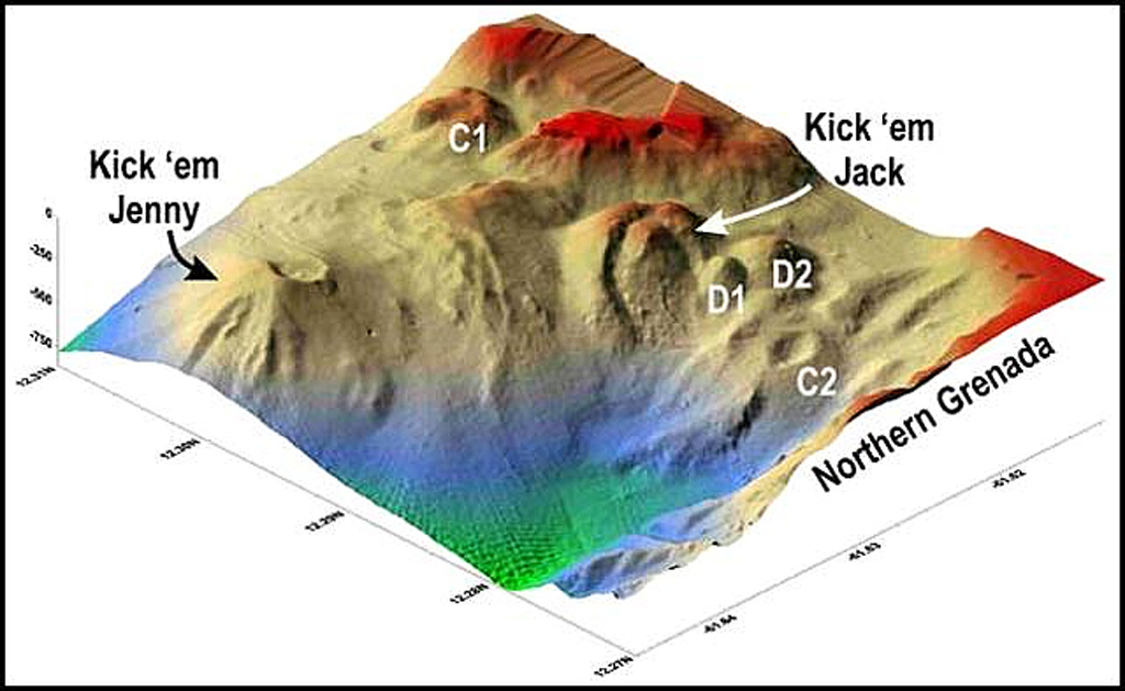 Kick 'em Jenny Kick 'em Jenny
Lesser Antilles Volcanic Arc
|
The University of the West Indies (UWI) Seismic Research Centre (SRC) and the National Disaster Management Agency (NaDMA) reported a period of increased seismicity at Kick 'em Jenny during 27-30 August. A seismic swarm began at around 1000 on 27 August and by 0800 on 28 August the seismic network had recorded around 800 tremors. The largest events were M 2.2-2.4; no reports were received of felt earthquakes in Grenada. Seismicity began to decline through the day. During 1200 on 28 August and 0830 on 29 August the network recorded 72 events, or an average of 3-4 per hour, reflecting decreasing unrest. The largest events were M 1.4-1.8. Unrest further declined and by 1200 on 30 August only one or two tremors per hour were detected. The Alert Level remained at Yellow (the second lowest level on a four-color scale) and the maritime exclusion zone did not change from the radius of 1.5 km.
Source: University of the West Indies Seismic Research Centre (UWI-SRC)
|
Kilauea (United States) | 27 August-2 September 2025 | Continuing ActivityCite this Report |
 Kilauea Kilauea
Hawaiian-Emperor Hotspot Volcano Group
|
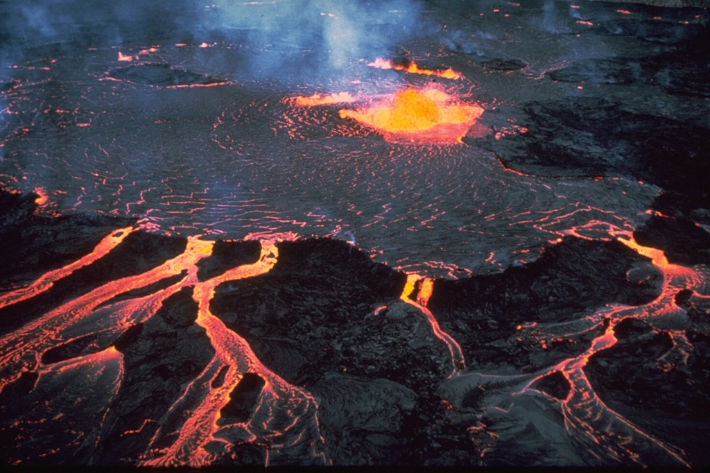
The Hawaiian Volcano Observatory (HVO) reported that the eruption within Kilauea’s Kaluapele summit caldera, characterized by episodic fountaining, incandescence, and intermittent spatter at vents with craters along the SW margin of Halema’uma’u Crater, continued at variable levels during 27 August-2 September. Minor incandescence at the N vent was intermittently visible during 27-30 August but intensified overnight during 30-31 August, indicating that lava was nearing the surface. Spattering at the N vent began at around 2000 on 31 August and by the early morning on 1 September the surface of the lava pond within the vent had risen to the point of being almost visible in a webcam view.
At around 2030 on 1 September gas-pistoning cycles began, with lava continuing to fill the N crater. Brief overflows of lava down the crater flanks were visible at 0043 and 0045 on 2 September. Several more vigorous and cyclic overflows occured at 0258, 0312, 0233, 0358, 0411, and 0425; each cycle lasted 6-17 minutes and was followed by minor drain-backs of 1-2 m. At 0521 the overflows became continuous and low dome fountains were visible. The dome fountains intensified at 0635; lava fountains soon grew to 100 m high and were inclined 45 degrees NW. By 0711 the fountains were 150 m high and arcing about 150 m across. At around 0820 the fountains turned slightly counterclockwise to the NNE. Sulfur dioxide emission rates were estimated to be at least 50,000 tonnes/day, a typical rate during periods of fountaining. Fountaining was continuous for 13.4 hours from the N vent, and during this time both the S and middle vents were also active. The N vent ceased erupting at 1949 and the S and middle vents ceased erupting at 2001, after a few minutes of lava jetting. Lava output averaged more than 200 cubic meters per second and produced over 9.6 million cubic meters of lava, the highest output so far during this eruption for one of these short fountaining episodes. Lava flows covered 40-50 percent of the caldera floor. The Volcano Alert Level remained at Watch (the third level on a four-level scale) and the Aviation Color Code remained at Orange (the third color on a four-color scale).
Source: US Geological Survey Hawaiian Volcano Observatory (HVO)
|
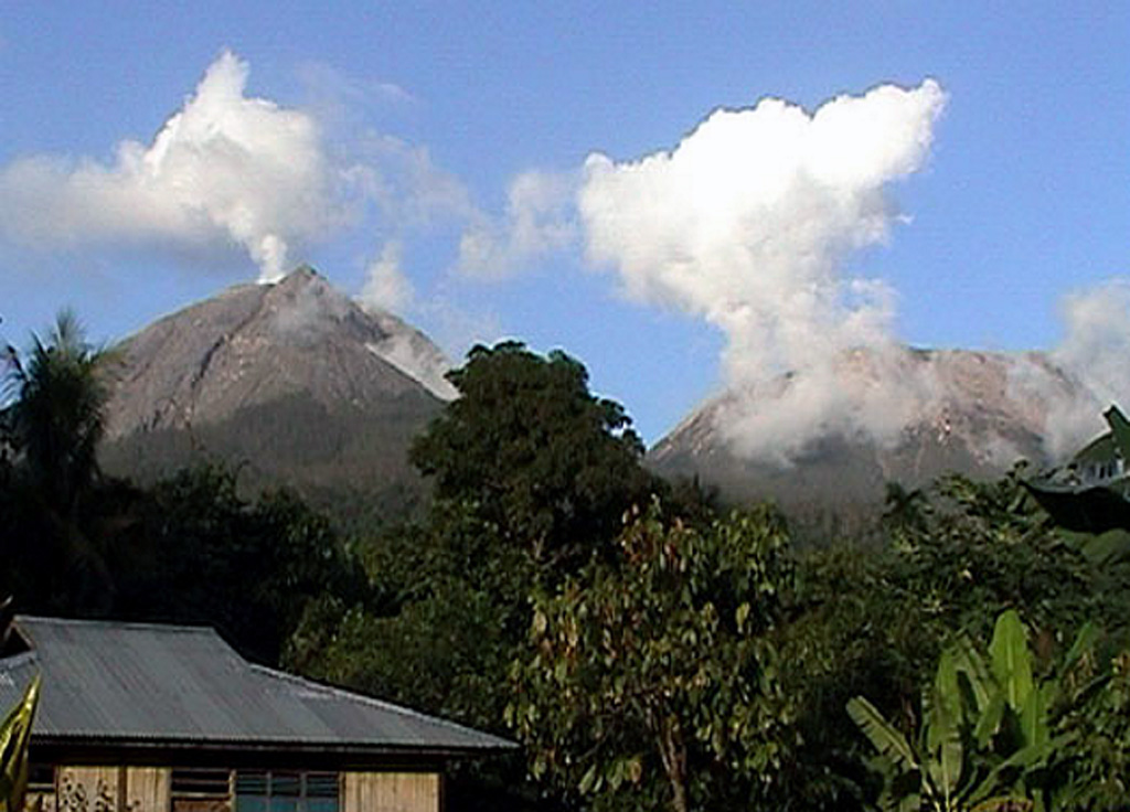
Kirishimayama (Japan) | 27 August-2 September 2025 | Continuing ActivityCite this Report |
 Kirishimayama Kirishimayama
Ryukyu Volcanic Arc
|
The Japan Meteorological Agency (JMA) reported that activity continued at Shinmoedake (Shinmoe peak, a stratovolcano of the Kirishimayama volcano group) during 26 August-2 September. Fumarolic plumes rose as high as 100 m above the fissures on the W flank. The number of volcanic earthquakes located beneath Shinmoedake, first detected in late October 2024, continued to be frequent; a short-duration volcanic tremor was detected around 0800 on 31 August. At 0453 on 28 August an ash plume rose 5.5 km above the crater rim and drifted S. Significant ashfall reported in areas downwind, including in Kirishima City (21 km SW) and Miyakonojo City (30 km SE), was enough to obscure the lines on some roads. Ashfall was also reported in Soo City (32 km SSE) and Kanoya City (60 km S). Ash plumes were continuous through the morning and early afternoon; the plumes rose 4.5 km above the crater rim and drifted S at 0523, then rose to 3.7 km at 0900 before stopping at 1450. A period of ash emissions was recorded from 1823 on 28 August to 0830 on 29 August, with ash plumes rising 700-1,300 m above the crater rim and occasionally drifting N. Continuous ash plumes rose as high as 600 m above the crater rim and drifted N during 0542-0830 on 30 August. At 1323 on 30 August an ash plume rose 300 m above the crater rim ana drifted NW. The Alert Level remained at 3 (on a 5-level scale) and the public was warned to exercise caution within 3 km from Shinmoedake Crater.
Source: Japan Meteorological Agency (JMA)
|
Lewotobi (Indonesia) | 27 August-2 September 2025 | Continuing ActivityCite this Report |
 Lewotobi Lewotobi
Sunda Volcanic Arc
|
The Pusat Vulkanologi dan Mitigasi Bencana Geologi (PVMBG) reported continuing activity at Lewotobi Laki-laki during 27 August-2 September. Daily white gas-and-steam plumes rose as high as 1 km above the summit and drifted SW, W, N, and NE. Ash plumes were visible during 27-29 August rising 500-1,600 m above the summit and drifting in the same directions as the gas-and-steam plumes. The Alert Level remained at 3 (on a scale of 1-4) and the public was warned to stay 6 km away from the center of Laki-laki.
Source: Pusat Vulkanologi dan Mitigasi Bencana Geologi (PVMBG, also known as CVGHM)
|
Lewotolok (Indonesia) | 27 August-2 September 2025 | Continuing ActivityCite this Report |
 Lewotolok Lewotolok
Sunda Volcanic Arc
|
The Pusat Vulkanologi dan Mitigasi Bencana Geologi (PVMBG) reported that an eruption at Lewotolok was ongoing during 27 August-2 September. White-to-gray ash plumes rose 200-500 m above the summit of the cone and drifted W during 27 and 29-30 August. A nighttime webcam image at 2142 on 29 August showed incandescent material being ejected above the cone and onto the flanks. The Alert Level remained at 3 (on a scale of 1-4) and the public was warned to stay 3 km away from the summit.
Source: Pusat Vulkanologi dan Mitigasi Bencana Geologi (PVMBG, also known as CVGHM)
|
Lopevi (Vanuatu) | 27 August-2 September 2025 | Continuing ActivityCite this Report |
 Lopevi Lopevi
Vanuatu Volcanic Arc
|
The Vanuatu Meteorology and Geohazards Department (VMGD) reported that seismic data confirmed continuing unrest at Lopevi during August. Low-level thermal anomalies identified in satellite images during 3, 6-7, and 15 August. Small fumarolic steam plumes were continuously emitted from the summit crater during 6-7, 9, and 11 August based on a webcam images and observation photos. The Alert Level remained at 2 (on a scale of 0-4).
Source: Vanuatu Meteorology and Geohazards Department (VMGD)
|
Marapi (Indonesia) | 27 August-2 September 2025 | Continuing ActivityCite this Report |
 Marapi Marapi
Sunda Volcanic Arc
|
The Pusat Vulkanologi dan Mitigasi Bencana Geologi (PVMBG) reported that eruptive activity at Marapi (on Sumatra) continued during 27 August-2 September. Gray-to-white ash plumes rose as high as 800 m above the crater rim and drifted N, NE, and SE on 27, 29, and 31 August. Two eruptive events recorded on 27 and 29 August were not visually observed. The Alert Level remained at 2 (on a scale of 1-4) and the public was warned to stay 3 km away from the active crater.
Source: Pusat Vulkanologi dan Mitigasi Bencana Geologi (PVMBG, also known as CVGHM)
|
Poas (Costa Rica) | 27 August-2 September 2025 | Continuing ActivityCite this Report |
 Poas Poas
Central America Volcanic Arc
|
The Observatorio Vulcanológico y Sismológico de Costa Rica-Universidad Nacional (OVSICORI-UNA) reported continuing gas-and-steam emissions with occasional minor amounts of ash at Poás during 27 August-2 September. Variable incandescence at Boca A vent continued to be visible at night. At 1230 on 2 September a gray steam-and-gas plume with a moderate amount of ash rose 500 m above the crater rim and drifted W. A few hours later, at 1703, a light-gray steam-and-gas plume with minor ash content rose 300 m above the crater rim. The Volcanic Alert Level remained at 2 (the second lowest level on a four-level scale).
Source: Observatorio Vulcanologico y Sismologico de Costa Rica-Universidad Nacional (OVSICORI-UNA)
|
Semeru (Indonesia) | 27 August-2 September 2025 | Continuing ActivityCite this Report |
 Semeru Semeru
Sunda Volcanic Arc
|
The Pusat Vulkanologi dan Mitigasi Bencana Geologi (PVMBG) reported that activity continued at Semeru during 27 August-2 September, sometimes with multiple daily eruptive events recorded by the seismic network. White-and-gray or gray ash plumes rose 200-900 m above the summit and drifted W, SW, and S on 27 and 31 August and during 1-2 September. The Alert Level remained at 2 (the second lowest level on a scale of 1-4). The public was warned to stay at least 3 km away from the summit in all directions, 8 km from the summit to the SE, 500 m from the banks of the Kobokan drainage as far as 13 km from the summit, and to avoid other drainages including the Bang, Kembar, and Sat, due to lahar, avalanche, and pyroclastic flow hazards.
Source: Pusat Vulkanologi dan Mitigasi Bencana Geologi (PVMBG, also known as CVGHM)
|
Sheveluch (Russia) | 27 August-2 September 2025 | Continuing ActivityCite this Report |
 Sheveluch Sheveluch
Eastern Kamchatka Volcanic Arc
|
The Kamchatkan Volcanic Eruption Response Team (KVERT) reported continuing eruptive activity at Sheveluch’s “300 years of RAS” dome on the SW flank of Old Sheveluch and at the Young Sheveluch dome during 21-28 August. Thermal anomalies over the domes were identified in satellite images on 21, 24, and 27 August; weather clouds obscured views on the other days. The Aviation Color Code remained at Orange (the second highest level on a four-color scale). Dates are based on UTC; specific events are in local time where noted.
Source: Kamchatkan Volcanic Eruption Response Team (KVERT)
|
Stromboli (Italy) | 27 August-2 September 2025 | Continuing ActivityCite this Report |
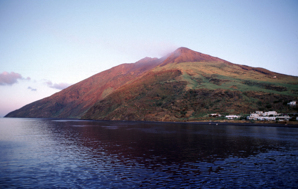 Stromboli Stromboli
Aeolian Volcanic Arc
|
The Sezione di Catania - Osservatorio Etneo (INGV) reported that eruptive activity continued at Stromboli during 25-31 August. Webcam images showed Strombolian activity at four vents in Area N within the upper part of the Sciara del Fuoco, and from at least two vents in Area C-S (South-Central Crater) on the crater terrace. The vents in Area N continued to produce low- to medium-intensity explosions at a rate of 9-17 events per hour, ejecting lapilli and bombs less than 150 m above the vents. Low- to medium-intensity explosions at the vents in Area C-S occurred at a rate of 0-5 times per hour. The Alert Level remained at Yellow (the second lowest level on a four-level scale) according to the Dipartimento della Protezione Civile.
Sources: Sezione di Catania - Osservatorio Etneo (INGV), Dipartimento della Protezione Civile
|
Suwanosejima (Japan) | 27 August-2 September 2025 | Continuing ActivityCite this Report |
 Suwanosejima Suwanosejima
Ryukyu Volcanic Arc
|
The Japan Meteorological Agency (JMA) reported that eruptive activity at Suwanosejima's Ontake Crater continued during 25 August-1 September. Incandescence was observed nightly in webcam images. Eruptive events during 25-31 August produced ash plumes that rose as high as 2.4 km above the crater rim and either rose straight up or drifted N. Ash-and-gas emissions were continuous from 2034 on 27 August to 0830 on 28 August, and again from 0911 on 28 August to 0500 on 29 August. Explosions at 1722 on 26 August and at 1047 on 1 September produced ash plumes that rose 1.5 km above the crater rim and 1.8 km above the crater rim and drifted N, respectively. Minor ashfall was reported in Toshima Village (3.5 km SSW). The Alert Level remained at 2 (the second level on a five-level scale) and the public was warned to be cautious within 1.5 km of the crater.
Source: Japan Meteorological Agency (JMA)
|
Yasur (Vanuatu) | 27 August-2 September 2025 | Continuing ActivityCite this Report |
 Yasur Yasur
Vanuatu Volcanic Arc
|
The Vanuatu Meteorology and Geohazards Department (VMGD) reported that activity at Yasur continued at a level of “major unrest,” as defined by the Alert Level 2 status (on a scale of 0-5) during August. Field photos and webcam images indicated that explosions continued, producing emissions of gas, steam, and/or ash during 1-17, 20-23, and 25-28 August. Sulfur dioxide gas emissions were identified in satellite images during 1-4, 6-14, 16-19, and 22-27 August, and low-level thermal anomalies were identified during 3-7, 10-13, 21, and 25-26 August. Seismic data confirmed continuing volcanic activity with explosions that were occasionally strong. The report warned that ejected material from explosions could fall in and around the crater. The public was reminded to not enter the restricted area within 600 m around the boundaries of the Permanent Exclusion Zone, defined by Danger Zone A on the hazard map.
Source: Vanuatu Meteorology and Geohazards Department (VMGD)
|
 Bagana
 Dempo
Dempo Karymsky
 Krasheninnikov
 Lokon-Empung
 Whakaari/White Island