Report on Apaneca Range (El Salvador) — 9 July-15 July 2025
Smithsonian Institution / US Geological Survey
Weekly Volcanic Activity Report, 9 July-15 July 2025
Managing Editor: Sally Sennert.
Please cite this report as:
Global Volcanism Program, 2025. Report on Apaneca Range (El Salvador) (Sennert, S, ed.). Weekly Volcanic Activity Report, 9 July-15 July 2025. Smithsonian Institution and US Geological Survey.
Apaneca Range
El Salvador
13.872°N, 89.742°W; summit elev. 2028 m
All times are local (unless otherwise noted)
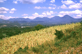
According to the Universidad de El Salvador a hydrothermal explosion occurred at Agua Shuca, a fumarolic field and lake (roughly 30 x 60 m) in the SW part of the Ahuachapán Geothermal Field in the Apaneca Range, on 10 July. Video of the event showed steam-and-gas plumes expanding from the lake area, ejections of boiling sediment and water, and waves of muddy water flowing over the surrounding land; a few people were seen running from the area, with one person taking shelter behind a wall. A team from the Universidad de El Salvador traveled to the area the next day to assess the event and the impacts, to take measurements, and to provide information to the nearby residents. The explosion created a crater about 70 m in diameter and 20 m deep. Photos indicated that mud and water were ejected mainly to the SE, covering an extending beyond a road, but deposits were seen around the margins of the lake in most directions. Gas emissions were low, suggesting that activity had returned to baseline levels; Agua Shuca does not have a monitoring network.
Geological Summary. The Apaneca Range (also known as the Cuyanausul Range) consists of a group of basaltic-to-andesitic Pleistocene and Holocene stratovolcanoes in western El Salvador between the Santa Ana complex and the Guatemala border. The Pleistocene dacitic-rhyolitic Concepción de Ataco caldera (5 x 3.5 km) lies at the W end of the complex, along with post-caldera late-Pleistocene to Holocene andesitic-dacitic lava domes. The post-caldera cones of Cerro el Aguila (the highest peak of the complex) and Cerro los Naranjos at the E end of the chain were mapped as Holocene by Weber and Weisemann (1978). Young craters on the basaltic Cerro Laguna Verde stratovolcano may also have been active during the Holocene. Numerous fumarole fields are located on the N flank of the range, and the Ahuachapán geothermal field has been producing since 1975. Several small hydrothermal explosions have occurred in historical time, including one in October 1990 at the Agua Shuca thermal area in which 26 people were killed.
Sources: Universidad de El Salvador, El Universitario (Universidad de El Salvador), hoycomsv, Canal 12