Report on Bur ni Telong (Indonesia) — 3 September-9 September 2025
Smithsonian Institution / US Geological Survey
Weekly Volcanic Activity Report, 3 September-9 September 2025
Managing Editor: Sally Sennert.
Please cite this report as:
Global Volcanism Program, 2025. Report on Bur ni Telong (Indonesia) (Sennert, S, ed.). Weekly Volcanic Activity Report, 3 September-9 September 2025. Smithsonian Institution and US Geological Survey.
Bur ni Telong
Indonesia
4.769°N, 96.821°E; summit elev. 2617 m
All times are local (unless otherwise noted)
The Pusat Vulkanologi dan Mitigasi Bencana Geologi (PVMBG) reported decreased seismicity at Bur ni Telong. Increases in both deep and shallow volcanic earthquakes were recorded in July and early August, though through late August only the number of deep volcanic earthquakes continued to be elevated. Seismicity decreased during 1-7 September. No emissions were observed. The Alert level was lowered to 1 (on a scale from 1 to 4) at 0900 on 8 September and the public was advised to not spend the night in the crater area and to avoid fumaroles and solfataras during cloudy or rainy weather.
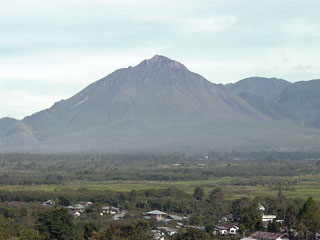
Geological Summary. The conical Bur ni Telong volcano was constructed at the southern base of the massive Bur ni Geureudong volcanic complex, one of the largest in northern Sumatra. The historically active volcano lies 4.5 km from the summit of Geureudong,and its summit crater has migrated to the ESE, leaving arcuate crater rims. Lava flows are exposed on the southern flank. Explosive eruptions were recorded during the 19th and 20th centuries.
Source: Pusat Vulkanologi dan Mitigasi Bencana Geologi (PVMBG, also known as CVGHM)