Global Volcanism Program | Image GVP-12204

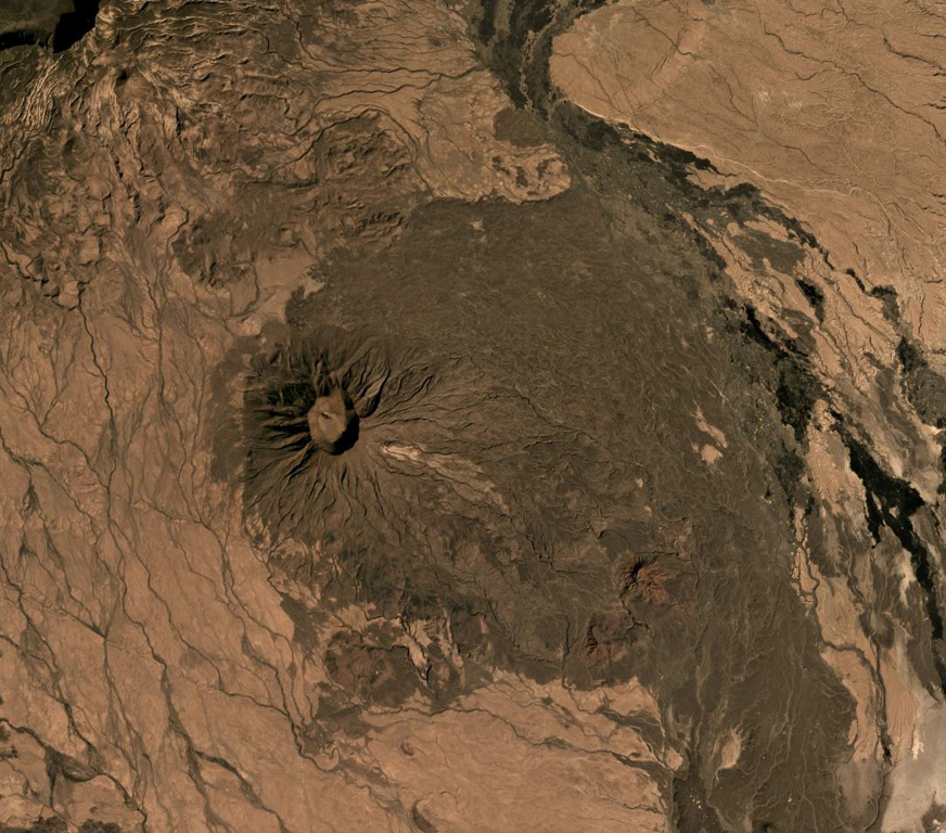
Sork Ale is part of the Nabro Volcanic Range between the Danakil Depression and the Red Sea. The 1,100 x 1,200 m, 300-m-deep crater is near the center of this December 2019 Planet Labs satellite image mosaic (N is at the top). Darker eroded lava flows form the flanks and the lighter areas to the NE and SW are ignimbrite deposits from large explosive eruptions.
Satellite image courtesy of Planet Labs Inc., 2019 (https://www.planet.com/).
Copyrighted image used with permission. All Rights Reserved. Contact photographer for any usage requests.
Keywords: crater

Sork Ale
