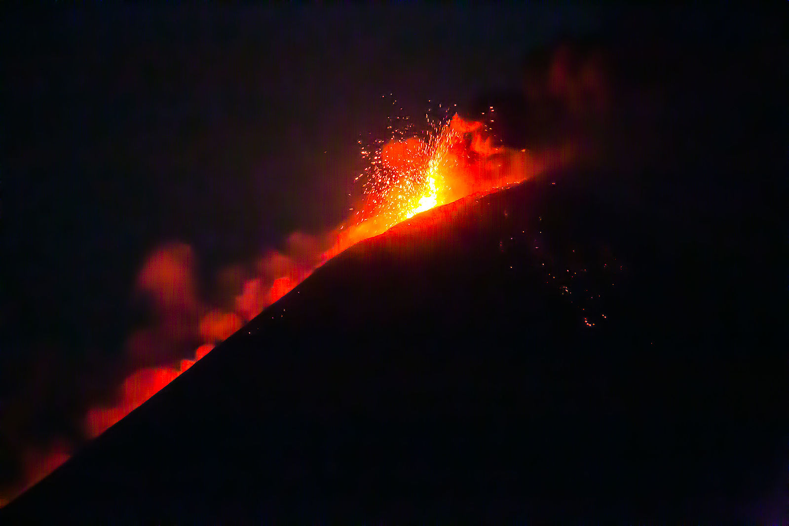
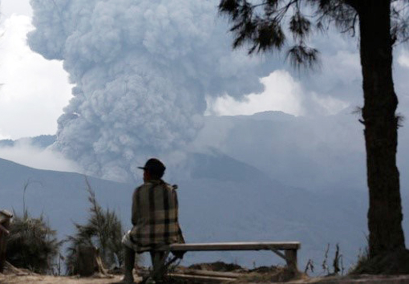
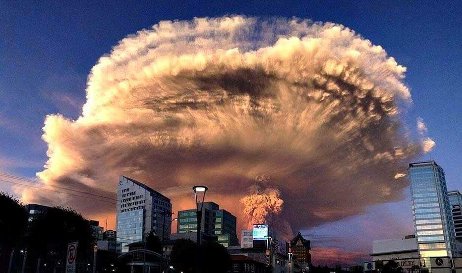
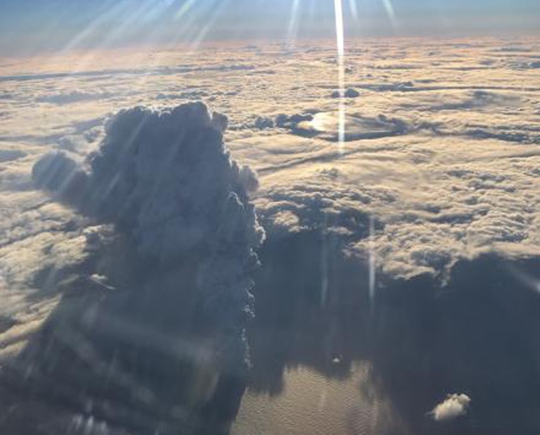
20th Anniversary of the Smithsonian / USGS Weekly Volcanic Activity Report
Hello volcano fans!
The first week of November 2020 marks 20 years since the first Weekly Volcanic Activity Report (WVAR) went public. It is a big milestone and worth celebrating, and what a better way to do that than with summaries of notable eruptions! My name is Sally Sennert. I work for the USGS and have been writing the WVAR for more than 14 years while embedded with GVP. I wanted to share with you how and why the WVAR got started, how it has evolved through time, and finally my top 50 picks of notable eruptions that have occurred in the past two decades.
The Weekly Volcanic Activity Report is a summary of global volcanic activity posted every Wednesday. It is a collaborative effort between the Smithsonian's Global Volcanism Program and the USGS Volcano Hazards Program. It was conceived in the late 1990s by Marianne Guffanti, the former USGS Volcano Hazards Program Coordinator, and James Luhr, the former GVP Director, to meet increasing expectations on both agencies to provide the public with more timely information about volcanic eruptions. USGS employee Gari Mayberry arrived at the Smithsonian in the summer of 2000 and produced the first public WVAR in collaboration with GVP staff, which covered 1-7 November 2000. I succeeded Gari in May 2006 and remain the WVAR writer. For the entire 20 years, Ed Venzke has provided crucial editorial reviews and helped to ensure both accuracy and a consistent style (rarely have I received a "star" and no edits, which we both find humorous).
Each week I virtually tour the world in search of information about volcanic eruptions. The world's volcano observatories are the first and most important stop as they are the primary and most authoritative source of eruption data. Additional sources include the Volcanic Ash Advisory Centers (VAACs), meteorological agencies, civil protection and emergency management agencies, local governments, official blogs, social media platforms, and news agencies. I draw upon all the resources I can find to write the most comprehensive and accurate summary possible within the time constraints, as eruptions and communication about them are handled differently around the world. I check and cross-check information and draw upon my years of experience in volcanology and knowledge of the volcanoes on which I am reporting. I have a duty to not mis-interpret reports, to archive crucial observations, and to always present accurate volcanic activity information.
Aside from knowing where to get accurate information (a harder task than may be obvious), gathering and archiving the data, each week I have the monumental task of distilling down hundreds of pages of information into one or two dozen succinct summaries. One crucial skill in this process is to "translate" the translations as most of the source data is not in English and the online translators are far from perfect; I can say with a large amount of confidence that I am quite good at this. It is a skill that should not be underestimated. In an official report about San Cristobal how would you interpret, "INETER reports that monkeypox activity recorded during this weekend?" Some translations are just hysterical. "The main crater was obstructed by a cone of pyroclasts of proportions, that on the brink of madness surpassed in height the elevated top more of the volcano." Madness, I tell you.
The most notable changes in eruption reporting evolved with the prevalence of cell phone usage and their ability to produce quality video, the widespread use of social media, and more recently the increase in personal drone usage for taking photos and video. Social media is of course the vehicle for sharing observations and data for both official entities and the public. These advances help me to curate a more thorough and detailed picture of an eruptive event, though data tends to be scattered across many platforms and delivered in many languages.
While reflecting on the past 14 years of my experiences writing the WVAR and looking further back through Gari's reports, several eruptions stand out for a variety of reasons. Some eruptions were surprises (and large), with almost no precursory events. Some were at remote volcanoes, not officially part of any observatory's charge, so information was hard to find; my sleuthing abilities were tested as I had to not only find often fragmented information but then make sense of it all based on my volcanological training. Some stand out because they were deadly. As I put this list together I also thought about the many other volcanoes that I have included in a WVAR and that did not make this list of notables; those that have impacted residents and caused loss of life and property, those that have led to advances in the field of volcanology, and those that have just been fun to write about. Many volcanoes feel like old friends as I have examined and written about their activity for years. All of them continue to draw me into the world of volcanoes and volcanology. They show me how the people of the world are impacted by eruptions and that there is much work still to be done. They remind me of the brave and compassionate people who work hard to minimize loss of life and property from eruptions. I am grateful to be a part of the world of volcanoes.
Sally's Picks: Interesting or noteworthy events during the previous 20 years
| Name | Country | Year |
|---|---|---|
| Kilauea | United States | 2000 |
| Lopevi | Vanuatu | 2001 |
| Nyiragongo | DR Congo | 2002 |
| Soufriere Hills | United Kingdom | 2003 |
| Lereboleng | Indonesia | 2003 |
| Anatahan | United States | 2003 |
| St. Helens | United States | 2004 |
| Grimsvotn | Iceland | 2004 |
| Fernandina | Ecuador | 2005 |
| Karthala | Comoros | 2005 |
| Krummel-Garbuna-Welcker | Papua New Guinea | 2005 |
| Dabbahu | Ethiopia | 2005 |
| Merapi | Indonesia | 2006 |
| Home Reef | Tonga | 2006 |
| Jebel at Tair | Yemen | 2007 |
| Nevado del Huila | Colombia | 2007 |
| Kelud | Indonesia | 2007 |
| Chaiten | Chile | 2008 |
| Llaima | Chile | 2008 |
| Sarychev Peak | Russia | 2009 |
| Hunga Tonga-Hunga Ha'apai | Tonga | 2009 |
| Eyjafjallajokull | Iceland | 2010 |
| Sinabung | Indonesia | 2010 |
| Zubair Group | Yemen | 2011 |
| Hierro | Spain | 2011 |
| Nabro | Eritrea | 2011 |
| Puyehue-Cordon Caulle | Chile | 2011 |
| Sirung | Indonesia | 2012 |
| Tongariro | New Zealand | 2012 |
| Zhupanovsky | Russia | 2013 |
| Mayon | Philippines | 2013 |
| Fogo | Cabo Verde | 2014 |
| Bardarbunga | Iceland | 2014 |
| Ahyi | United States | 2014 |
| Ontakesan | Japan | 2014 |
| Rabaul | Papua New Guinea | 2014 |
| Momotombo | Nicaragua | 2015 |
| Tengger Caldera | Indonesia | 2015 |
| Calbuco | Chile | 2015 |
| Bogoslof | United States | 2016 |
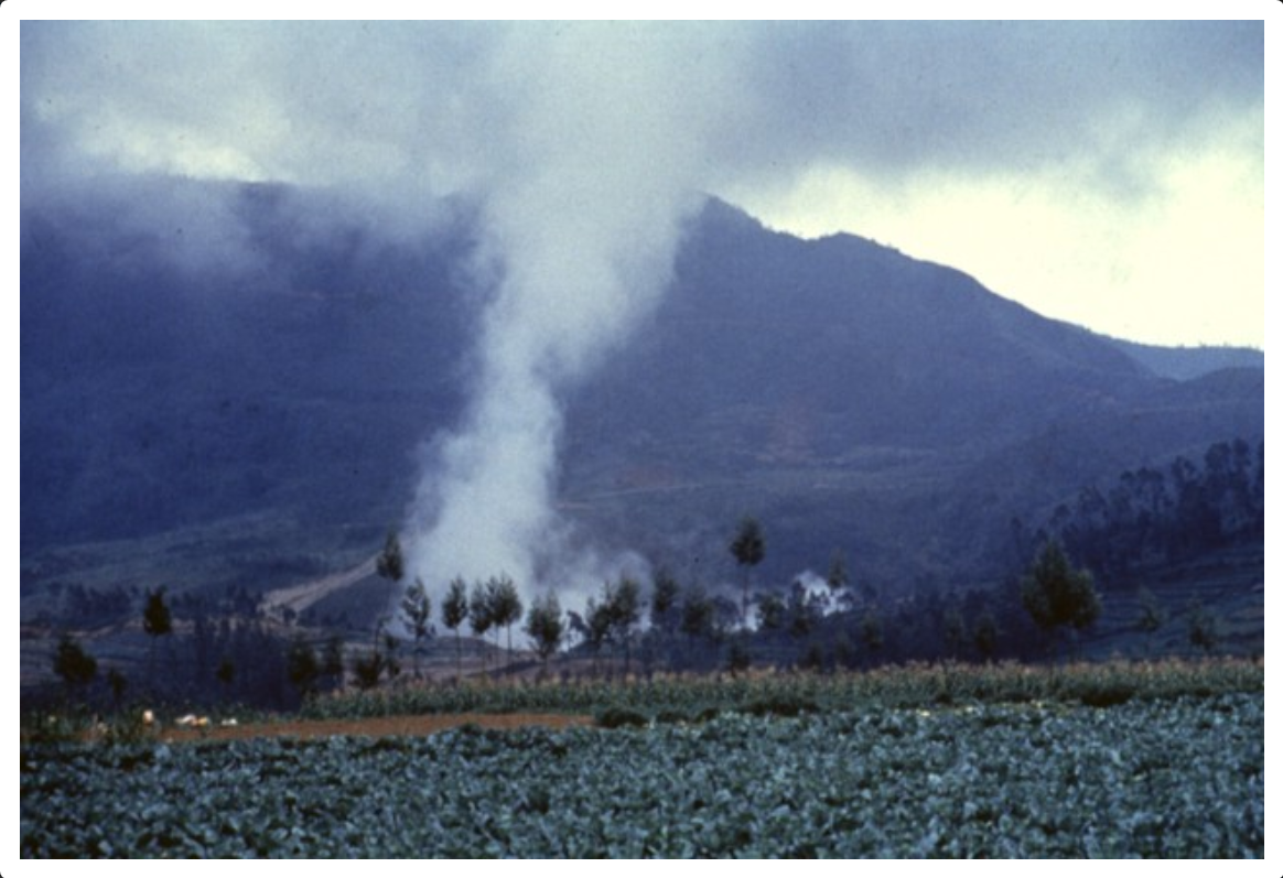
| Dieng Volcanic Complex | Indonesia | 2017 |
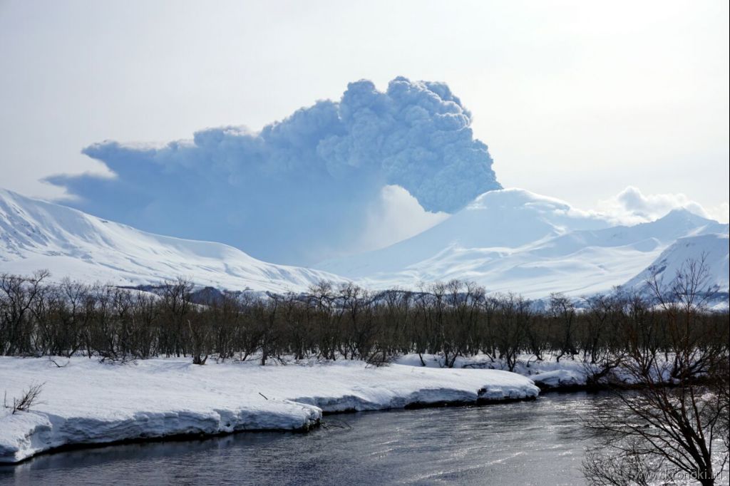
| Kambalny | Russia | 2017 |
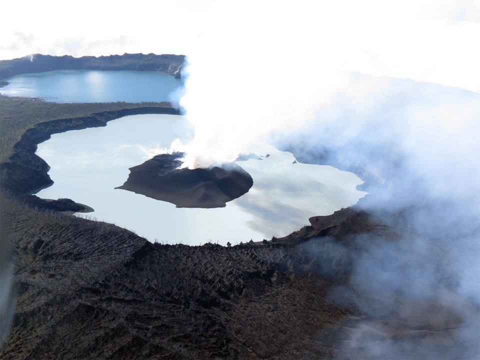
| Ambae | Vanuatu | 2017 |
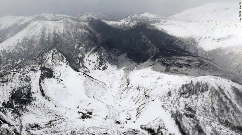
| Kusatsu-Shiranesan | Japan | 2018 |
| Fuego | Guatemala | 2018 |
| Krakatau | Indonesia | 2018 |
| Kadovar | Papua New Guinea | 2018 |
| Karangetang | Indonesia | 2019 |
| Whakaari/White Island | New Zealand | 2019 |
| Taal | Philippines | 2020 |
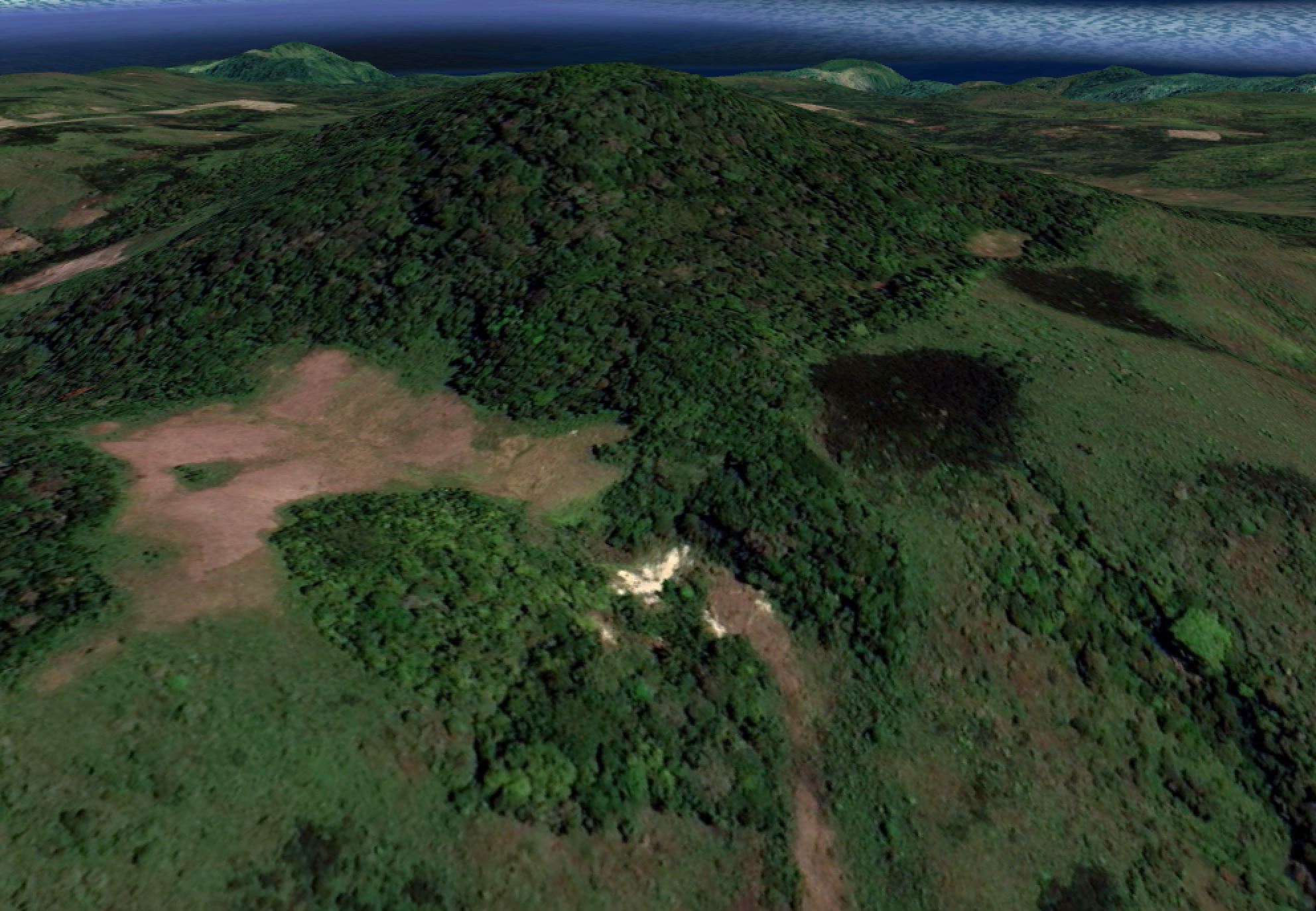
Kilauea (2000) |
|||
 Kilauea KilaueaUnited States |
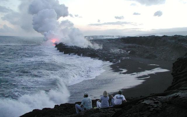
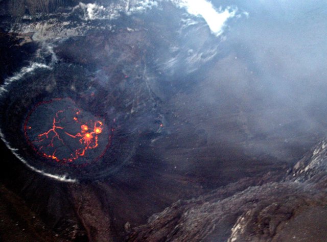
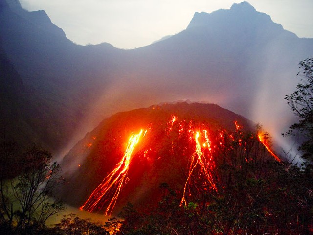
Kilauea is an accessible volcano with a rich history of awe-inspiring eruptions spanning decades. The observatory was established in 1912, though descriptions of eruptions from native Hawaiians and early missionaries go back further. GVP coverage of activity extends back to 1968 during the first year of the Center for Short-Lived Phenomena. Kilauea was featured in the first Weekly Report in 2000, and has been covered nearly every week since then, until the spectacular and destructive end of the eruption in 2018. I participated in a short field school on Kilauea in 2003. This was first experience seeing active lava flows. I had been carrying a "frozen" burrito with me all day. By the evening it was thawed and mushy, so I laid it across a glowing crack to cook it - best burrito I ever ate!
|
||
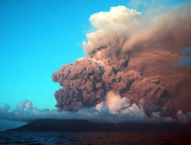
Lopevi (2001) |
|||
 Lopevi LopeviVanuatu |
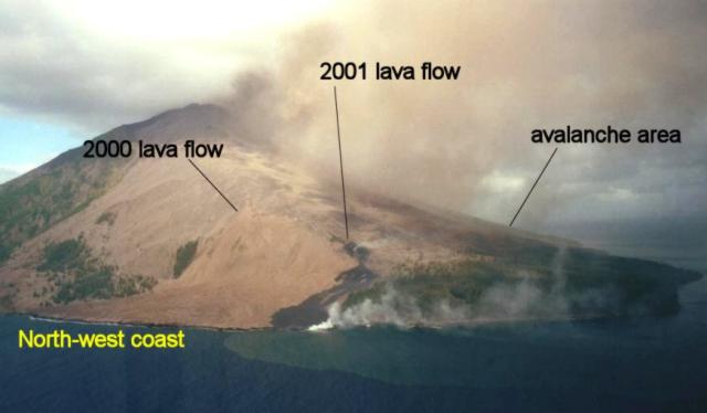
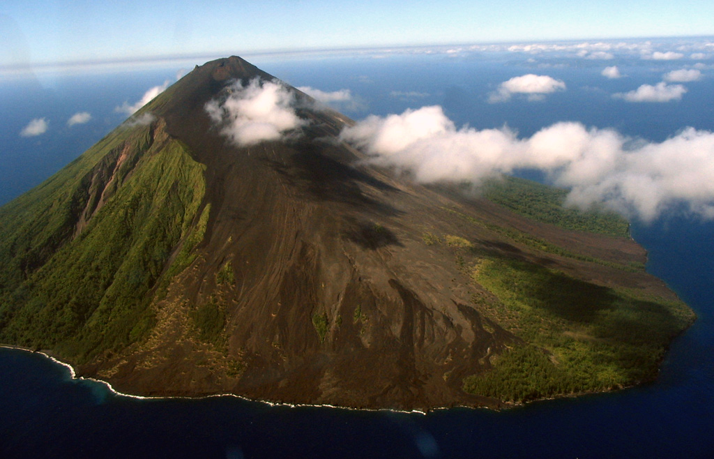
An eruption at Lopevi that began on 8 June at 1250 produced an ash cloud that rose at least 6 km a.s.l. and drifted to the WNW. The ash cloud was clearly visible in satellite imagery for many hours. More than 0.9 m of ash was deposited on the uninhabited island of Lopevi and several centimeters covered the neighboring island of Paama, contaminating water for the ~1,600 residents and destroying crops. The National Disaster Management Office project officer stated that hundreds of people on Paama suffered from throat, chest, and lung problems as a result of breathing ash and gas. Ashfall had almost ceased by 12 June, but strong trade winds continued to spread the ash.
|
||
Nyiragongo (2002) |
|||
 Nyiragongo NyiragongoDR Congo |
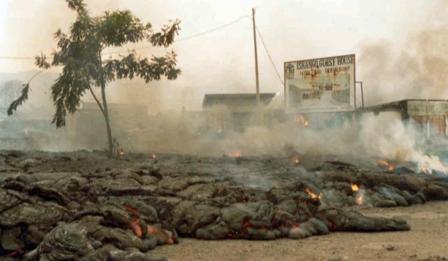
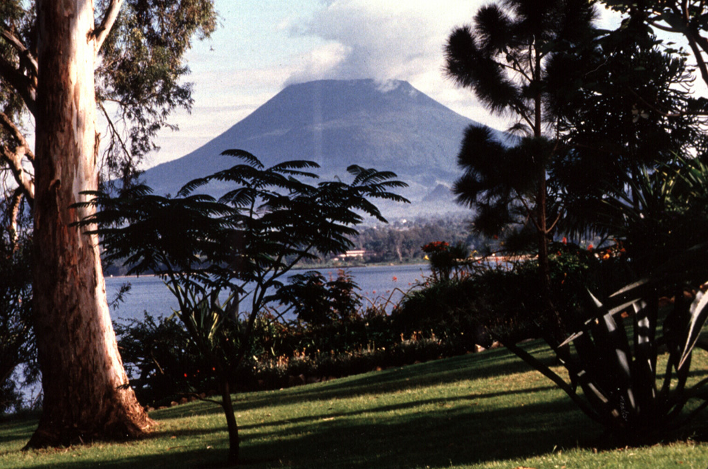
Nyiragongo is one of Africa's most notable volcanoes, it contained a lava lake in its deep summit crater that was active for half a century before draining catastrophically through its outer flanks in 1977. Another eruption in 2002 produced lava flows that covered much of the city of Goma and led to the self-evacuation of ~400,000 people.
|
||
Soufriere Hills (2003) |
|||
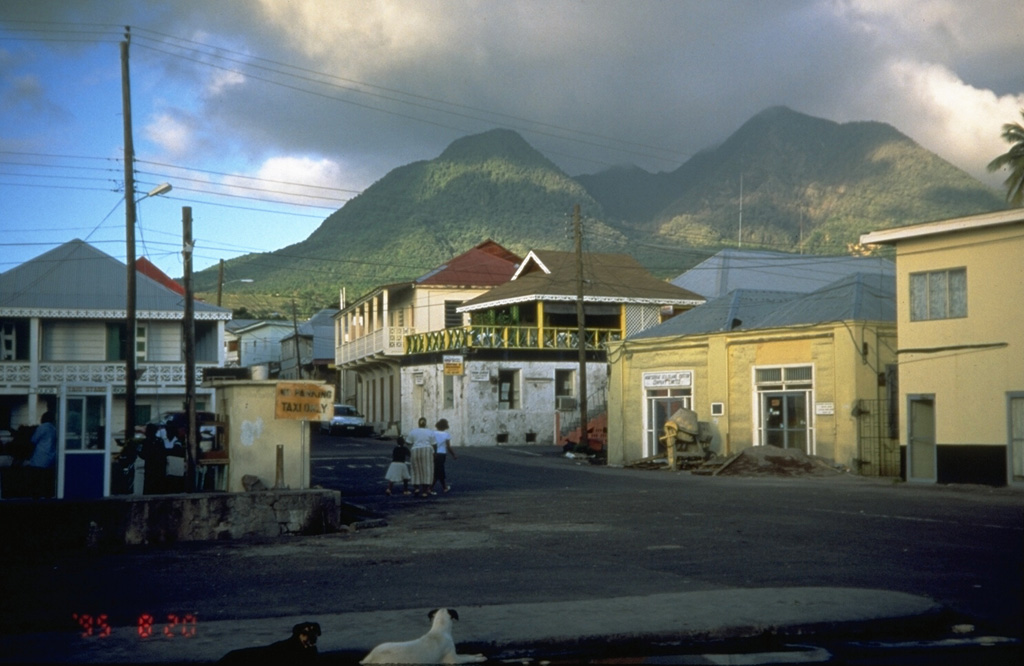 Soufriere Hills Soufriere HillsUnited Kingdom |
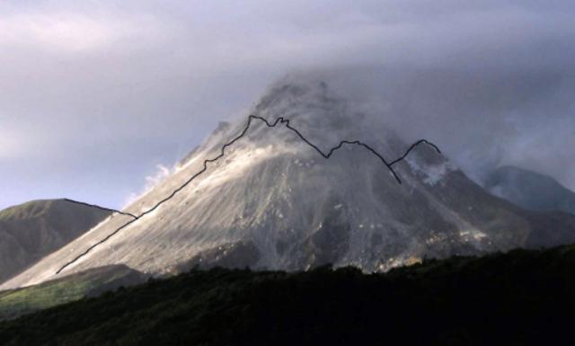
A series of explosions and pyroclastic flows from collapses of parts of the Soufriere Hills lava dome during 12-13 July caused significant falls of ash and rock fragments over all of the inhabited parts of Montserrat. The ashfall deposit was 115 mm thick at Lime Kiln Bay. The ash burden resulted in the collapse of several wooden buildings in the Salem area. Vegetation damage was extensive with downed trees and branches broken from many others. Ashfall from this event was reported on the islands of Nevis, St Kitts, Anguilla, and St Maarten, and resulted in the closure of several airports. Several pyroclastic surges flowing down the Tar River Valley and 2 km over the ocean. This volcano was the subject of my Master's thesis.
|
||
Lereboleng (2003) |
|||
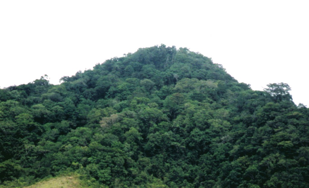 Lereboleng LerebolengIndonesia |
Two ash plumes observed in July 2003, prior eruptive history includes three small eruptions in the late 1800s. Information about these kinds of transient events is often hard to find at the time and not always discoverable years later. Gathering all of the available information as quickly as possible is a critical part in fulfilling GVP's mission of documenting, understanding, and disseminating information about global volcanic activity.
|
||
Anatahan (2003) |
|||
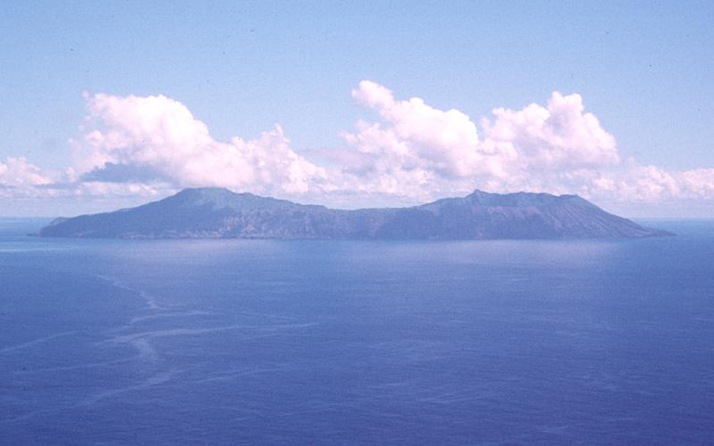 Anatahan AnatahanUnited States |
On 10 May an eruption began at Anatahan, a volcanic island which has had no historically documented eruptions. Scientists on a small ship about 10 km away saw an ash plume that eventually rose to ~12 km a.s.l. The eruption occurred primarily from Anatahan's eastern crater.
|
||
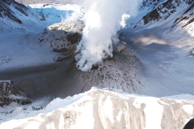
St. Helens (2004) |
|||
 St. Helens St. HelensUnited States |
Shortly before noon on 1 October, Mount St. Helens emitted a plume of steam and minor ash from an area of new crevasses that had opened in a portion of the crater glacier between the headwall of the 1980 crater and the lava dome. This marked the first eruption from Mount St. Helens since a series of phreatic explosions during 1989-1991; the 2004-2008 activity was characterized by rapid dome-building events seen in this time-lapse video.
|
||
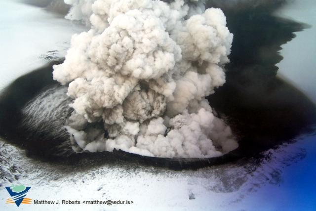
Grimsvotn (2004) |
|||
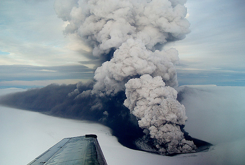 Grimsvotn GrimsvotnIceland |
An eruption on 1 November was preceded by both long-term and short-term precursors and was triggered by the release of overburden pressure associated with a glacial outburst flood (jokulhlaup), originating from the Grímsvötn subglacial caldera lake. The amount of drop in water level in the Grímsvötn caldera at the onset of the eruption is uncertain, but was probably on the order of 10-20 m. An ash plume rose ~12.2 km a.s.l. On 3 November, eruptive activity occurred in pulses, resulting in a changing eruption column height from 8-9 km to 13-14 km above the volcano. The ash fall sector extended at least 150 km from the eruption site. The distal ash plume was observed in Norway, Finland, and Sweden.
|
||
Fernandina (2005) |
|||
 Fernandina FernandinaEcuador |
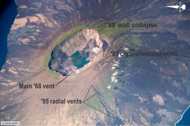
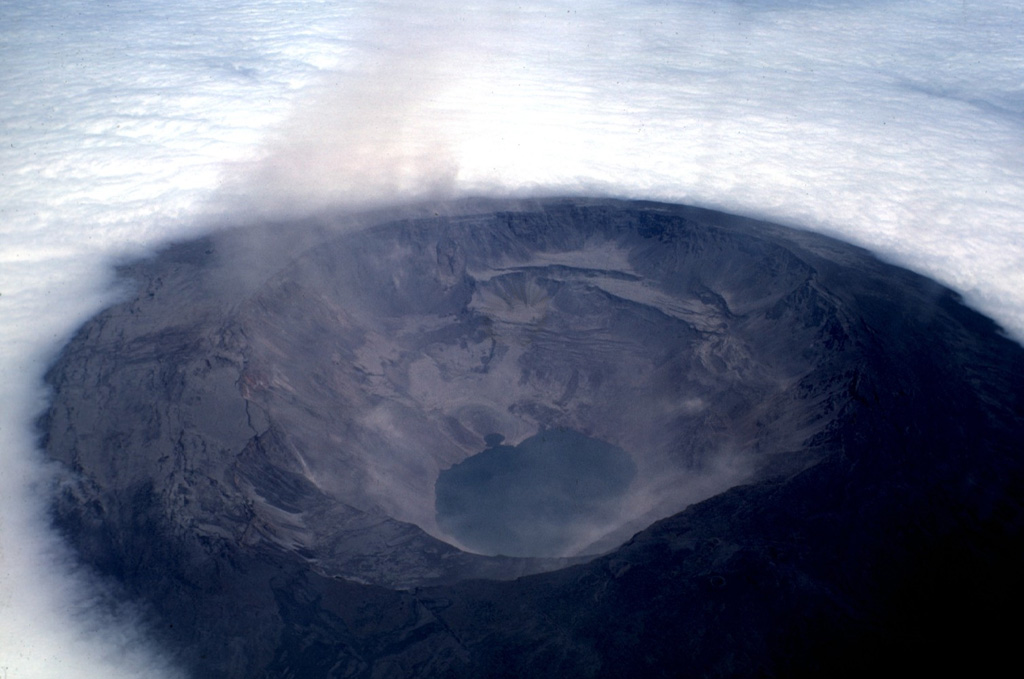
Fernandina, the most active of Galápagos volcanoes and the one closest to the Galápagos mantle plume, is a basaltic shield volcano with a deep 5 x 6.5 km summit caldera. Collapse of a nearly 1 cu km section of the east caldera wall during an eruption in 1988 produced a debris-avalanche deposit that covered much of the caldera floor and absorbed the caldera lake. Fissure eruptions were noted in 2005 and 2009. The satellite image and terrain quality of Galápagos volcanoes in Google Earth is spectacular and produces great virtual fly-throughs of the islands.
|
||
Karthala (2005) |
|||
 Karthala KarthalaComoros |
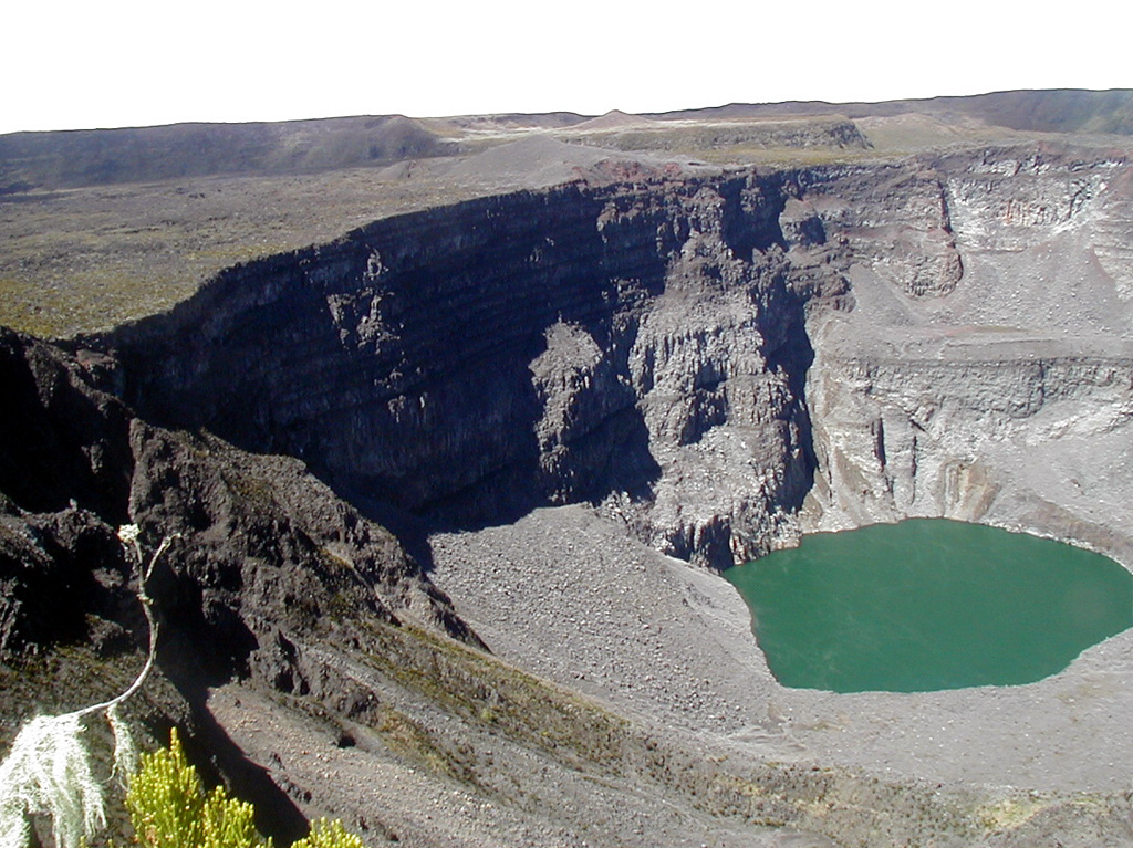
There were reports of ash emissions and lava at the bottom of the crater in April. A phreatomagmatic eruption occurred in November, causing ashfall and the evacuation of 2,000 people. Preliminary assessments revealed that about 118,000 people living in 75 villages may have been affected by the contamination of domestic water tanks.
|
||
Krummel-Garbuna-Welcker (2005) |
|||
 Krummel-Garbuna-Welcker Krummel-Garbuna-WelckerPapua New Guinea |
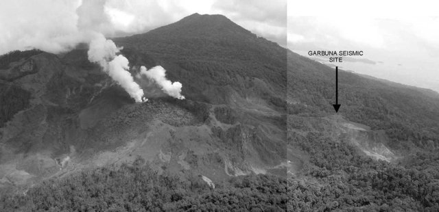
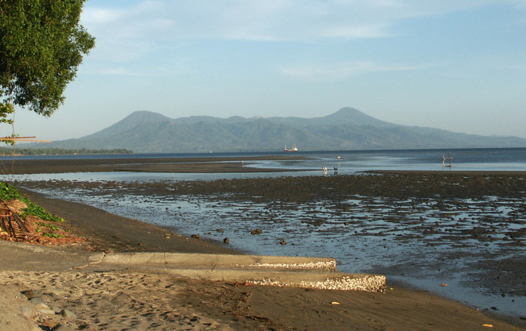
The last eruption occurred in 150 CE. The first historically witnessed eruption began at Garbuna on the afternoon of 16 October when "white vapor" rose above the volcano and a couple of felt earthquakes occurred. On 17 October, an eruption column rose 3-4 km above the volcano's summit (or 11,700-15,000 ft a.s.l.). At 1100 fine ash fell on the W and NW sides of the volcano, covering two plantations. Water sources originating from Garbuna were affected by the eruption.
|
||
Dabbahu (2005) |
|||
 Dabbahu DabbahuEthiopia |
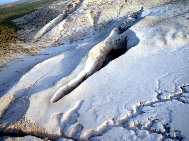
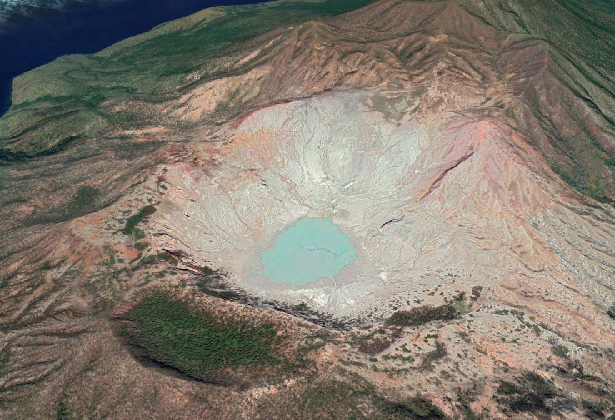
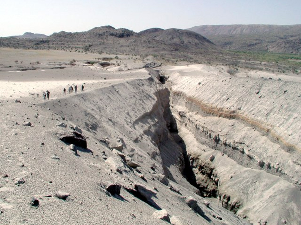
The first historical eruption took place from a fissure vent on the NE flank in September 2005. A team of scientists visited the Da'Ure locality immediately adjacent to the NE flank of the Quaternary Dabbahu (or Boina) felsic complex on 4 and 5 October after receiving reports of volcanic activity there on 26 September. People in the area noted that on 26 September at about 1300 a very strong earthquake shook the area, and was followed by a dark column of "smoke" that rose high into the atmosphere and spread out to form a cloud, which darkened the area for 3 days and 3 nights. The scientists determined that a minor explosive eruption occurred from two semi-circular vents, producing ashfall that was ~5 cm thick near the vent. Ash deposits extended more than 500 m from the vent. Boulders emitted during the eruption were as large as 3 m and were deposited as far as 20 meters away. More than 6,000 people were evacuated from neighboring villages.
|
||
Merapi (2006) |
|||
 Merapi MerapiIndonesia |
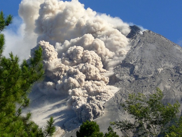
One of Indonesia's most active volcanoes and lies in one of the world's most densely populated areas. Merapi dominates the landscape immediately north of the major city of Yogyakarta, 30 km SSW. An eruption in 2006 caused two deaths and the evacuation of about 22,000 people; the eruption was dominated by ash emissions, vigorous dome growth and collapse, and pyroclastic flows that traveled as far as 7 km.
|
||
Home Reef (2006) |
|||
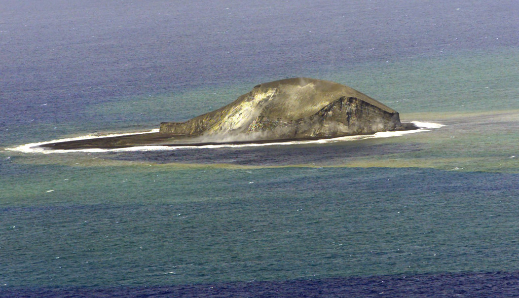 Home Reef Home ReefTonga |
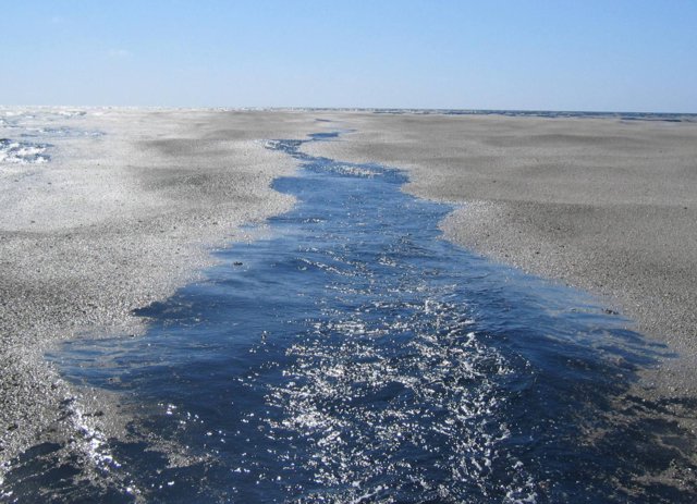
Pumice rafts are sometimes hard to trace back to their source but reports and pictures are always interesting. Large pumice rafts in the Fiji Islands were circulating during August-September. The source was initially thought to be Metis Shoal but due to some great sleuthing was later confirmed to be from Home Reef.
|
||
Jebel at Tair (2007) |
|||
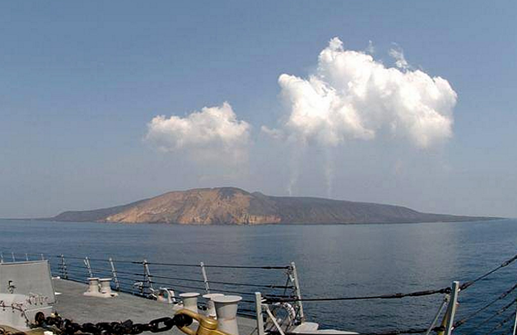 Jebel at Tair Jebel at TairYemen |
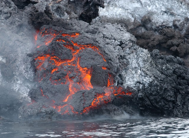
Before a fissure eruption at Jebel at Tair in 2007, explosive eruptions were reported in the 18th and 19th centuries. The 2007 was observed from several passing NATO ships on the evening of 30 September. Witnesses described a fissure eruption that produced lava fountains approximately 100 m high and ash plumes to a height of 300 m (1,000 ft) a.s.l. Multiple 1-km-long lava flows descended to the sea and a large landslide occurred on the W part of the island. Activity continued for at least two days.
|
||
Nevado del Huila (2007) |
|||
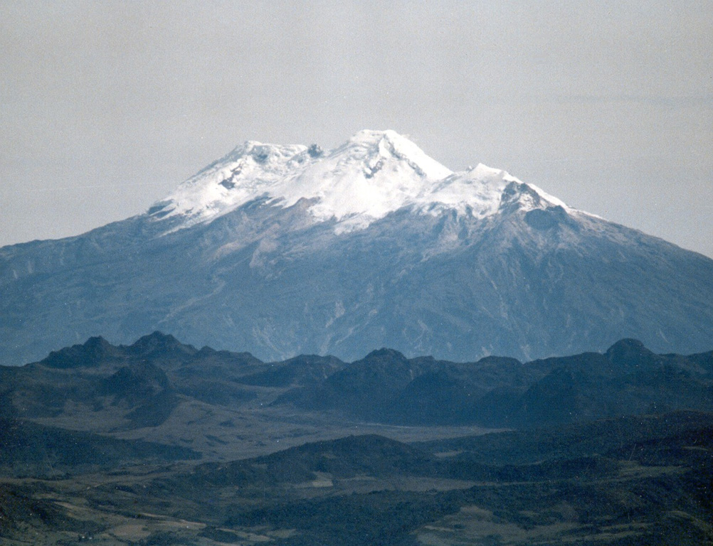 Nevado del Huila Nevado del HuilaColombia |
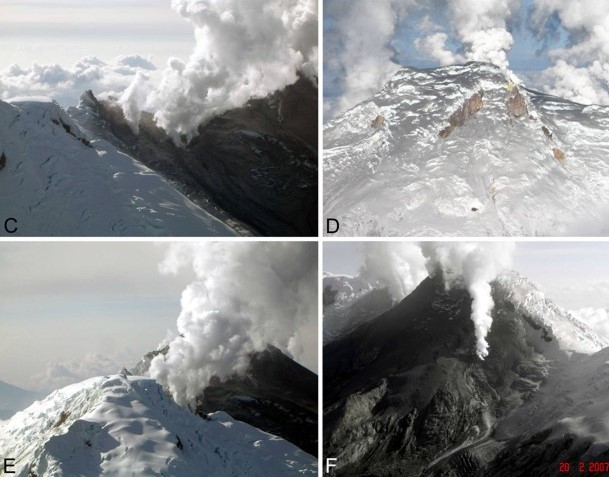
The first historical eruption from this little-known volcano was an explosive eruption in the mid-16th century. Long-term, persistent steam columns had risen from Pico Central prior to the next eruption in 2007, when explosive activity was accompanied by damaging mudflows. An eruption on 20 November 2008 destroyed part of a new lava dome that had formed during the previous months. Two gas-and-ash plumes rose to altitudes of 12.4-15.4 km (40,700-50,500 ft) a.s.l. and drifted W and SE. Hot material melted areas of the surrounding glacier and caused lahars that damaged infrastructure and destroyed homes; there may have been as many as 10 fatalities and 10 others were missing, and several populations were left without means of communication.
|
||
Kelud (2007) |
|||
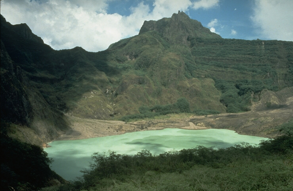 Kelud KeludIndonesia |
Kelut has a significant history of deadly eruptions. After more than 5,000 people were killed during an eruption in 1919, an ambitious engineering project sought to drain the crater lake. This initial effort lowered the lake by more than 50 m, but the 1951 eruption deepened the crater by 70 m, leaving 50 million cubic meters of water after repair of the damaged drainage tunnels. After more than 200 deaths in the 1966 eruption, a new deeper tunnel was constructed, and the lake's volume before the 1990 eruption was only about 1 million cubic meters. Amazingly, the eruption of a lava dome in 2007 was quite passive and visually fascinating.
|
||
Chaiten (2008) |
|||
 Chaiten ChaitenChile |
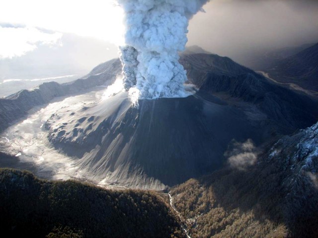
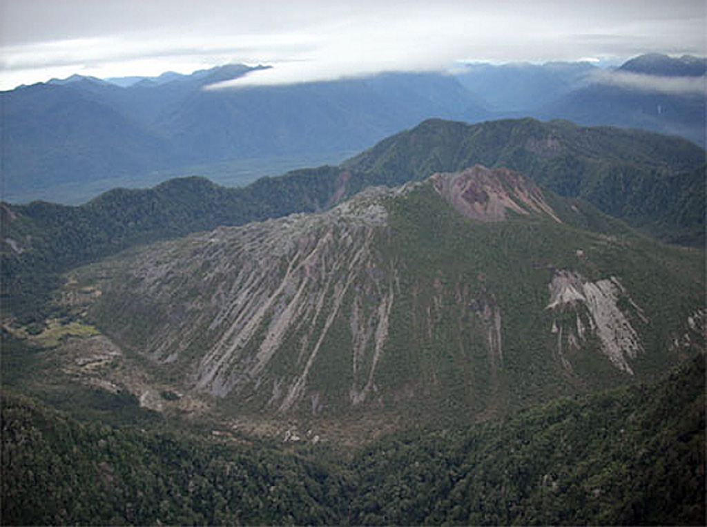
The first historical eruption of Chaitén volcano beginning in 2008 produced major rhyolitic explosive activity and growth of a lava dome that filled much of the caldera. The eruption was initially thought to have been from Minchinmávida. Chaitén began erupting on 2 May, following increased seismicity in the region just the day before. A pulsating white to gray ash plume rose to an estimated altitude greater than 21 km (68,900 ft) a.s.l. and drifted SSE. Residents evacuated Chaitén town (10 km SW); lahars and ashfall rendered the town uninhabitable. On 6 May the eruption became more forceful and generated a wider and darker gray ash plume to an estimated altitude of 30 km (98,400 ft) a.s.l. All remaining people in Chaitén were ordered to evacuate, as well as anyone within 50 km of the volcano.
|
||
Llaima (2008) |
|||
 Llaima LlaimaChile |
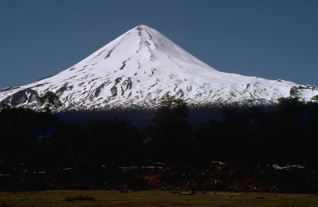
Llaima, one of Chile's largest and most active volcanoes, contains two main historically active craters, one at the summit and the other, Pichillaima, to the SE. An eruption began on the first of the year in 2008 and during January-February was characterized by Strombolian activity, fissure activity, a lava lake, lava flows, lahars, and tall ash plumes.
|
||
Sarychev Peak (2009) |
|||
 Sarychev Peak Sarychev PeakRussia |
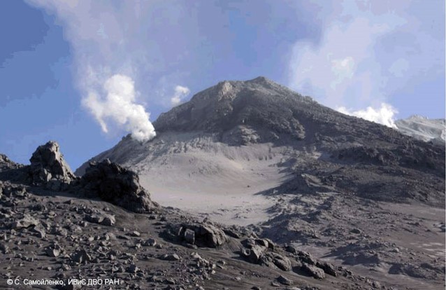
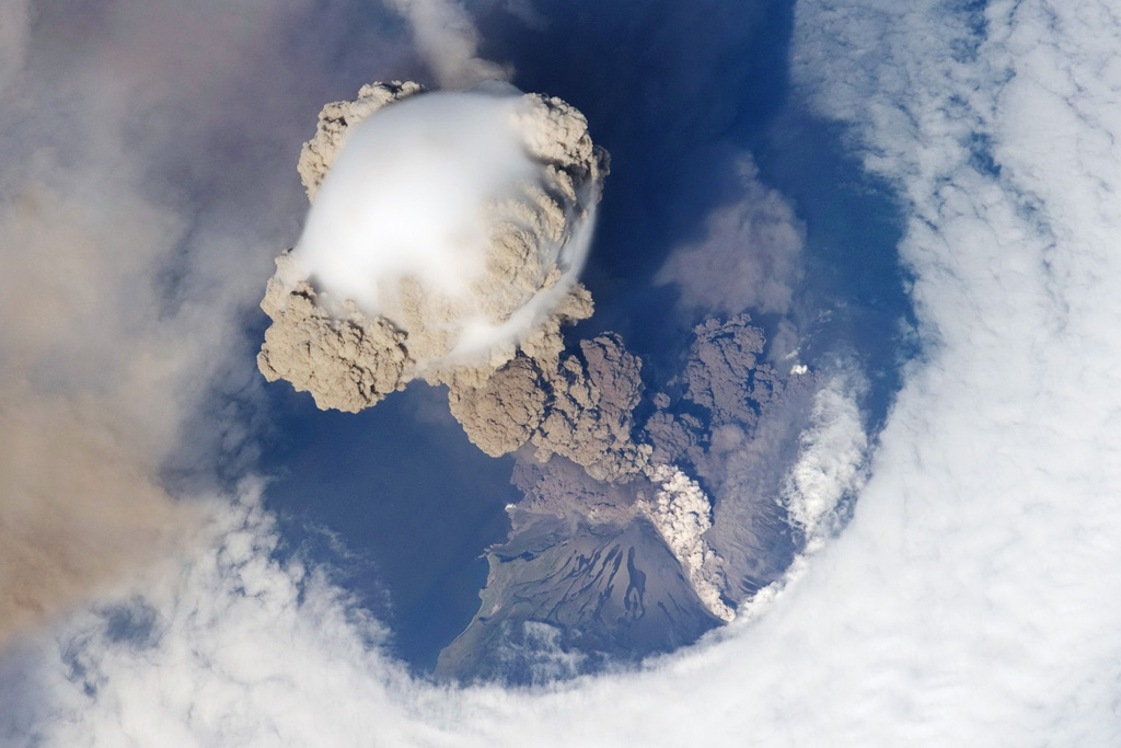
Eruptions have been recorded since the 1760's and include both quiet lava effusion and violent explosions. One of the largest historical eruptions of Sarychev Peak in 1946 produced pyroclastic flows that reached the sea. A short but incredible series of images of the 2009 eruption was captured by astronauts aboard the International Space Station.
|
||
Hunga Tonga-Hunga Ha'apai (2009) |
|||
 Hunga Tonga-Hunga Ha'apai Hunga Tonga-Hunga Ha'apaiTonga |
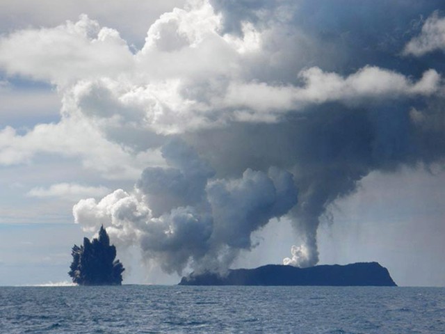
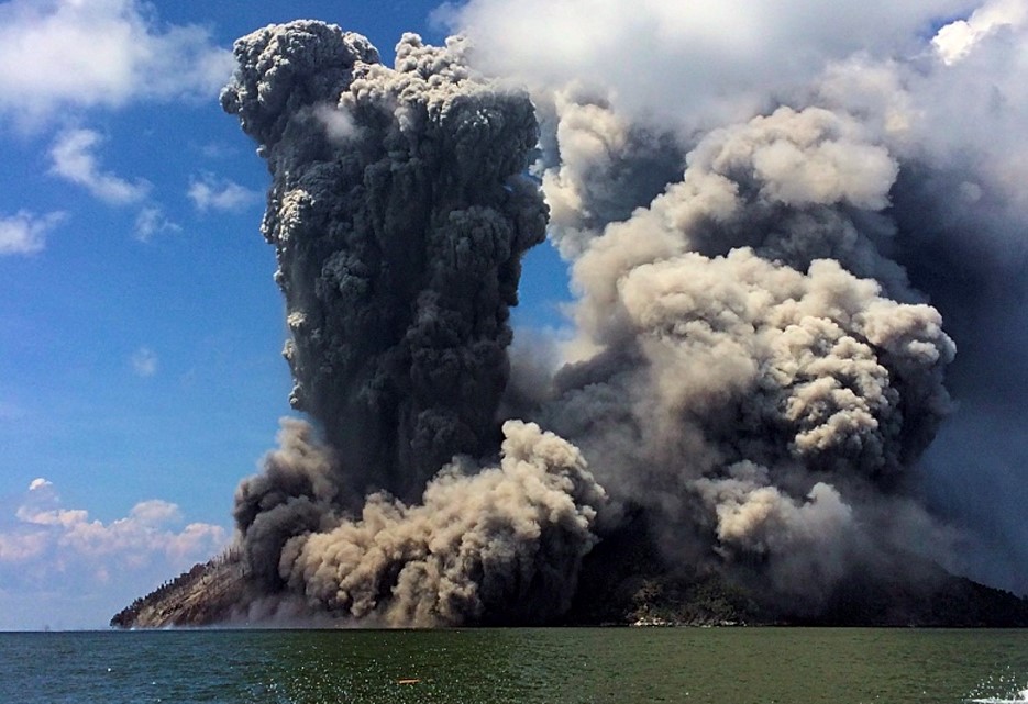
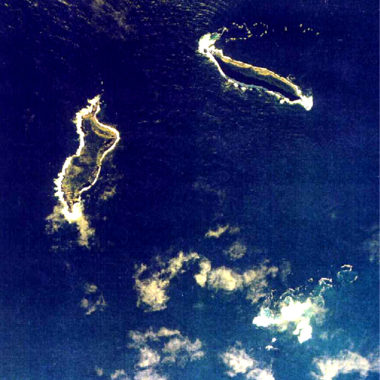
The 2009 and 2014-2015 eruptions were interesting to write about because of the multitude of non-traditional observations we received, like from passers-by on boats, folks in private planes, and local photographers. And, ultimately, a new island was built.
|
||
Eyjafjallajokull (2010) |
|||
 Eyjafjallajokull EyjafjallajokullIceland |
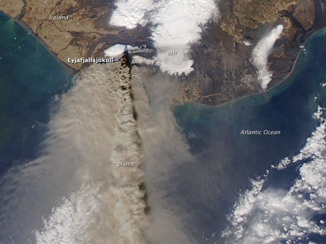
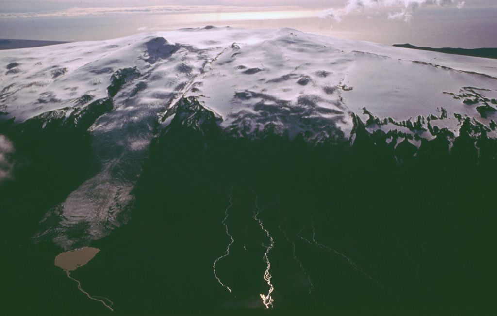
Although the 1,666-m-high volcano has erupted during historical time, it has been less active than other volcanoes of Iceland's eastern volcanic zone. The eruption began in March 2010 from a flank fissure, but it was the summit eruption in April that brought recent world-wide attention to how ash plumes impact air travel and safety. Although the eruption was not large, it caused major travel disruptions across Europe, significant monetary loss, and spurred more research into the finer details of aircraft and ash-plume encounters.
|
||
Sinabung (2010) |
|||
 Sinabung SinabungIndonesia |
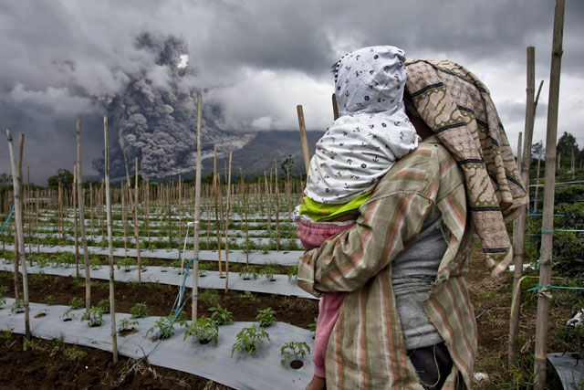
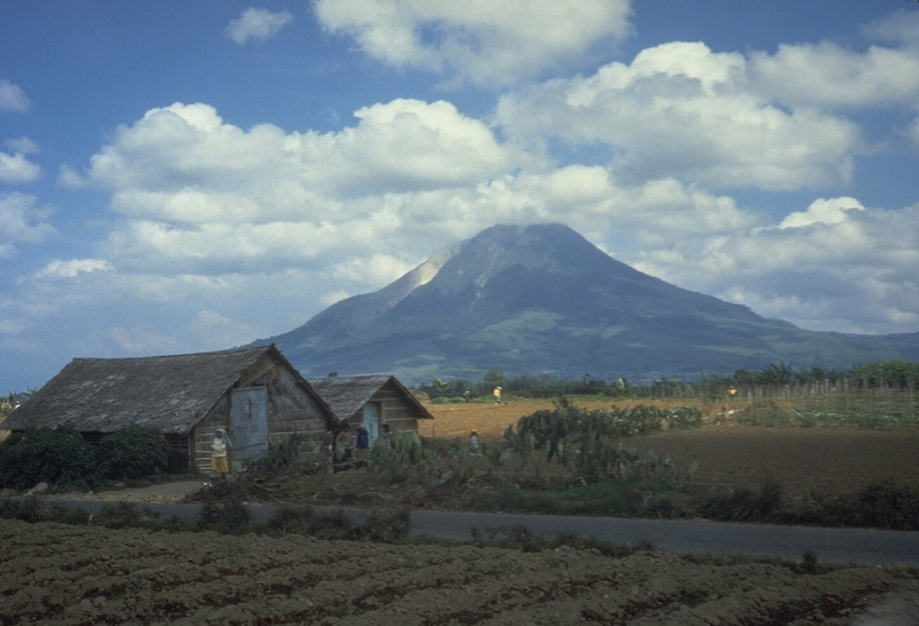
The initial phreatic eruption on 27 August heralding the first historic eruption. By 30 August there had been 20,000-30,000 residents evacuated. The next months were characterized by fluctuating but overall increasing levels of activity, and cycles of residents being evacuated and returning to their homes. On 25 November BNPB reported that 17,713 people, out of the 20,270 residents living within 5 km, had been evacuated to 31 shelters. At 1030 on 1 February a large dome collapse generated pyroclastic flows that traveled 4.5 km S, killing 17 people that had entered the 5-km exclusion zone without permission. BNPB lists the victims’ names and their ages; I was saddened to see so many young people among the deceased. On 4 February the number of displaced people reached 31,739 (9,915 families) in 42 evacuation centers, many from outside of the exclusion zone. Activity continued through mid-2018. An eruption period was recorded in mid-2019, and activity again returned in 2020.
|
||
Zubair Group (2011) |
|||
 Zubair Group Zubair GroupYemen |
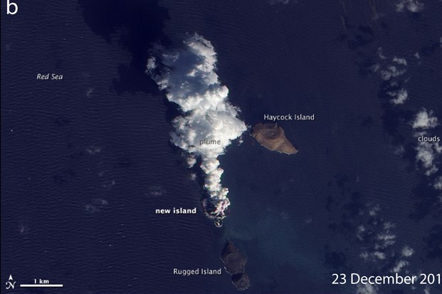
Fishermen from the port city of Salif on the western Red Sea coast of Yemen reported an offshore eruption from the island of Jebel Zubair, about 60 km SW, with lava fountains rising 20-30 m above the summit on 19 December. On 19 December a SO2 cloud was detected in an OMI satellite image. MODIS imagery from 20 December shows a plume rising from a submarine eruption about 1.5 km SW of Haycock and N of Rugged (near the N end of the Az-Zubair island group), and about 12 km NE of Jebel Zubair island. A bathymetric sketch map made in 1973 indicates a water depth of about 100 m in that area. Two new islands were built.
|
||
Hierro (2011) |
|||
 Hierro HierroSpain |
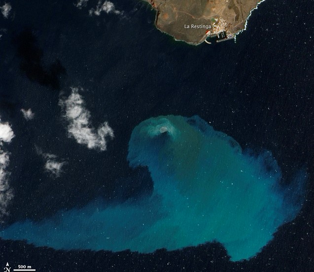
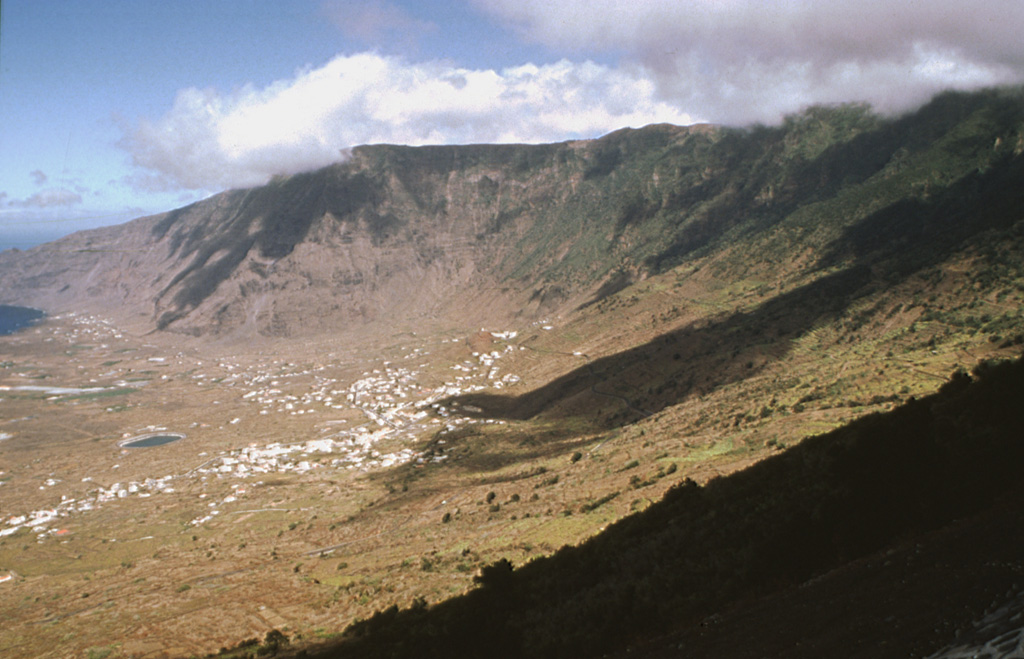
The triangular island of Hierro is the SW-most and least studied of the Canary Islands, though contains the greatest concentration of young vents. A submarine eruption in 2011 represented the first documented historical activity. A helicopter observed steaming lava fragments floating over the emission area, S of La Restinga village.
|
||
Nabro (2011) |
|||
 Nabro NabroEritrea |
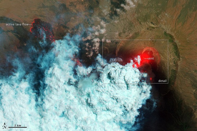
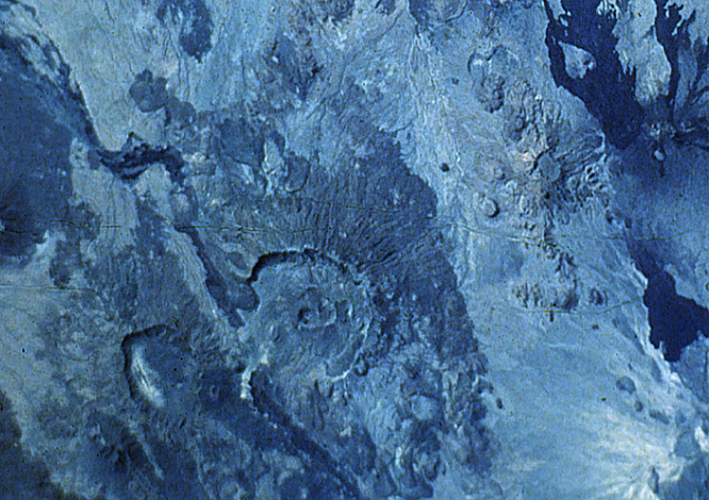
An eruption plume from this remote volcano initially rose to altitudes of 9.1-13.7 km (30,000-45,000 ft) a.s.l. on 13 June, then was later detected at altitudes of 6.1-10.7 km (20,000-35,000 ft) a.s.l. during 13-14 June. Ashfall covered hundreds of kilometers and the government evacuated area residents. A lava flow traveled WNW.
|
||
Puyehue-Cordon Caulle (2011) |
|||
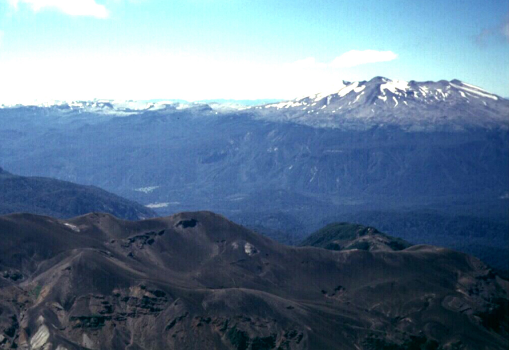 Puyehue-Cordon Caulle Puyehue-Cordon CaulleChile |
Significantly increased seismicity over a period of a few days led to the evacuation of 700 residents on 4 June. Later that day, an explosion produced a 5-km-wide ash-and-gas plume that rose to altitudes of 10.7-13.7 km (35,000-45,000 ft) a.s.l. and drifted 870 km ESE. The next day an ash plume continued to rise to altitudes of 10.7-12.2 km (35,000-40,000 ft) a.s.l. and had drifted as far as 1,778 km ESE, over the coast of Argentina, and out into the Atlantic Ocean, disrupting flights. During 4-5 June ashfall several centimeters thick was reported 100 km SE in Argentina. At least five pyroclastic flows, possibly as long as 10 km, were generated from partial collapses of the eruptive column and traveled N in the Nilahue River drainage. Pumice and vitreous tephra had accumulated in many area lakes and rivers, and ash had turned many rivers darker. Poor visibility and flight disruptions continued on 10 June. On 13 June the eruptive vent diameter was 300-400 m. Gas-and-steam plumes rose from two or three locations along the same fissure as the eruptive vent. Ashfall and column collapses were visible. At night incandescence from the base of the plume reached 1.5-2 km high. By 17 June ash plumes had circumnavigated the globe. Flights in South Africa were disrupted during 18-19 June. A 50-m-wide lava flow from the emissions center had traveled 200 m NW and 100 m NE, filling up a depression by 20 June.
|
||
Sirung (2012) |
|||
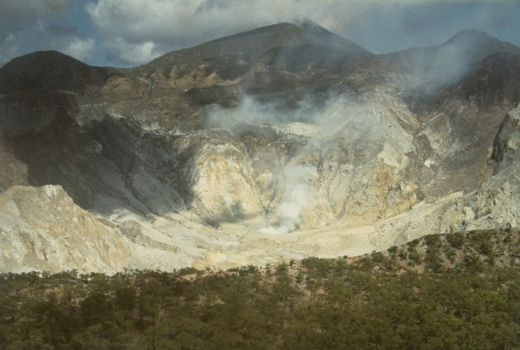 Sirung SirungIndonesia |
On 8 May a three-hour long ash eruption from Sirung was accompanied by loud sounds and incandescence that reached 10 m above the crater. An ash plume rose 3.5 km above the crater and drifted N, producing ashfall up to 4 mm thick near the crater.
|
||
Tongariro (2012) |
|||
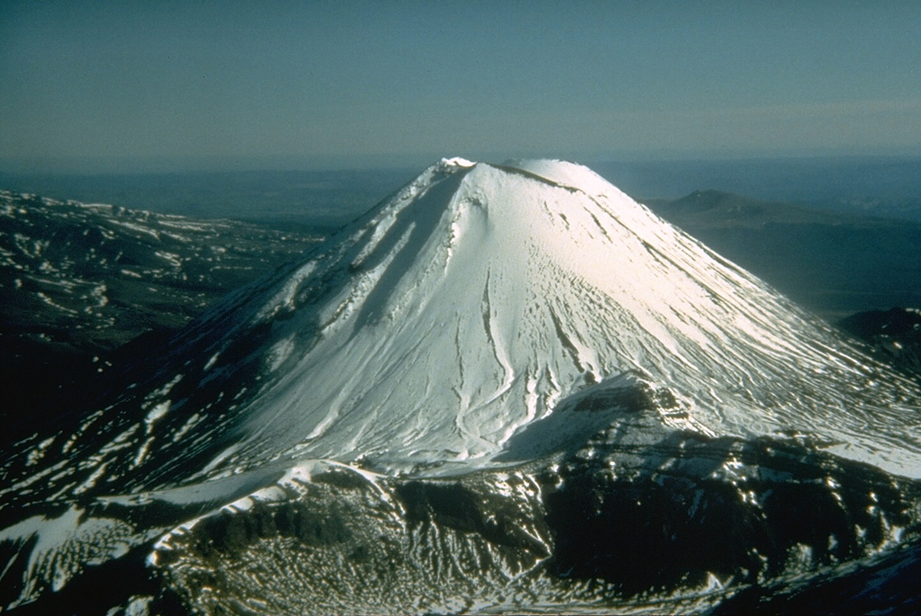 Tongariro TongariroNew Zealand |
A short-lived (~1-2 minutes) phreatic eruption occurred at the Te Mari craters area, followed by a series of discrete small earthquakes over the next few tens of minutes. An ash plume drifted E and ashfall was reported in areas around the volcano. Blocks of old and hydrothermally altered lava, as large as 1 m in diameter, ejected by the eruption fell 1.5-2 km from the Te Mari craters area. The last eruption occurred in 1896.
|
||
Zhupanovsky (2013) |
|||
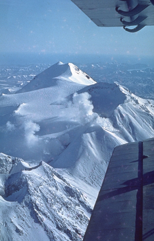 Zhupanovsky ZhupanovskyRussia |
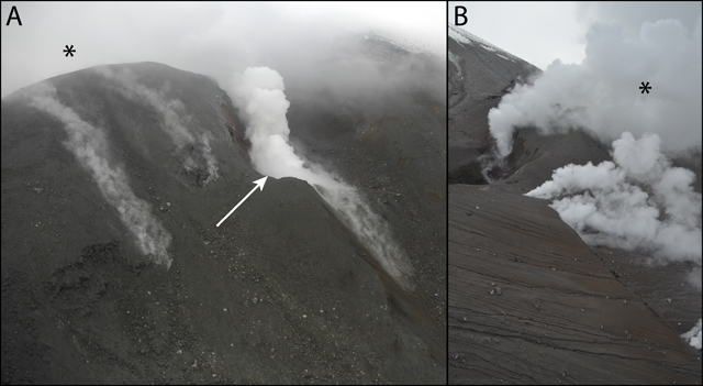
The last major eruption took place about 800-900 years BP. Historical eruptions have consisted of relatively minor explosions from the third cone. On 24 October a phreatic eruption began at about 0300 and generated an ash plume that rose 5 km (16,400 ft) a.s.l. The ash plume was visible in satellite images drifting 40 km SE and S. Ash deposits about 10 cm thick were visible at the summit of the central part of the volcano, and deposits about 1 mm thick covered the Nalychevo Valley. This was the first eruption since the 1950’s.
|
||
Mayon (2013) |
|||
 Mayon MayonPhilippines |
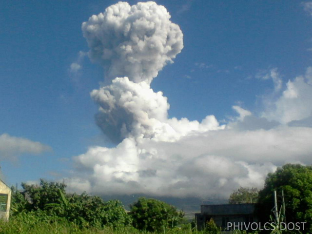
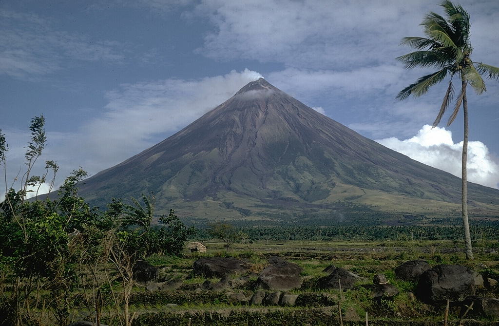
In May a phreatic eruption ejected large "room-sized rocks" towards about 30 climbers, killing five and injuring eight. The volcano had been quiet for more than a year. This event highlights the danger of entering an exclusion zone, even during non-eruptive periods, in this case one that encompasses a 6-km-radius.
|
||
Fogo (2014) |
|||
 Fogo FogoCabo Verde |
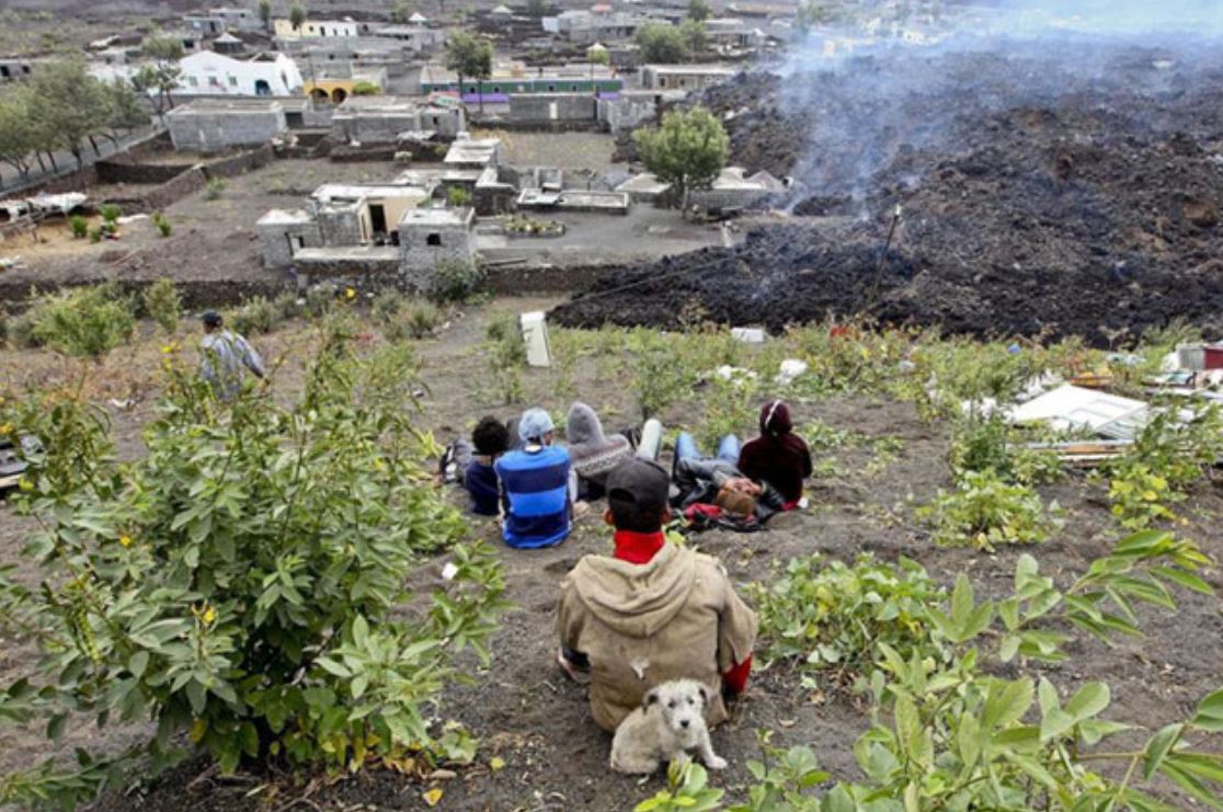
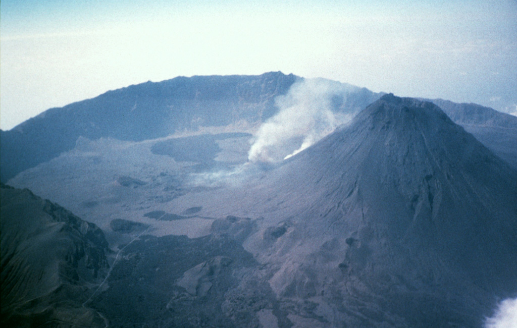
I was introduced to this volcano when it began erupting again in 2004 from Pico Cone. Lava, sometimes flowing at a rate of 30 meters per hour, overtook structures and caused the almost 1,500 residents of the caldera to evacuate. By 8 December about 90% of Bangaeira and 95% of Portela were overtaken by the flows which, and as noted by the article, destroyed 100 years of town history.
|
||
Bardarbunga (2014) |
|||
 Bardarbunga BardarbungaIceland |
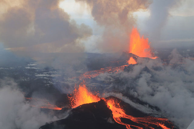
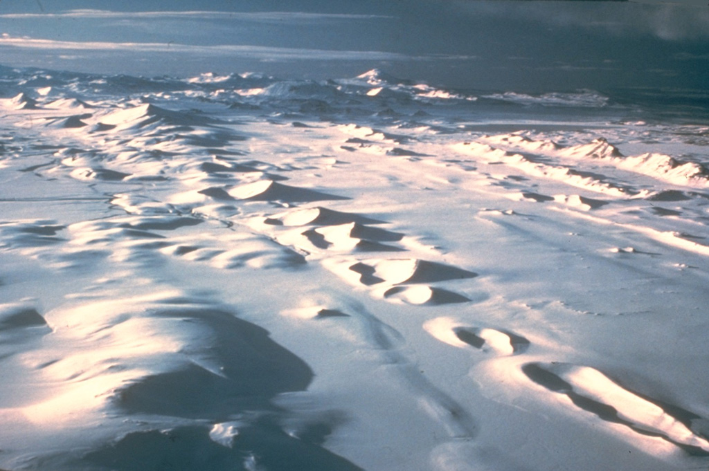
GPS stations showed movement upward and away from the volcano since early June 2014. Earthquakes increased on 16 August. By 18 August there had been 2,600 earthquakes detected at the volcano; earthquake locations from N and E swarms had been migrating NE, but in the evening activity of the N swarm had decreased significantly. GPS and seismic data indicated that an intrusive dike had increased from 25 to 40 km in length E, NE, and N of the volcano during the next week. On 29 August a small fissure eruption started in Holuhraun along an old fissure about 600 m in length. A fissure eruption ensued, bringing in spectators from all over the world and producing remarkable photographs and video. A local chef had cooked a fancy dinner on the lava flow for a lucky couple.
|
||
Ahyi (2014) |
|||
 Ahyi AhyiUnited States |
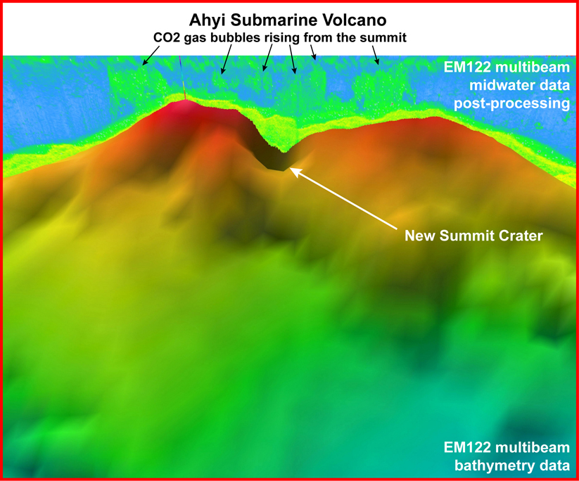
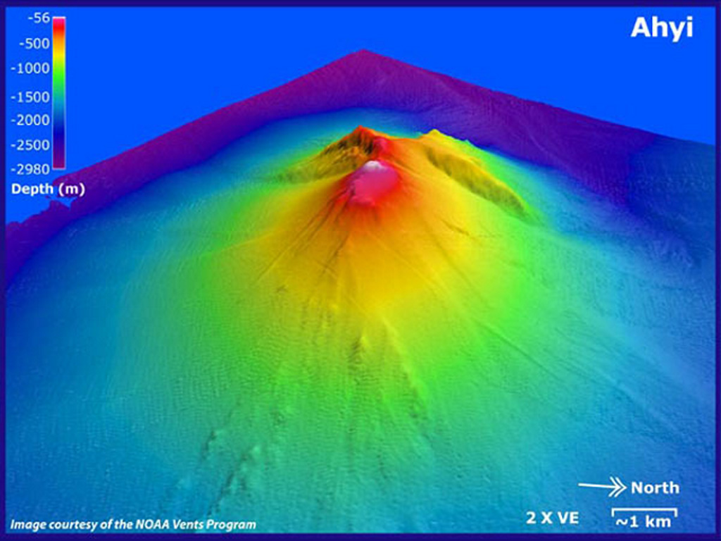
Seismic stations on Pagan, Sarigan, Anatahan, and Saipan began recording signals starting at 0635 on 24 April believed to be from an undersea volcanic source. While conducting coral reef research at Farallon de Pajaros, NOAA divers reported hearing loud explosions and feeling the shock waves. One of the more powerful explosions was felt by the crew as it reverberated through the hull of the ship.
|
||
Ontakesan (2014) |
|||
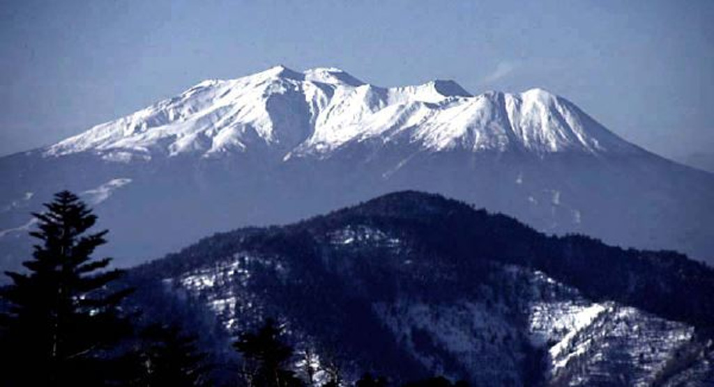 Ontakesan OntakesanJapan |
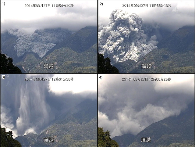
An unexpected phreatic eruption that killed 47 tourists and injured almost 70 more again was a poignant reminder of the power and unpredictability of a natural system. The eruption produced a pyroclastic flow that traveled more than 3 km down the S flank. Some fleeing tourists recorded the pyroclastic flow descended upon them as they ran, giving viewers an insight into this deadly hazard and the terrifying event.
|
||
Rabaul (2014) |
|||
 Rabaul RabaulPapua New Guinea |
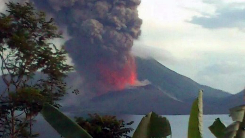
The most dramatic event at this volcano during the past several years occurred when a Strombolian explosion on 29 August sent an ash plume to ~18 km altitude. One of my favorite videos showing a shock wave is from an explosion at Rabaul on that same day.
|
||
Momotombo (2015) |
|||
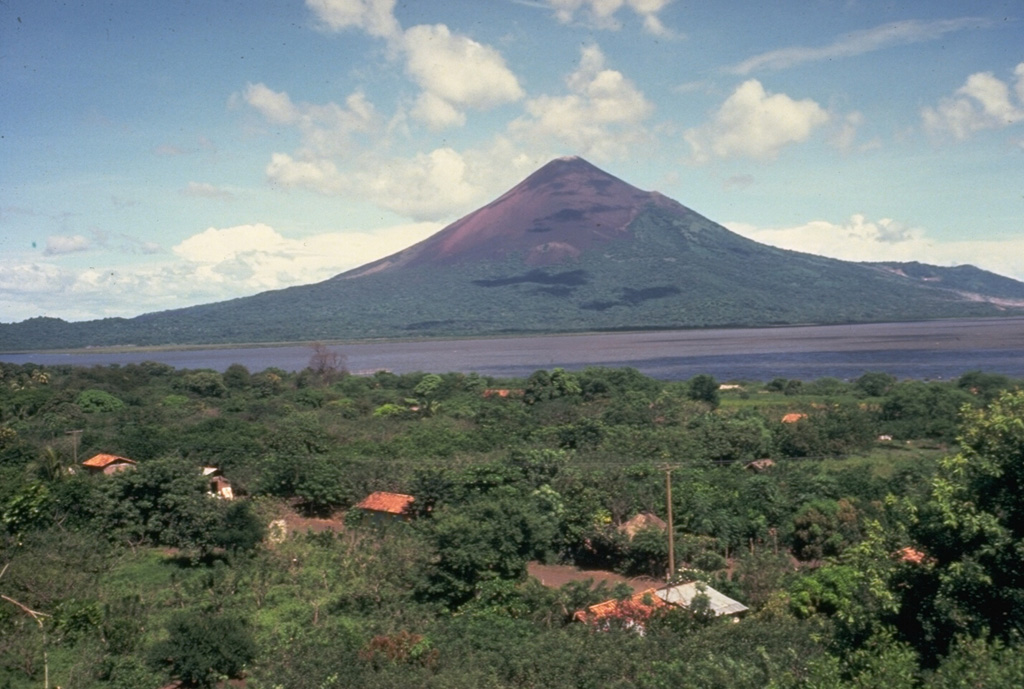 Momotombo MomotomboNicaragua |
The first eruption at Momotombo after around 100 years began in December with an explosion and a gas-and-ash plume. Explosions ejected incandescent tephra and a slow-moving lava flow traveled on the N flank. Ashfall was reported in nearby communities to the W and SW. Fieldwork revealed a small, incandescent, circular crater halfway up Momotombo's E flank that was fuming during the morning on 6 December. An explosion on 7 December destroyed part of the crater.
|
||
Tengger Caldera (2015) |
|||
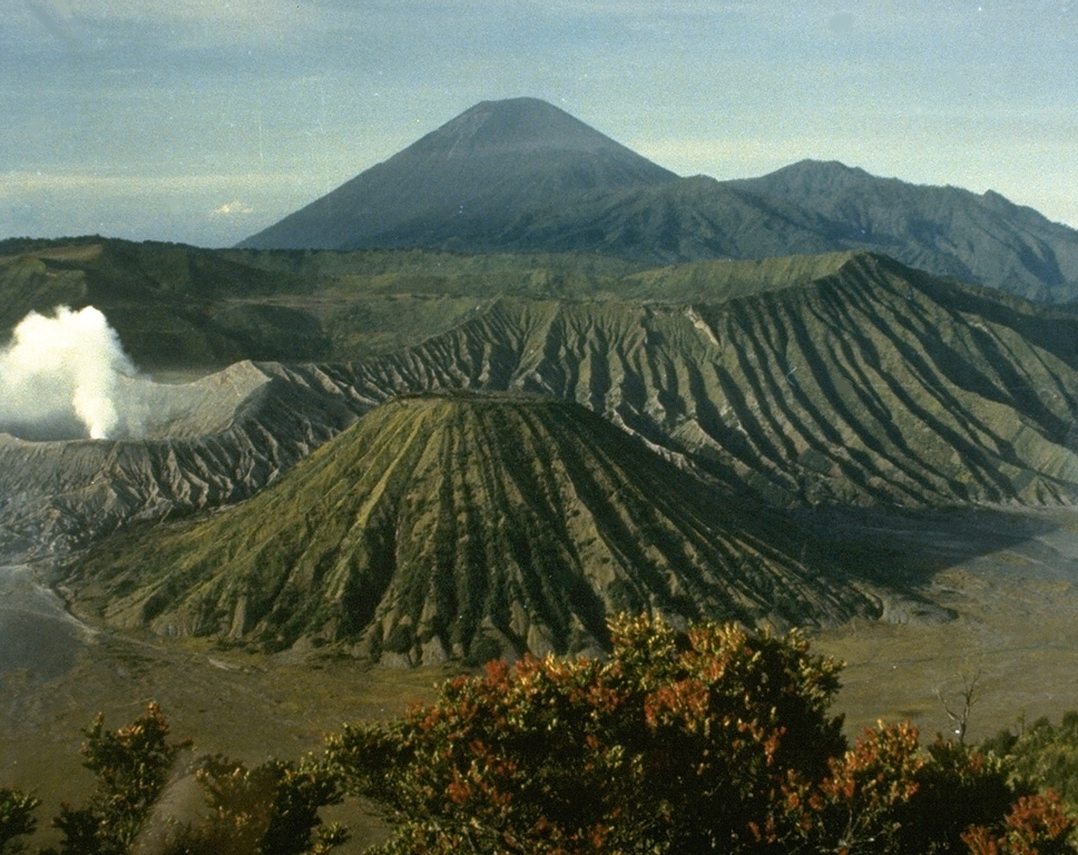 Tengger Caldera Tengger CalderaIndonesia |
Nothing exceptional occurred in 2015, except that activity resumed at Bromo, the youngest cone, after almost a year of low-to-no activity. This volcano is included in the list because it is a popular tourist area and the many breath-taking tourist photos posted online are worth browsing through (which I have spent hours doing).
|
||
Calbuco (2015) |
|||
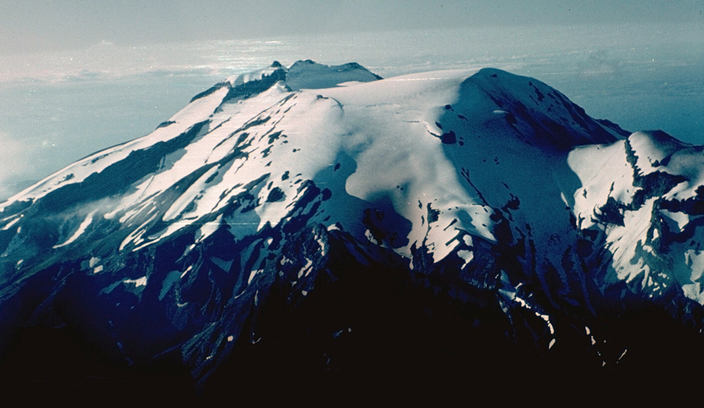 Calbuco CalbucoChile |
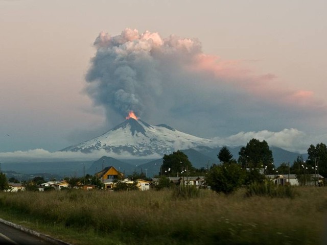
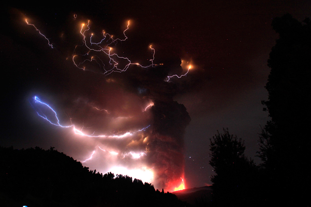
An eruption began on 22 April, the first since 1972, prompting a declaration of a 20-km exclusion zone. The eruption was preceded by an hour-long period of volcano-tectonic events followed by long-period events. After a large seismic event, a 90-minute eruption generated a sub-Plinian, gray ash plume that rose 15 km above the main crater and drifted mainly ENE, although fine ash drifted N and NW. Column collapses occurred locally and radially. A larger second event on 23 April lasted six hours, and also generated a sub-Plinian ash plume that rose higher than 15 km and drifted N, NE, and E. Incandescent tephra was ejected as far as 5 km; deposits were concentrated to the N and NE, with thicknesses varying from tens of centimeters to a few millimeters. Pyroclastic flows traveled a maximum distance of 7 km and lahars traveled 15 km. Scientists aboard an overflight observed ash emissions from at least six vents on the W, SW, and S sides of the old lava dome. About 5,000 people had been evacuated. Sulfur dioxide was detected as high as 21 km altitude. Although most ash had fallen out of the plume over Chile and Argentina, some may have remained in the stratospheric plume that within a few days had traveled around the globe. The large plume and favorable weather conditions led to breath-taking photographs of the eruption, especially of lightning strikes within the ash cloud.
|
||
Bogoslof (2016) |
|||
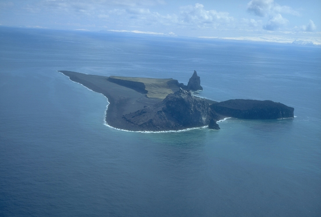 Bogoslof BogoslofUnited States |
A powerful, short-lived explosion in December heralded a new eruption and sent ash to over 10.3 km altitude. The eruption would last until the July 2017, and in the meantime produce many eruption plumes as high as 11.6 km a.s.l. and drastically change the shape of the island.
|
||
Dieng Volcanic Complex (2017) |
|||
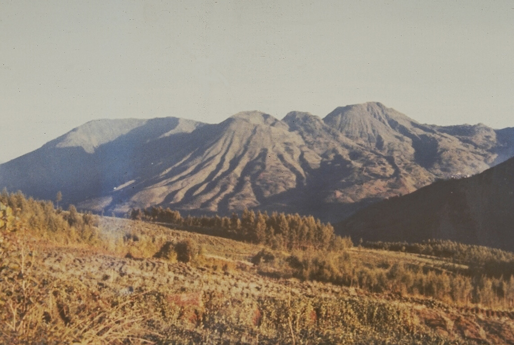 Dieng Volcanic Complex Dieng Volcanic ComplexIndonesia |
A phreatic eruption at the Sileri Crater lake occurred in July, ejecting mud and material 150 m high, and 50 m to the N and S. The event injured 11 of 18 tourists that were near the crater. A helicopter on the way to help evacuated people after the event crashed, killing all eight people (four crewmen and four rescuers) on board.
|
||
Kambalny (2017) |
|||
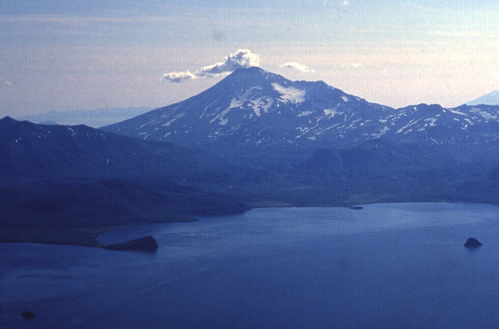 Kambalny KambalnyRussia |
The onset of the first eruption in almost 700 years was witnessed by staff at the Kronotsky State Nature Reserve. Satellite data showed an ash plume drifting 35 km SW at altitudes of 5-6 km a.s.l. The eruption intensified later that day, with ash plumes rising as high as 7 km a.s.l. and drifting as far as 255 km SSW. This is an eruption from a remote volcano that may not have made it into the record without witnesses or before the age of satellite observations.
|
||
Ambae (2017) |
|||
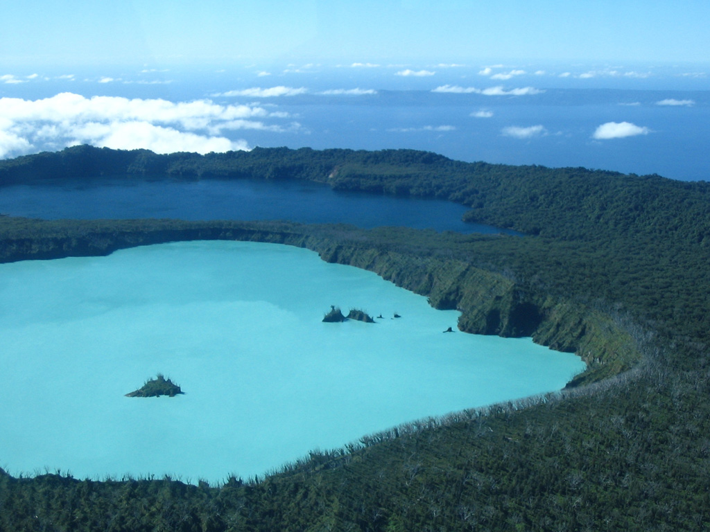 Ambae AmbaeVanuatu |
Lava was first observed on 22 September emerging from a vent at the summit of the pyroclastic cone. Ash plumes and fountaining lava persisted for a few weeks as the pyroclastic cone increased in size. Activity became more intermittent by mid-October, but explosions still produced ash plumes; the highest was reported at 9.1 km altitude. By 4 October about 11,600 people had been evacuated but they began returning home later that month.
|
||
Kusatsu-Shiranesan (2018) |
|||
 Kusatsu-Shiranesan Kusatsu-ShiranesanJapan |
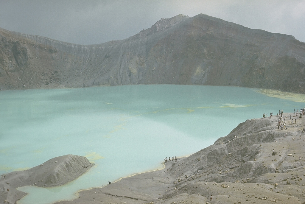
In January an eruption began coincident with the onset of volcanic tremor; there were no indications of an impending eruption. Skiers at the popular Kusatsu Kokusai resort took incredible video showing a plume of tephra and ejected bombs rising over the hillside. Tephra hit a gondola, shattering glass and injuring four skiers. Material crashed through the roof of a lodge, where about 100 people had already been evacuated. Ground Self-Defense Force troops were engaging in ski training at the time of the event; one member died, and seven others were injured. All previous historical activity had been from Yagama Crater on Shiranesan. I used Google Earth and the video taken by skiers to identify the vent, which was on the Motoshiranesan edifice, about 2 km SSE of Yagama Crater, to get the most accurate information into the WVAR.
|
||
Fuego (2018) |
|||
 Fuego FuegoGuatemala |
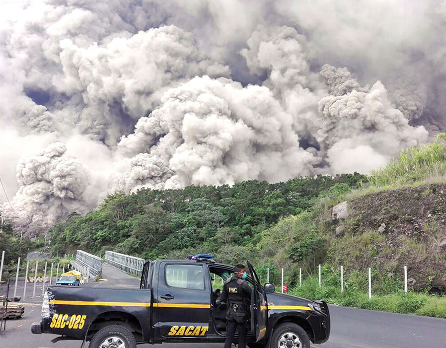
Frequent vigorous historical eruptions have been recorded since the onset of the Spanish era in 1524, and have produced major ashfalls, along with occasional pyroclastic flows and lava flows. The current eruption began in 2002. On 3 June 2018 a large explosive eruption generated an ash plume that rose to 9 km (30,000 ft) a.s.l. Pyroclastic flows traveled at least 8 km and reached temperatures of 700 degrees Celsius. Tephra and lapilli fell in areas more than 25 km away. Eyewitness accounts described the fast-moving pyroclastic flows inundating fields people were working in, overtaking bridges, and burying homes up to their roof lines in some areas. San Miguel Los Lotes, Alotenango, and El Rodeo (10 km SSE) were the worst affected. As of 22 August, the number of people confirmed to have died due to the pyroclastic flows was 169, and 256 remained missing. As I was searching for information about what was happening I came across videos taken by residents showing the seemingly silent and terrifying pyroclastic flows descending valleys and expanding in all directions. Videos also showed stunned and anguished residents covered with tephra as well as some that had perished. It was raw and deeply affected me. These folks have lived with products of Fuego’s activity for a long time; what happened that day? For weeks I grappled with the very existence of the videos, specifically why I could see almost in real time the pain and devastation residents were themselves trying to understand. The video is helpful for event reconstruction and documentation, but also unfiltered and graphic; I watched but should have been uninvited, and I too felt and still feel loss.
|
||
Krakatau (2018) |
|||
 Krakatau KrakatauIndonesia |
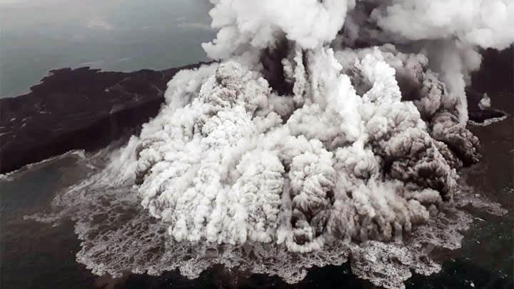
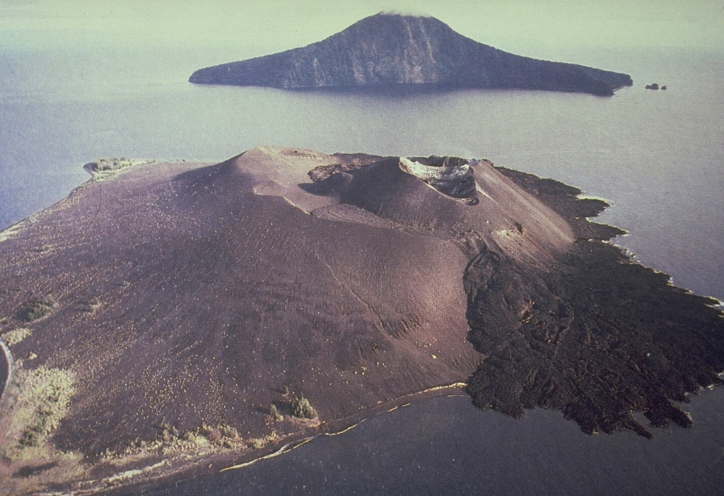
The partial collapse of the cone and resulting destructive tsunami, Surtseyan activity, and ash plumes with lightning in December 2018 is not covered in the WVAR, as I was under strict orders to not work as part of a government-wide shut down. It was frustrating to follow the unfolding story on my own and not collect the large amounts of reports and observations being shared widely; information from significant events like this can be buried and repeatedly overprinted by more information. Sometimes it is better to wait until it all sorts itself out and authorities have the chance to breath, curate the data, and write a more accurate account of events. Either way, the estimated removed volume above sea level was 150-180 million m3. The summit of the pre-collapse cone was 338 m, while the highest point post-collapse was reduced to 110 m. While the event was fascinating, scary videos of the tsunami emerged, and are reminders that volcanoes can change many lives in an instant.
|
||
Kadovar (2018) |
|||
 Kadovar KadovarPapua New Guinea |
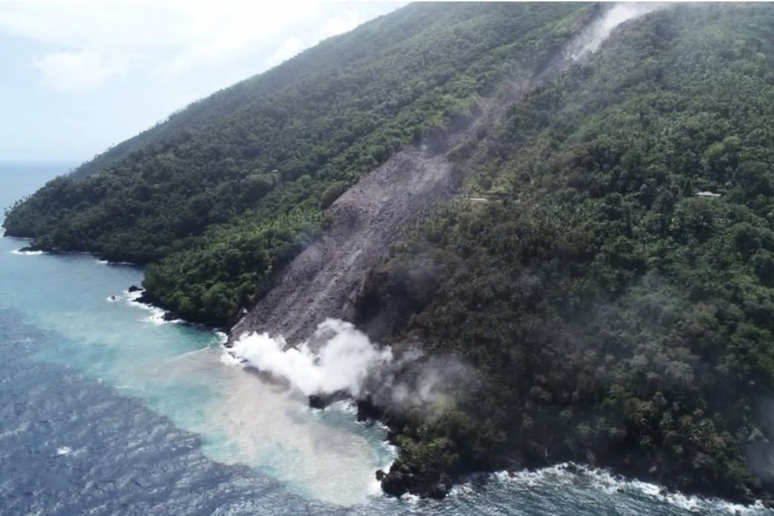
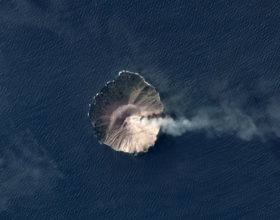
The entire population of the island (about 500 people) was evacuated by boats and numerous canoes to Blup Blup (15 km N) just after eruption plumes started rising from a vent on the SE side on 5 January. The next day observers 24 km away noted ash emissions rising from Kadovar and they experienced ashfall. As they were later circling near the island a large event ejected large boulders into the ocean. Within weeks, multiple vents opened, and a lava dome emerged at the SE coast. A lava dome also formed at the summit vent and remains active.
|
||
Karangetang (2019) |
|||
 Karangetang KarangetangIndonesia |
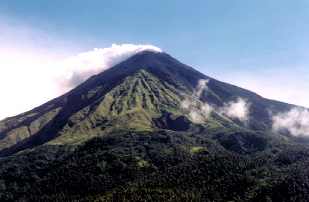
In early February an ’a’a lava from Kawah Dua (North Crater) had traveled 2.5 km NNW down the Melebuhe River drainage, prompting the evacuation of eight families (about 21 people). Drone footage showed that the flow was about 160 m wide where it crossed a main road (about 210 m from the coast) and about 140 m wide at the coast.
|
||
Whakaari/White Island (2019) |
|||
 Whakaari/White Island Whakaari/White IslandNew Zealand |
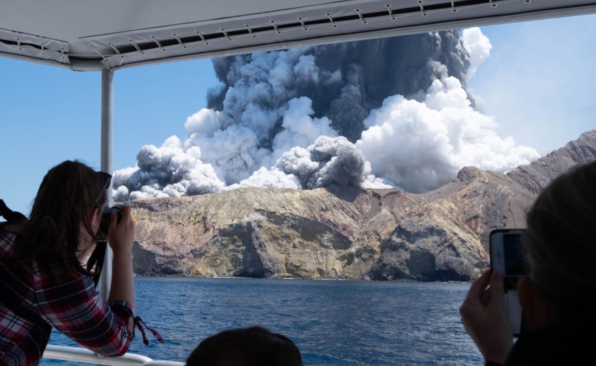
A deadly and short-lived (1-2 minutes) eruption on 9 December originated from the crater floor and generated an ash plume that rose 3.7 km (12,000 ft) above the vent. A tour group were on the island at the time of the eruption causing fatalities and victims with severe burns; survivors faced a long recovery, and some would later die. By early February 2020 the death toll was 21. Video of the event emerged, taken by a tourist on a boat who had just left the island and realized that another group was likely there. The event shed light on volcano tourism and the unpredictability of volcanic eruptions once again.
|
||
Taal (2020) |
|||
 Taal TaalPhilippines |
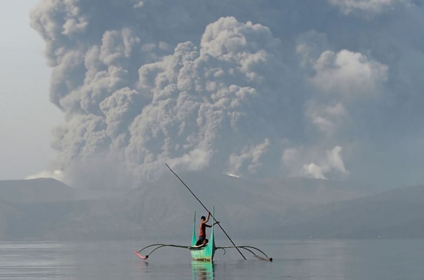
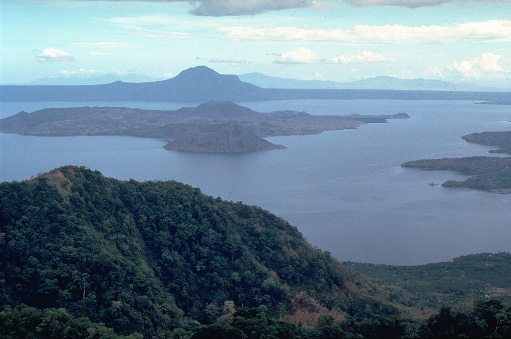
A phreatic eruption from a dike intrusion began on 12 January. Activity escalated and a total evacuation of the island and high-risk areas within a 14-km radius began. The eruption plume of steam, gas, and tephra significantly intensified and rose 10-15 km (32,800-49,200 ft) a.s.l., producing frequent lightning. Lava fountaining began the next day; fountains were 500-800 m tall. Ground cracking was observed in areas mainly to the SW. There were a total of 148,987 people in 493 evacuation centers on 21 January; the landscape was eerily gray with tephra deposits which devastated the local residences. In the days following the start of the eruption a fascinating video emerged possibly showing the very start of the eruption.
|
||

