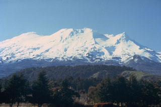
Report on Ruapehu (New Zealand) — March 1990
Bulletin of the Global Volcanism Network, vol. 15, no. 3 (March 1990)
Managing Editor: Lindsay McClelland.
Ruapehu (New Zealand) Phreatic explosions stop; increased tremor
Please cite this report as:
Global Volcanism Program, 1990. Report on Ruapehu (New Zealand) (McClelland, L., ed.). Bulletin of the Global Volcanism Network, 15:3. Smithsonian Institution. https://doi.org/10.5479/si.GVP.BGVN199003-241100
Ruapehu
New Zealand
39.28°S, 175.57°E; summit elev. 2797 m
All times are local (unless otherwise noted)
Phreatic eruptions had apparently stopped by 1 February. A possible eruption cloud was reported on 19 March, but a field inspection that day revealed only steam rising from the lake surface. There was no evidence of recent surging associated with small eruptions. Crater Lake was battleship gray with yellow and gray sulfur slicks. No convection was observed over the main vent, and only faint upwelling could be detected over the N vents. The lake temperature had cooled to 34.1°C from 46.5°C on 6 February. A sizeable lake had formed in an area of ice collapse in the valley draining Crater Lake to the S. Since 1 February, the lake had grown from ~60 ± 15 m to 100 ± 30 m. Sudden release of the lake could cause flooding in the Whangaehu River.
Volcanic tremor gradually declined in February, nearing background levels by 8 March. Continuous tremor with fairly uniform amplitude changed to bursts of tremor alternating with periods of quiet, similar to small volcanic earthquakes. On 8 March, tremor increased to high levels and broadened its frequency range, with 1 and 1.5 Hz tremor in addition to the usual 2 Hz signal. Tremor remained strong for 2-3 days before declining to more moderate amplitude. During the period of strongest activity, 6-hour energy release reached 400-1,400 x 104 joules, exceeding levels that accompanied the January 1982 eruptions, but less than in September 1982, when there were no eruptions and declining lake temperature. Tremor increased again on 16 March, almost to the level of 8 March, but by the 22nd had decreased to moderate-strong amplitude. EDM measurements on four lines across the N portion of the crater detected only small (<7mm) changes since the 1 February survey.
Geological Summary. Ruapehu, one of New Zealand's most active volcanoes, is a complex stratovolcano constructed during at least four cone-building episodes dating back to about 200,000 years ago. The dominantly andesitic 110 km3 volcanic massif is elongated in a NNE-SSW direction and surrounded by another 100 km3 ring plain of volcaniclastic debris, including the NW-flank Murimoto debris-avalanche deposit. A series of subplinian eruptions took place between about 22,600 and 10,000 years ago, but pyroclastic flows have been infrequent. The broad summait area and flank contain at least six vents active during the Holocene. Frequent mild-to-moderate explosive eruptions have been recorded from the Te Wai a-Moe (Crater Lake) vent, and tephra characteristics suggest that the crater lake may have formed as recently as 3,000 years ago. Lahars resulting from phreatic eruptions at the summit crater lake are a hazard to a ski area on the upper flanks and lower river valleys.
Information Contacts: P. Otway, DSIR Wairakei.

