Report on Guagua Pichincha (Ecuador) — March 1990
Bulletin of the Global Volcanism Network, vol. 15, no. 3 (March 1990)
Managing Editor: Lindsay McClelland.
Guagua Pichincha (Ecuador) Phreatic explosions and tremor after 10 days of A-type shocks
Please cite this report as:
Global Volcanism Program, 1990. Report on Guagua Pichincha (Ecuador) (McClelland, L., ed.). Bulletin of the Global Volcanism Network, 15:3. Smithsonian Institution. https://doi.org/10.5479/si.GVP.BGVN199003-352020
Guagua Pichincha
Ecuador
0.171°S, 78.598°W; summit elev. 4784 m
All times are local (unless otherwise noted)
After 15 months of quiet, phreatic activity began on 16 April at 0221. The activity was confined to the phreatic crater formed in 1981-82, on the NE side of the 600-m-diameter dome that occupies most of the caldera floor. Activity began with spasmodic harmonic tremor of small to intermediate amplitude, accompanied by strong fumarolic emissions generating a vapor column that rose at least 800 m. Several explosions were heard and recorded by seismographs 1.5 km and (very weakly) 9 km from the crater. Seven new fumaroles were observed within the 1981 crater, but by 17 April had joined to form a single fumarole 4 m in diameter. Non-juvenile material, rocks, and mud were thrown outward to 250 m from the vent, forming a layer 4 cm thick. The explosions enlarged the 1981 crater by ~20 m.
Precursory activity began with a M 2.3 earthquake on 5 April and a M 2.2 shock on 13 April. Only a few small events, both A- and B-type, were detected during subsequent days. The tremor had a typical frequency of 1.7 Hz on 15-17 April. Periods of tremor lasted as much as 3 hours, separated by intervals of low-amplitude tremor or quiescence. Intermittent explosions were also recorded, always associated with tremor. Only a few very small B-type events have been recorded since the onset of phreatic activity. Fumarolic waters remained at their normal temperature of 87°C.
Given the shallow character of the activity, geologists believed that it was partly related to the previous week's increased precipitation. Stepped-up monitoring and re-deployment of the Instituto Geofísico's seismic net (dismantled following the 1988 activity) were begun 16-17 April, and tilt stations and EDM lines were being resurveyed. The Instituto's hazard map and previously planned preparedness exercises for a hypothetical eruption of Guagua Pichincha were helping civil defense authorities to prepare for the possibility of increased activity.
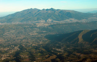
Geological Summary. Guagua Pichincha and the older Pleistocene Rucu Pichincha stratovolcanoes form a broad volcanic massif that rises immediately W of Ecuador's capital city, Quito. A lava dome grew at the head of a 6-km-wide scarp formed during a late-Pleistocene slope failure ~50,000 years ago. Subsequent late-Pleistocene and Holocene eruptions from the central vent consisted of explosive activity with pyroclastic flows accompanied by periodic growth and destruction of the lava dome. Many minor eruptions have been recorded since the mid-1500's; the largest took place in 1660, when ash fell over a 1,000 km radius and accumulated to 30 cm depth in Quito. Pyroclastic flows and surges also occurred, primarily to then W, and affected agricultural activity.
Information Contacts: M. Hall, Instituto Geofísico de la Escuela Politécnica Nacional.

