Report on Arjuno-Welirang (Indonesia) — August 1991
Bulletin of the Global Volcanism Network, vol. 16, no. 8 (August 1991)
Managing Editor: Lindsay McClelland.
Arjuno-Welirang (Indonesia) White plume from Welirang summit
Please cite this report as:
Global Volcanism Program, 1991. Report on Arjuno-Welirang (Indonesia) (McClelland, L., ed.). Bulletin of the Global Volcanism Network, 16:8. Smithsonian Institution. https://doi.org/10.5479/si.GVP.BGVN199108-263290
Arjuno-Welirang
Indonesia
7.733°S, 112.575°E; summit elev. 3343 m
All times are local (unless otherwise noted)
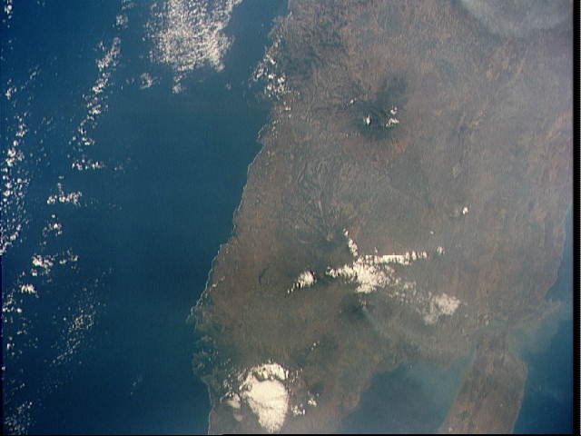
A plume from the summit area of Welirang . . . was photographed by Space Shuttle astronauts on 13 September at [1535] (photo no. S48-151-064) (figure 1). The dense portion of the apparently ash-poor plume extended roughly 50 km N and more diffuse material continued for another 65 km. The summit area was white and apparently de-vegetated. A plume was observed again on direct video downlink from the spacecraft on [17] September at [1306]. No ground reports were available at press time.
Geological Summary. The Arjuno and Welirang volcanoes anchor the SE and NW ends, respectively, of a 6-km-long line of volcanic cones and craters. The complex overlies most of the Gunung Ringgit edifice, whose summit is about 3 km NE from the main ridge. Pyroclastic cones are located on the north flank of Gunung Welirang and along an E-W line cutting across the southern side of Gunung Arjuno that extends to the lower SE flank. Fumarolic areas with sulfur deposition occur at several locations on Welirang.
Information Contacts: C. Evans and D. Helms, NASA-SSEOP.


