Report on Langila (Papua New Guinea) — October 1991
Bulletin of the Global Volcanism Network, vol. 16, no. 10 (October 1991)
Managing Editor: Lindsay McClelland.
Langila (Papua New Guinea) Explosive activity from two craters; small pyroclastic flows
Please cite this report as:
Global Volcanism Program, 1991. Report on Langila (Papua New Guinea) (McClelland, L., ed.). Bulletin of the Global Volcanism Network, 16:10. Smithsonian Institution. https://doi.org/10.5479/si.GVP.BGVN199110-252010
Langila
Papua New Guinea
5.525°S, 148.42°E; summit elev. 1330 m
All times are local (unless otherwise noted)
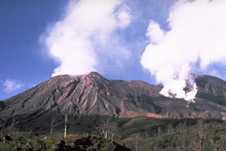
"Moderate to strong activity persisted throughout October. Crater 2 activity consisted of continuous release of white vapour, producing a small emission column that frequently (5-15 times/hour) turned into a forceful jet of ash-laden vapour, generating a whooshing sound. Occasionally, a discontinuous tremor-like signal was recorded by the 1-km-distant LAN seismometer. Light ashfalls were experienced in coastal areas 10 km downwind. On most nights this Vulcanian activity was accompanied by dull glow above the crater, becoming brighter at times when incandescent lava fragments were ejected onto the flanks of the cone.
"Activity at Crater 3 was intermittent, with periods of 5-15 minutes devoid of any emission separated by sudden forceful explosive emissions of thick, mushrooming, dark grey ash clouds that rose 400-650 m above the crater rim. The crater was more strongly active 4-10 October, when small pyroclastic flows were generated at the base of the strongest explosions, but these did not advance beyond the cone's upper flanks. Intermittent glow from the crater was accompanied by incandescent projections to ~100 m above the crater rim. Crater 3 explosions were recorded as distinct impulsive signals (5-50/day) by the LAN seismic station, with the strongest ones (1-12/day) recorded 9 km away (CGA station).
"Seismic activity dropped significantly in October. The intermittent tremor recorded since June disappeared in September but reappeared sporadically in October. Most of the seismicity consisted of discrete earthquakes. The daily totals of these events ranged from 15 to 60.
"Aerial and ground inspections were carried out 10-11 October. The main change noted since the last inspection, in mid-August, concerned Crater 3. Of the 2 active vents previously observed in the mound of lava filling the original crater, the N one (which seemed the most active in August) was inactive, while a 50-m explosion crater had formed around the S vent, which was the source of the reported Vulcanian activity. This new crater was bowl-shaped, ~6 m deep, and filled with loose debris-blocks and ash. Similar debris also extended in short tongues to <100 m outside the crater rim and probably was deposited by small pyroclastic flows such as those reported earlier in October. Within the crater were irregular arcuate ridges of loose debris that may have been deposited by pyroclastic flows. The active vent area was only ~5 m across. Although it remained glowing for a short time after each explosion, the maximum temperature measured with an infrared thermometer from 30 m distance was only 500°C when erupting, and 270°C when quiet. The temperature of the crater floor was 140-170°C.
"The short lava flow observed 12 August on the cone's N flank had cooled, but a few rootless fumaroles remained on its surface, which was partly buried under airfall blocks and ash. The flow had the rugged surface features of aa lava and was ~300 m long, extending from the crater rim (~1,100 m elev) to 950 m elev. Its thickness decreased from 2.5 m (where it spilled over the crater rim) to <1 m at its front. The volume of the flow is estimated to be <=15,000 m3.
"Crater 2 was estimated to be 130 m wide and 30 m deep. Its floor is now at the level of the upper bench described in the last ground inspection, in June 1989 (SEAN 14:06). Several small vents (<=1 m in diameter), although closely grouped at the base of the crater, were activated independently. At the times of the strongest emissions however, up to four vents erupted concurrently with a deafening jet engine noise, generating air and ground vibrations recorded by the summit seismic station as emergent periods of tremor-like signals. The westernmost vent was directing its jet of ash-laden vapour at an angle of 15° toward the SE, resulting in the backfall of blocks and spatter-like scoriae on the SE crater rim and beyond. The maximum measured temperature at the base of the jet (although glowing at times) was only 240°C, and 70°C higher up in the plume."
Geological Summary. Langila, one of the most active volcanoes of New Britain, consists of a group of four small overlapping composite basaltic-andesitic cones on the lower E flank of the extinct Talawe volcano in the Cape Gloucester area of NW New Britain. A rectangular, 2.5-km-long crater is breached widely to the SE; Langila was constructed NE of the breached crater of Talawe. An extensive lava field reaches the coast on the N and NE sides of Langila. Frequent mild-to-moderate explosive eruptions, sometimes accompanied by lava flows, have been recorded since the 19th century from three active craters at the summit. The youngest and smallest crater (no. 3 crater) was formed in 1960 and has a diameter of 150 m.
Information Contacts: P. de Saint-Ours and C. McKee, RVO.

