Report on Karkar (Papua New Guinea) — November 1991
Bulletin of the Global Volcanism Network, vol. 16, no. 11 (November 1991)
Managing Editor: Lindsay McClelland.
Karkar (Papua New Guinea) Thermal areas shrink; continued deflation
Please cite this report as:
Global Volcanism Program, 1991. Report on Karkar (Papua New Guinea) (McClelland, L., ed.). Bulletin of the Global Volcanism Network, 16:11. Smithsonian Institution. https://doi.org/10.5479/si.GVP.BGVN199111-251030
Karkar
Papua New Guinea
4.647°S, 145.976°E; summit elev. 1839 m
All times are local (unless otherwise noted)
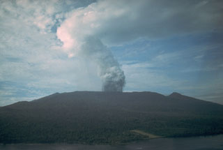
"An inspection of Karkar was carried out on 8-11 November. Over the last few years, the areas of fumarolic activity have been in recession; the maximum temperature measured during the 1991 survey was 84°C. Cracks up to 10 cm wide had developed across Bagiai cone and seemed related to gravitational instability. This was most noticeable on Bagiai's SE flank, which borders on the 1979 crater.
"EDM and levelling lines and tilt arrays were re-surveyed. The clearest change since the last survey (in November 1990) was shown by the levelling measurements, which indicated a slight (-12 mm) but consistent subsidence in the center of the caldera floor relative to its outer margin. Steady subsidence of the central caldera floor has been recorded over the last 7 years by both levelling measurements and radial tilt vectors (typically -20 µrad/year). Changes along the EDM lines across the summit caldera were inconclusive, as they were within the uncertainty range of the measuring instrument.
"The overall picture gained over the last few years of measurement at Karkar is of a gradual progression into dormancy. As in previous years, vegetation was rapidly being re-established on the caldera floor and walls, on Bagiai cone, and in the crater produced by the 1979 eruption."
Geological Summary. Karkar is a 19 x 25 km forest-covered island that is truncated by two nested summit calderas. The 5.5 km outer caldera was formed during one or more eruptions, the last of which occurred 9,000 years ago. The steep-walled 300-m-deep, 3.2 km diameter, inner caldera was formed sometime between 1,500 and 800 years ago. Cones are present on the N and S flanks of this basaltic-to-andesitic volcano; a linear array of small cones extends from the northern rim of the outer caldera nearly to the coast. Recorded eruptions date back to 1643 from Bagiai, a pyroclastic cone constructed within the inner caldera, the floor of which is covered by young, mostly unvegetated andesitic lava flows.
Information Contacts: B. Talai and C. McKee, RVO.

