Report on Barren Island (India) — January 1992
Bulletin of the Global Volcanism Network, vol. 17, no. 1 (January 1992)
Managing Editor: Lindsay McClelland.
Barren Island (India) Crater enlarges; ash mantles lava surface
Please cite this report as:
Global Volcanism Program, 1992. Report on Barren Island (India) (McClelland, L., ed.). Bulletin of the Global Volcanism Network, 17:1. Smithsonian Institution. https://doi.org/10.5479/si.GVP.BGVN199201-260010
Barren Island
India
12.278°N, 93.858°E; summit elev. 354 m
All times are local (unless otherwise noted)
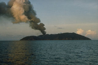
By the time of the 15 November visit by members of SANE (16:12), the 1991 cone had enlarged considerably, burying the pre-existing central cone. Partial collapse had occurred on one side of the active cone. The new cone's rim was irregular in height. When they returned during the third week in December, ~2 m of ash mantled the surface of the still-hot lava flow. Gases escaping from the lava formed rootless vents on the ash surface.
Early 1992 fieldwork by the GSI revealed a cooling lava flow and significant morphological changes to the active cone. Gas emerged from rootless vents 2-3 m in diameter and 1 m deep in the ash-covered surface of the flow, where sulfur and reddish oxides were being deposited. The base of the cone was strewn with broken blocks ranging in size from 2 to 75 cm. The height of the now crescent-shaped crater had declined from 305 m to not more than 225 m above sea level, but its diameter had increased from a pre-eruption 60 m to [~400 m]. Two cinder cones [~8-10 m high] had developed in the W part of the lava field, ~100 and 130 m W of the main cone, respectively.
Geological Summary. Barren Island, a possession of India in the Andaman Sea about 135 km NE of Port Blair in the Andaman Islands, is the only historically active volcano along the N-S volcanic arc extending between Sumatra and Burma (Myanmar). It is the emergent summit of a volcano that rises from a depth of about 2250 m. The small, uninhabited 3-km-wide island contains a roughly 2-km-wide caldera with walls 250-350 m high. The caldera, which is open to the sea on the west, was created during a major explosive eruption in the late Pleistocene that produced pyroclastic-flow and -surge deposits. Historical eruptions have changed the morphology of the pyroclastic cone in the center of the caldera, and lava flows that fill much of the caldera floor have reached the sea along the western coast.
Information Contacts: Director General, GSI, Calcutta; S. Acharya, SANE, Port Blair; D. Shackelford, Fullerton, CA.

