Report on El Chichon (Mexico) — September 1992
Bulletin of the Global Volcanism Network, vol. 17, no. 9 (September 1992)
Managing Editor: Lindsay McClelland.
El Chichon (Mexico) Occasional seismicity; lake less acidic
Please cite this report as:
Global Volcanism Program, 1992. Report on El Chichon (Mexico) (McClelland, L., ed.). Bulletin of the Global Volcanism Network, 17:9. Smithsonian Institution. https://doi.org/10.5479/si.GVP.BGVN199209-341120
El Chichon
Mexico
17.3602°N, 93.2297°W; summit elev. 1150 m
All times are local (unless otherwise noted)
The following reports the results of fieldwork on 5-11 August. "Reports of strange noises and vibrations in the small town of Coapilla, 21 km S of El Chichón, caused some concern among the population, since rumors that an eruption should be expected on the 10th anniversary of the 1982 catastrophic eruptions were spreading across Chiapas state. To help the local government to dismiss (or confirm) those rumors, a special trip was made to deploy three portable seismic stations around the volcano, and to obtain more samples of the crater-lake water. The seismic stations were located in Coapilla, Chapultenango (11 km ESE of the summit), and Ostuacán (12 km NW). Due to local ground noise, only the Chapultenango station could be set at a relatively high gain. During the seismic recording, the volcano was visited to obtain samples. On 8 August at 0922, while two of the geologists (J.L.M. and M.A.C.E.) were collecting rock samples on the rim of the outer crater, a small earthquake was detected by the Chapultenango station. At that time, an impulsive shake, accompanied by an explosion-like sound, was reported by the geologists at the crater rim. Although they could not look into the crater from the outer rim, they observed no signs of explosion, dust, or increased fumarolic activity. The nature of this event is difficult to interpret, since only one station detected it, but the waveform is similar to some explosion earthquakes recorded elsewhere.
"The Coapilla noises and vibrations were found to be produced by the town's water-piping net.
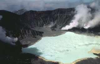
"The water sample (taken about 1 hour before the seismic event) shows a composition similar to other recent samples. The overall trend in the last few years is toward an increase in pH and a decrease in concentration of major species."
Geological Summary. El Chichón is a small trachyandesitic tuff cone and lava dome complex in an isolated part of the Chiapas region in SE México. Prior to 1982, this relatively unknown volcano was heavily forested and of no greater height than adjacent non-volcanic peaks. The largest dome, the former summit of the volcano, was constructed within a 1.6 x 2 km summit crater created about 220,000 years ago. Two other large craters are located on the SW and SE flanks; a lava dome fills the SW crater, and an older dome is located on the NW flank. More than ten large explosive eruptions have occurred since the mid-Holocene. The powerful 1982 explosive eruptions of high-sulfur, anhydrite-bearing magma destroyed the summit lava dome and were accompanied by pyroclastic flows and surges that devastated an area extending about 8 km around the volcano. The eruptions created a new 1-km-wide, 300-m-deep crater that now contains an acidic crater lake.
Information Contacts: S. De la Cruz-Reyna, Z. Jiménez, J.M. Espíndola, and M.A. Armienta, UNAM; Marco A. Cuesta Escobar, Raul García Santiago, Edipson Pastrana Vázquez, and Silvia Ramos Hernández, Coordinación de Investigación, Consejo Estatal de Fomento a la Investigación y Difusión de la Cultura, Chiapas, México; J.L. Macías, State Univ of New York, Buffalo, NY.

