Report on Pacaya (Guatemala) — September 1996
Bulletin of the Global Volcanism Network, vol. 21, no. 9 (September 1996)
Managing Editor: Richard Wunderman.
Pacaya (Guatemala) Moderate Strombolian eruption; fountaining up to 500 m; lava flow
Please cite this report as:
Global Volcanism Program, 1996. Report on Pacaya (Guatemala) (Wunderman, R., ed.). Bulletin of the Global Volcanism Network, 21:9. Smithsonian Institution. https://doi.org/10.5479/si.GVP.BGVN199609-342110
Pacaya
Guatemala
14.382°N, 90.601°W; summit elev. 2569 m
All times are local (unless otherwise noted)
Pacaya erupted more forcefully than usual beginning late on 10 October. Based on an INSIVUMEH report, between about 2300 on 10 October and 0200 on 11 October Pacaya produced a moderate Strombolian eruption with sustained fountaining of incandescent materials up to 500 m high.
The plume's maximum height reached ~3.7 km altitude; within that plume the ash column rose to ~700 m. During the eruption winds blew from the NNE at 35 km/hour with gusts to 45 km/hour; they carried fine ash toward the town of Esquintla. A report from Puerto San Jose, a city on the Pacific coast ~60 km SW, indicated that the earlier dark ash cloud had thinned during the day.
The explosive eruption was followed by significant lava effusion from the crater. The longest lava flow traveled SW for 1.5 km over the surface of an older flow field. At 0300 the flow front's velocity was 100 m/hour; it came within 300 m of the relatively flat area reached by the 1991 lava flow. Lava ceased venting at dawn; however, the SW flow remained incandescent and slowly moving. Although eruptive strength diminished, some tremor persisted on 11 October. On that day satellite images (Band 2 on GOES-8) showed a small hot spot. An INSIVUMEH report on 14 October noted that ongoing eruptions continued into the morning of the 12th. After that the eruptive vigor and amount of tremor both dropped and no new lava vented from the crater.
On 16 October INSIVUMEH reported that Pacaya continued to expel abundant white steam. At that time there were no audible explosions, underground booming noises, or newly vented lava flows. Tremor was present, presumably related to the degassing seen at the surface. Eddy Sanchez noted that 38 people were evacuated from neighboring villages during the height of the eruption.
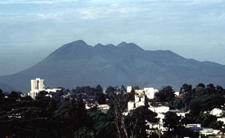
Geological Summary. Eruptions from Pacaya are frequently visible from Guatemala City, the nation's capital. This complex basaltic volcano was constructed just outside the southern topographic rim of the 14 x 16 km Pleistocene Amatitlán caldera. A cluster of dacitic lava domes occupies the southern caldera floor. The post-caldera Pacaya massif includes the older Pacaya Viejo and Cerro Grande stratovolcanoes and the currently active Mackenney stratovolcano. Collapse of Pacaya Viejo between 600 and 1,500 years ago produced a debris-avalanche deposit that extends 25 km onto the Pacific coastal plain and left an arcuate scarp inside which the modern Pacaya volcano (Mackenney cone) grew. The NW-flank Cerro Chino crater was last active in the 19th century. During the past several decades, activity has consisted of frequent Strombolian eruptions with intermittent lava flow extrusion that has partially filled in the caldera moat and covered the flanks of Mackenney cone, punctuated by occasional larger explosive eruptions that partially destroy the summit.
Information Contacts: Eddy Sanchez and Otoniel Matías, Seccion Vulcanologia, INSIVUMEH (Instituto Nacional de Sismologia, Vulcanologia, Meteorologia e Hydrologia of the Ministerio de Communicaciones, Transporte y Obras Publicas), 7A Avenida 14-57, Zona 13, Guatemala City, Guatemala; NOAA/NESDIS Satellite Analysis Branch, Room 401, 5200 Auth Road, Camp Springs, MD 20746, USA.

