Report on Cerro Negro (Nicaragua) — November 1996
Bulletin of the Global Volcanism Network, vol. 21, no. 11 (November 1996)
Managing Editor: Richard Wunderman.
Cerro Negro (Nicaragua) Fumarole temperatures decrease in November
Please cite this report as:
Global Volcanism Program, 1996. Report on Cerro Negro (Nicaragua) (Wunderman, R., ed.). Bulletin of the Global Volcanism Network, 21:11. Smithsonian Institution. https://doi.org/10.5479/si.GVP.BGVN199611-344070
Cerro Negro
Nicaragua
12.506°N, 86.702°W; summit elev. 728 m
All times are local (unless otherwise noted)
On 27 November, a visit to the crater found that fumarole temperatures had generally decreased by 80- 100°C and the maximum temperature was only 630°C. From November 1995, when a significant eruption took place, to October 1996, fumarole temperatures were as high as 700°C.
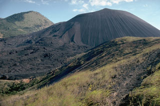
Cerro Negro is a basaltic cinder cone that has erupted repeatedly since its birth in 1850. It is part of a group of four young cinder cones NW of Las Pilas volcano. Following a major explosive eruption in 1971, Cerro Negro was quiet until April 1992, when an eruption produced a Plinian column 7.5 km high, deposited ash in León (20 km WSW), and forced the evacuation of 28,000 people (BGVN 17:03 and 17:04). A significant eruption in November-December 1995 built a new cone, lava dome, and lava flows within the summit crater, sent lava flows down the N flank, and deposited ash over at least 200 km2 (BGVN 20:11/12).
Geological Summary. Nicaragua's youngest volcano, Cerro Negro, was created following an eruption that began in April 1850 about 2 km NW of the summit of Las Pilas volcano. It is the largest, southernmost, and most recent of a group of four youthful cinder cones constructed along a NNW-SSE-trending line in the central Marrabios Range. Strombolian-to-subplinian eruptions at intervals of a few years to several decades have constructed a roughly 250-m-high basaltic cone and an associated lava field constrained by topography to extend primarily NE and SW. Cone and crater morphology have varied significantly during its short eruptive history. Although it lies in a relatively unpopulated area, occasional heavy ashfalls have damaged crops and buildings.
Information Contacts: Alain Creusot, Instituto Nicaraguense de Energía, Managua, Nicaragua.

