Report on Irazu (Costa Rica) — May 1997
Bulletin of the Global Volcanism Network, vol. 22, no. 5 (May 1997)
Managing Editor: Richard Wunderman.
Irazu (Costa Rica) Comparatively high numbers of earthquakes in April and May
Please cite this report as:
Global Volcanism Program, 1997. Report on Irazu (Costa Rica) (Wunderman, R., ed.). Bulletin of the Global Volcanism Network, 22:5. Smithsonian Institution. https://doi.org/10.5479/si.GVP.BGVN199705-345060
Irazu
Costa Rica
9.979°N, 83.852°W; summit elev. 3436 m
All times are local (unless otherwise noted)
In April and May there were 107 and 136 earthquakes, respectively, a higher number than is typical. These were mainly detected locally. One M 1.9 earthquake centered 4 km SW of the active crater at a depth of 3.8 km took place at 0054 on 6 April. A M 2.2 earthquake struck at 0437 the same day at 5.2 km depth centered 11 km NW of the crater. On 19 May the station 5 km SW (IRZ2) registed a swarm consisting of 23 high-frequency earthquakes.
Irazú lies along a fault zone shaken by repeated earthquakes in the past 6 years. It was estimated that ~40 of May's 136 earthquakes were associated with faulting. Earlier summaries of monthly earthquakes for December 1996, and January and March 1997 reported 51, 82, and 92 events, respectively.
Irazú's ashfalls frequently reached San Jose, 25 km to the E, during its historically most active period in 1963- 65. That period of intermittent, weak-to-moderate explosive activity severely affected agricultural areas over much of central Costa Rica, causing major economic problems. During the same interval, 46 secondary mudflows swept down the Rio Reventado valley.
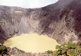
Geological Summary. The massive Irazú volcano in Costa Rica, immediately E of the capital city of San José, covers an area of 500 km2 and is vegetated to within a few hundred meters of its broad summit crater complex. At least 10 satellitic cones are located on its S flank. No lava effusion is known since the eruption of the Cervantes lava flows from S-flank vents about 14,000 years ago, and all known Holocene eruptions have been explosive. The focus of eruptions at the summit crater complex has migrated to the W towards the main crater, which contains a small lake. The first well-documented eruption occurred in 1723, and frequent explosive eruptions have occurred since. Ashfall from the last major eruption during 1963-65 caused significant disruption to San José and surrounding areas. Phreatic activity reported in 1994 may have been a landslide event from the fumarolic area on the NW summit (Fallas et al., 2018).
Information Contacts: E. Fernandez, R. Van der Laat, F. de Obaldia, T. Marino, V. Barboza, W. Jimenez, R. Saenz, E. Duarte, M. Martinez, E. Hernandez, and F. Vega, Observatorio Vulcanologico y Sismologico de Costa Rica, Universidad Nacional (OVSICORI-UNA), Apartado 86-3000, Heredia, Costa Rica.

