Report on Adams (United States) — September 1997
Bulletin of the Global Volcanism Network, vol. 22, no. 9 (September 1997)
Managing Editor: Richard Wunderman.
Adams (United States) Avalanche moves 5 km down the uninhabited east flank on 20 October
Please cite this report as:
Global Volcanism Program, 1997. Report on Adams (United States) (Wunderman, R., ed.). Bulletin of the Global Volcanism Network, 22:9. Smithsonian Institution. https://doi.org/10.5479/si.GVP.BGVN199709-321040
Adams
United States
46.206°N, 121.49°W; summit elev. 3742 m
All times are local (unless otherwise noted)
A sizable rock avalanche occurred during 20 October on the E side of Mount Adams. Based on seismic signals, the avalanche began at 0031 and lasted about six minutes. There were no seismic precursors.
On 21 October, a US Geological Survey scientist inspected the avalanche deposit from a small airplane. The avalanche originated at ~3,500 m elevation on the S face of The Castle, a prominent topographic knob at the head of Battlement Ridge. The source area formed an obvious, near-vertical scar roughly triangular in shape with sides ~300 m long. The summit of The Castle remained intact. The avalanche descended the Klickitat Glacier icefall and left a thin veneer of rock debris on the steep upper part of the glacier. Below ~2,500 m elevation the deposit thickened. The avalanche traveled beyond the end of the Klickitat Glacier and continued ~2 km down the valley of Big Muddy Creek, a Klickitat River tributary. The length of the avalanche track totaled ~5 km, and the width may exceed 1 km in places. The average width is ~0.5 km. Maximum deposit thickness may exceed 20 m. The volume of the avalanche debris is probably between 1 and 5 million m3.
The avalanche deposit temporarily blocked the flow of Big Muddy Creek, resulting in the formation of a small lake on the avalanche debris. By noon on 21 October the avalanche dam had breached, and flow in Big Muddy Creek did not appear unusual. Continuing hazards exist due to the threat of additional rockfalls, damming and downstream flooding. However, these hazards exist primarily in unpopulated areas deep within the backcountry of Yakima Nation lands. No evidence suggests that hazards in populated areas far downstream have increased significantly.
This avalanche appeared unrelated to a similar-sized avalanche on the W flank of Mount Adams about seven weeks earlier (31 August). This earlier avalanche consisted of about 90% snow and ice; its source was Avalanche Glacier cirque at ~ 3,650-m elevation on the upper SW flank. Both avalanches originated where rocks evidently had been weakened by intense hydrothermal alteration. Both avalanches may have been triggered in part by wet subsurface conditions associated with late-season thawing of exceptionally heavy snowpack in conjunction with early-season storms. Neither avalanche was triggered by regional earthquake or volcanic activity.
After the 20 October avalanche, a second, smaller one swept down the same path and yielded a much smaller seismic signal that began at 0729 on 24 October. Preliminary reports suggested that the second avalanche traveled only about half the distance of the first.
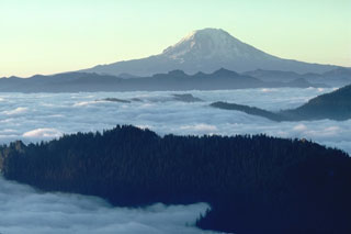
Mount Adams, one of the largest volcanoes in the Cascade Range, dominates the Mount Adams volcanic field in Washington's Skamania, Yakima, Klickitat, and Lewis counties and the Yakima Indian Reservation of S-central Washington (1,250 km2). At Adams, large landslides and lahars that need not be related to eruptions probably pose the most destructive, far-reaching hazard.
Geological Summary. The andesitic-dacitic Mount Adams stratovolcano is second in volume only to Mount Shasta in the Cascade Range. The volcanic complex is elongated along a NNW-SSE line, and includes more than 60 flank vents over 200 km2. Volcanism began about 940 ka, with three main cone-building stages occurring at about 500, 450, and 30 ka. It was active throughout the Holocene, producing two dozen minor explosive eruptions from summit and flank vents. Six Holocene lava flows are located on the flanks between 2,100 and 2,600 m elevation. The most voluminous Holocene lava flows, some of which traveled 10 km or more, were emplaced between about 7,000 and 4,000 years ago. The latest eruption about 1,000 years ago produced a minor tephra layer and possibly a small lava flow down the E flank.
Information Contacts: Cascades Volcano Observatory (CVO), U.S. Geological Survey, 5400 MacArthur Blvd., Vancouver, WA 98661, USA (URL: http://volcanoes.usgs.gov/); Geophysics Program, University of Washington, Seattle, WA 98195, USA (URL: https://volcanoes.usgs.gov/observatories/cvo/).

