Report on Heard (Australia) — February 1998
Bulletin of the Global Volcanism Network, vol. 23, no. 2 (February 1998)
Managing Editor: Richard Wunderman.
Heard (Australia) No evidence of recent activity in March
Please cite this report as:
Global Volcanism Program, 1998. Report on Heard (Australia) (Wunderman, R., ed.). Bulletin of the Global Volcanism Network, 23:2. Smithsonian Institution. https://doi.org/10.5479/si.GVP.BGVN199802-234010
Heard
Australia
53.106°S, 73.513°E; summit elev. 2745 m
All times are local (unless otherwise noted)
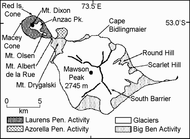
During 18-21 March geologists sampled Holocene lava flows on Heard Island. On beaches of the N Laurens Peninsula, they found fresh pumice ranging in size up to about 20 x 20 cm . The pumice was concentrated among other storm- transported debris a little distance above the normal surf zone and appeared to have been deposited by wave action. Light creamy green to pale gray in color, the pumice had angular, ovoid or flattened shapes and contained predominantly microphenocrysts and occasional phenocrysts visible to the naked eye. Lithic fragments were not observed.
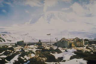
On Heard Island, Big Ben's summit was usually obscured by clouds. The summit was visible on 20 March, however, and at this time no evidence of recent volcanic activity was observed at Mawson Peak, Big Ben's recently active crater (figure 3). Similarly no plume was seen coming from Heard when McDonald vented steam in early April. In accord with these observations, scientists inferred that the December 1996-January 1997 volcanic activity attributed to Heard actually denoted activity at McDonald.
References. LeMasurier, W.E., and Thompson, J.W., primary eds., 1990, Volcanoes of the Antarctic Plate and Southern Oceans, Antarctic Research Series: American Geophysical Union, Washington, D. C. (ISBN 0066-4634).
Collerson, K. D., 1997, Field studies at Heard and McDonald Island in March 1997: unpublished Australian National Antarctic Research Expedition (ANARE) report.
Geological Summary. Heard Island on the Kerguelen Plateau in the southern Indian Ocean consists primarily of the emergent portion of two volcanic structures. The large glacier-covered composite basaltic-to-trachytic cone of Big Ben comprises most of the island, and the smaller Mt. Dixon lies at the NW tip of the island across a narrow isthmus. Little is known about the structure of Big Ben because of its extensive ice cover. The active Mawson Peak forms the island's high point and lies within a 5-6 km wide caldera breached to the SW side of Big Ben. Small satellitic scoria cones are mostly located on the northern coast. Several subglacial eruptions have been reported at this isolated volcano, but observations are infrequent and additional activity may have occurred.
Information Contacts: Kenneth Collerson, Department of Earth Sciences, University of Queensland, Brisbane, Queensland 4072, Australia; Kevin Kiernan, Department of Geography and Environmental Sciences, University of Newcastle, Newcastle, New South Wales 2300, Australia; Richard Williams, Australian Antarctic Division, Channel Highway, Hobart, Tasmania, Australia; Andrew Tupper, Northern Territory Regional Forecasting Centre, Bureau of Meteorology, P. O. Box 735, Darwin, Northern Territory 0801, Australia.


