Report on Guagua Pichincha (Ecuador) — April 1999
Bulletin of the Global Volcanism Network, vol. 24, no. 4 (April 1999)
Managing Editor: Richard Wunderman.
Guagua Pichincha (Ecuador) Summary of activity in April; tremor for extended durations; phreatic explosions
Please cite this report as:
Global Volcanism Program, 1999. Report on Guagua Pichincha (Ecuador) (Wunderman, R., ed.). Bulletin of the Global Volcanism Network, 24:4. Smithsonian Institution. https://doi.org/10.5479/si.GVP.BGVN199904-352020
Guagua Pichincha
Ecuador
0.171°S, 78.598°W; summit elev. 4784 m
All times are local (unless otherwise noted)
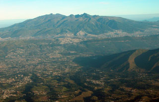
The Instituto Geofísico of Ecuador's Escuela Politécnica Nacional (IG-EPN) records visual observations and monitors seismic events, crustal deformation, and geochemistry at Guagua Pichincha. This volcano consists of a 2-km-wide caldera, breached to the west, on whose floor lies a dome complex and the present explosion craters. The following summarizes their daily observations for April 1999. During this period, a Yellow alert status persisted.
Bad weather often prevented or hindered visual observations. Guards at the refuge station and visiting scientists frequently reported noises and the strong smell of sulfur from the fumaroles. Ash-and-steam plumes from dome fumaroles, when visible, ranged from 100 to 800 m in height, while explosion plumes reached 1 km. On 21 April, a new crater with a diameter of ~8 m was reported east of the 1981 explosion crater.
A summary of monthly events since August 1998 is presented in table 3. Volcano-tectonic (VT), long-period (LP), and hybrid earthquakes, sometimes in multiples, occurred almost daily throughout April with the daily numbers increasing substantially during the latter third of the month. Similarly, two-thirds of the 18 phreatic explosions (PE) occurred during the last week of April. Reduced displacement measurements (RDs) of phreatic explosions ranged from those too small to measure to the largest of 11.7 cm2.
Table 3. Monthly summaries of phreatic explosions and seismic events (volcano-tectonic, long-period, and hybrid) at Guagua Pichincha, August 1998-April 1999. Courtesy IG-EPN.
| Month | Phreatic Explosions | Volcano-tectonic | Long-period | Hybrid |
| Aug 1998 | 8 | 23 | 18 | 29 |
| Sep 1998 | 24 | 73 | 165 | 1,626 |
| Oct 1998 | 25 | 49 | 191 | 1,448 |
| Nov 1998 | 18 | 52 | 234 | 419 |
| Dec 1998 | 7 | 59 | 94 | 166 |
| Jan 1999 | 18 | 41 | 218 | 1,163 |
| Feb 1999 | 28 | 60 | 190 | 2,099 |
| Mar 1999 | 21 | 115 | 73 | 940 |
| Apr 1999 | 17 | 45 | 51 | 369 |
Tremor of 17 hours duration occurred on the 3 April, and the subsequent tremor that started on the 9th continued to be active throughout the remainder of the month with varying amplitude and frequency. As the number of PE and HY events increased during the last week of April , the character of the tremor varied markedly having extended periods of quiescence and then periods of large amplitude at varying frequency. For example, on 26 April the amplitude of the tremor diminished until 1800 hours, but after an explosion that evening, the amplitude increased and tremor persisted for about 2 hours. Then on the 27th, the tremor changed character after a morning explosion and high amplitudes at nearby stations at frequencies between 2.8-3.3 Hz diminished over a period of 6 hours.
Geological Summary. Guagua Pichincha and the older Pleistocene Rucu Pichincha stratovolcanoes form a broad volcanic massif that rises immediately W of Ecuador's capital city, Quito. A lava dome grew at the head of a 6-km-wide scarp formed during a late-Pleistocene slope failure ~50,000 years ago. Subsequent late-Pleistocene and Holocene eruptions from the central vent consisted of explosive activity with pyroclastic flows accompanied by periodic growth and destruction of the lava dome. Many minor eruptions have been recorded since the mid-1500's; the largest took place in 1660, when ash fell over a 1,000 km radius and accumulated to 30 cm depth in Quito. Pyroclastic flows and surges also occurred, primarily to then W, and affected agricultural activity.
Information Contacts: Instituto Geofísico, Escuela Politécnica Nacional, Apartado 17-01-2759, Quito, Ecuador.

