Report on Lopevi (Vanuatu) — July 1999
Bulletin of the Global Volcanism Network, vol. 24, no. 7 (July 1999)
Managing Editor: Richard Wunderman.
Lopevi (Vanuatu) Intracrater vent emits December 1998 lava flow; 1999 ash emissions
Please cite this report as:
Global Volcanism Program, 1999. Report on Lopevi (Vanuatu) (Wunderman, R., ed.). Bulletin of the Global Volcanism Network, 24:7. Smithsonian Institution. https://doi.org/10.5479/si.GVP.BGVN199907-257050
Lopevi
Vanuatu
16.507°S, 168.346°E; summit elev. 1413 m
All times are local (unless otherwise noted)
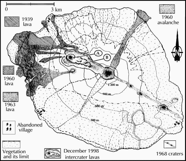
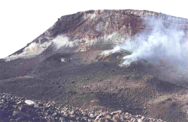
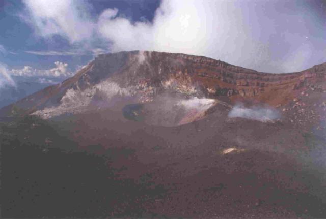
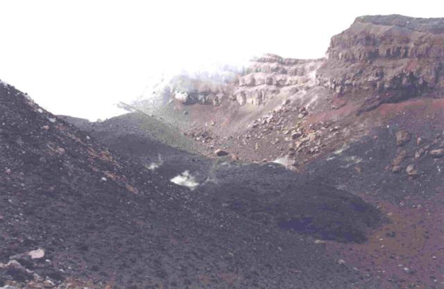
Sporadic eruptive activity at Lopevi volcano occurring since July 1998 has consisted of intermittent Strombolian explosions confined to a NW-flank crater at ~1,000 m altitude. Lava extrusion in December 1998 produced a small intracrater flow (figure 3). The flow originated from a ~20-m-high cone ("A" on figure 3) at the NW end of the main 1963 crater. The cone itself contained a small but prominent steep-walled crater (figures 4 and 5).
During a March 1999 visit scientists examined the intracrater flow (figure 6), which had a volume of ~6,000 m3. The lower (eastern end) of the flow is labeled "B" on the map (figure 3). The intracrater flow contained abundant lava blocks with aa texture and a cover of explosion debris. Meter-sized blocks originating from a relatively viscous magma had been rafted to the flow front.
Following initially more rapid movement, the lava slowed to advance at daily rates of a few to a dozen meters. Minor Vulcanian eruptions accompanied the flow. Constant fumarolic activity along with periodic small explosion plumes continued since January 1999. From 2 August 1999 scientists observed eruption plumes that rose to about 1 km altitude associated with the ejection of bombs from the crater.
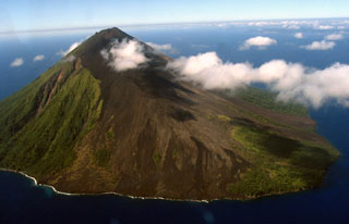
Geological Summary. The small 7-km-wide conical island of Lopevi, known locally as Vanei Vollohulu, is one of Vanuatu's most active volcanoes. A small summit crater containing a cinder cone is breached to the NW and tops an older cone that is rimmed by the remnant of a larger crater. The basaltic-to-andesitic volcano has been active during historical time at both summit and flank vents, primarily along a NW-SE-trending fissure that cuts across the island, producing moderate explosive eruptions and lava flows that reached the coast. Historical eruptions at the 1413-m-high volcano date back to the mid-19th century. The island was evacuated following major eruptions in 1939 and 1960. The latter eruption, from a NW-flank fissure vent, produced a pyroclastic flow that swept to the sea and a lava flow that formed a new peninsula on the western coast.
Information Contacts: Sandrine Wallez and Michel Lardy, Institut de Recherche pour la Développment (IRD), BP 76, Port Vila, Vanuatu; Claude Robin, OPGC, 5 rue Kessler, 63000 Clermont-Ferrand, France; Charley Douglas, Vanuatu Department of Geology, Mines and Water Resources, PMB 01, Port Vila, Vanuatu.

