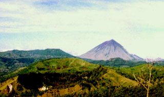
Report on Inielika (Indonesia) — January 2001
Bulletin of the Global Volcanism Network, vol. 26, no. 1 (January 2001)
Managing Editor: Richard Wunderman.
Inielika (Indonesia) Explosive activity declines; new images of the summit area
Please cite this report as:
Global Volcanism Program, 2001. Report on Inielika (Indonesia) (Wunderman, R., ed.). Bulletin of the Global Volcanism Network, 26:1. Smithsonian Institution. https://doi.org/10.5479/si.GVP.BGVN200101-264090
Inielika
Indonesia
8.73°S, 120.98°E; summit elev. 1559 m
All times are local (unless otherwise noted)
The following report covers Inielika's activity during 23 January-5 February 2001. The VSI issued three photographs showing Inielika's summit area (figures 1-3). No explosions occurred during 23-29 January, unlike earlier in the month (BGVN 25:12). Instead, a white gas-and-steam plume rose 100-500 m above the summit. Volcanic earthquakes, tectonic earthquakes, and continuous tremor with amplitudes varying from 0.3 to 1.2 mm occurred.
 |
Figure 1. A gas-and-steam plume exiting from one of Inielika's craters on 11 January 2001. Courtesy of VSI. |
 |
Figure 3. A recently formed vent (arrow) seen in a crater on Inielika's summit on 11 January 2001. Courtesy of VSI. |
Activity remained relatively similar during the following week of 30 January-5 February. A gas-and-steam plume rose 25-500 m above the summit. The number of deep volcanic (A-type) earthquakes increased with respect to the previous week, and tremor was no longer continuous. The VSI maintained Inielika's hazard status at Level 3 (on a scale of 1-4) as of 5 February.
Geological Summary. Inielika is a broad, low volcano in central Flores Island that was constructed within the Lobobutu caldera. The complex summit contains ten craters, some of which are lake filled, in a 5 km2 area north of the city of Bajawa. The largest of these, Wolo Runu and Wolo Lega North, are 750 m wide. A phreatic explosion in 1905 formed a new crater, and was the volcano's only eruption during the 20th century. Another eruption took place about a century later, in 2001. A chain of Pleistocene cinder cones, the Bajawa cinder cone complex, extends southward to Inierie.
Information Contacts: Dali Ahmad, Volcanological Survey of Indonesia (VSI), Jalan Diponegoro No. 57, Bandung 40122, Indonesia (URL: http://www.vsi.esdm.go.id/).


