Report on Niuafo'ou (Tonga) — May 2001
Bulletin of the Global Volcanism Network, vol. 26, no. 5 (May 2001)
Managing Editor: Richard Wunderman.
Niuafo'ou (Tonga) New hot spring in caldera during May-June 1999
Please cite this report as:
Global Volcanism Program, 2001. Report on Niuafo'ou (Tonga) (Wunderman, R., ed.). Bulletin of the Global Volcanism Network, 26:5. Smithsonian Institution. https://doi.org/10.5479/si.GVP.BGVN200105-243110
Niuafo'ou
Tonga
15.6°S, 175.63°W; summit elev. 260 m
All times are local (unless otherwise noted)
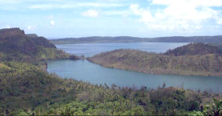
On 8 May 1999 a group of natives were traveling around the E shore of Vai Si'i, the smaller of the two lakes that occupy the caldera in the center of the island. The water level in the lake was reported to be noticeably higher (about 0.5 m) than usual. At a locality on the E shore of the lake, below the caldera wall (figure 3) a new hot spring had formed. At the time of this observation it was below the level of the lake. Bubbles were being produced from the site and the water was noticeably warmer than usual.
This report of the new hot spring was communicated to Paul Taylor, a volcanic geologist who was conducting a workshop on the island during the first week of June 1999. When Taylor visited the lake on 1 June the water level had returned to its normal level, but the hot spring was clearly present in a small embankment on the side of the track that followed the edge of the lake. A small amount of steam and a quantity of hot water were still being produced by the spring at that time. The temperature of the water was estimated to be about 70-80°C. A small stream of the warm water was flowing across the track and into Vai Si'i. A strong smell of sulfur was present in the immediate area of the spring. A large deposit of dark, sulfur-rich mud was present along the shore within Vai Si'i near the new hot spring. Vegetation had withered noticeably and a large number of dead fish were present along the shoreline. The new hot spring represents the first reported activity in the NE part of the central caldera, and the first activity reported on the island in more than a decade.
Geological Summary. Niuafo'ou ("Tin Can Island") is a low 8-km-wide island that forms the summit of a largely submerged basaltic shield volcano in the north central Lau Basin about 170 km W of the northern end of the Tofua volcanic arc. The circular island encloses a 5-km-wide caldera that is mostly filled by a lake whose bottom extends to below sea level. The inner walls of the caldera drop sharply to the lake, named Big Lake (or Vai Lahi), which contains several small islands and pyroclastic cones on its NE shore. Eruptions recorded since 1814, mostly from circumferential fissures on the west-to-south side of the island, have often damaged villages. A major eruption in 1946 forced evacuation of most of its 1,200 inhabitants.
Information Contacts: Paul W. Taylor, Australian Volcanological Investigations, PO Box 291, Pymble, NSW 2073, Australia.


