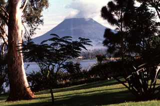
Report on Nyiragongo (DR Congo) — May 2002
Bulletin of the Global Volcanism Network, vol. 27, no. 5 (May 2002)
Managing Editor: Richard Wunderman.
Nyiragongo (DR Congo) Increased tremor during April-May; lava fountain observed in crater
Please cite this report as:
Global Volcanism Program, 2002. Report on Nyiragongo (DR Congo) (Wunderman, R., ed.). Bulletin of the Global Volcanism Network, 27:5. Smithsonian Institution. https://doi.org/10.5479/si.GVP.BGVN200205-223030
Nyiragongo
DR Congo
1.52°S, 29.25°E; summit elev. 3470 m
All times are local (unless otherwise noted)
During the catastrophic eruption of Nyiragongo on 17 January 2002 all lava drained from the summit, leaving an empty crater more than 700 m deep. Harmonic tremor that was registered at two seismic stations on Nyiragongo's S flank beginning in late April continued to increase irregularly in amplitude through at least May 2002. Anomalous clouds were noticed above the crater on two occasions since 1 May, but no glow was noted at night. A brief flight over the summit during daylight on 14 May failed to disclose eruptive activity. That day, increasing tremor amplitude (including many hours of banded tremor with a one-hour period), suggested that magma was moving within the summit area.
During 17-18 May an expedition traveled to the summit to look for any possible extrusive activity, and a small lava fountain was observed on the floor of the crater. It vented along the same NW-SE-trending fissure that apparently drained the crater in January. The lone fountain ejected incandescent spatter to a height of ~12 m and built a low spatter rampart, but no lake formed. Several small incandescent vents on the rubble-filled crater floor ejected hot gases. This observation indicated that magma had risen high within the edifice. A long period of extrusive activity could prevail in the years ahead, assuming the typical pattern of development in Nyiragongo's historical eruptions, and this was interpreted as no cause for immediate concerns. A similar pattern followed the January 1977 eruption, when in June 1982 activity resumed in Nyiragongo's main crater, beginning with a lava fountain that fed a new lava lake in less than two weeks. It remained active until September 1982.
Geological Summary. The Nyiragongo stratovolcano contained a lava lake in its deep summit crater that was active for half a century before draining catastrophically through its outer flanks in 1977. The steep slopes contrast to the low profile of its neighboring shield volcano, Nyamuragira. Benches in the steep-walled, 1.2-km-wide summit crater mark levels of former lava lakes, which have been observed since the late-19th century. Two older stratovolcanoes, Baruta and Shaheru, are partially overlapped by Nyiragongo on the north and south. About 100 cones are located primarily along radial fissures south of Shaheru, east of the summit, and along a NE-SW zone extending as far as Lake Kivu. Many cones are buried by voluminous lava flows that extend long distances down the flanks, which is characterized by the eruption of foiditic rocks. The extremely fluid 1977 lava flows caused many fatalities, as did lava flows that inundated portions of the major city of Goma in January 2002.
Information Contacts: Celestin Kasereka, Jean-Pierre Bajope, and Mathieu Yalire, Goma Volcano Observatory, Departement de Geophysique, Centre de Recherche en Sciences Naturelles, Lwiro, D.S. Bukavu, Zaire; Jacques Durieux, Dario Tedesco, and Jack Lockwood, Groupe d'Etude des Volcans Actifs, 6, rue des Razes, 69320 Feyzin, France.

