Report on Dukono (Indonesia) — March 2003
Bulletin of the Global Volcanism Network, vol. 28, no. 3 (March 2003)
Managing Editor: Edward Venzke.
Dukono (Indonesia) Infrared satellite data suggest a significant event during August-September 2002
Please cite this report as:
Global Volcanism Program, 2003. Report on Dukono (Indonesia) (Venzke, E., ed.). Bulletin of the Global Volcanism Network, 28:3. Smithsonian Institution. https://doi.org/10.5479/si.GVP.BGVN200303-268010
Dukono
Indonesia
1.6992°N, 127.8783°E; summit elev. 1273 m
All times are local (unless otherwise noted)
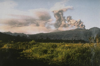
The last reported activity at Dukono consisted of a plume that reached 6 km altitude on 25 September 1995 (BGVN 20:10). Post-May 2000 MODIS data suggested a significant event during 26 August-7 September 2002. During that period, anomalies rose well above alert detection threshold, triggering 10 thermal alerts. All of the alert pixels were located within a 1-km radius.
Geological Summary. Reports from this remote volcano in northernmost Halmahera are rare, but Dukono has been one of Indonesia's most active volcanoes. More-or-less continuous explosive eruptions, sometimes accompanied by lava flows, have occurred since 1933. During a major eruption in 1550 CE, a lava flow filled in the strait between Halmahera and the N-flank Gunung Mamuya cone. This complex volcano presents a broad, low profile with multiple summit peaks and overlapping craters. Malupang Wariang, 1 km SW of the summit crater complex, contains a 700 x 570 m crater that has also been active during historical time.
Information Contacts: Diego Coppola and David A. Rothery, Department of Earth Sciences, The Open University, Milton Keynes, MK7 6AA, UK. Thermal alerts courtesy of the HIGP MODIS Thermal Alerts Team (URL: http://modis.higp.hawaii.edu/).

