Report on Lopevi (Vanuatu) — June 2003
Bulletin of the Global Volcanism Network, vol. 28, no. 6 (June 2003)
Managing Editor: Edward Venzke.
Lopevi (Vanuatu) June ash plumes to altitudes of 2.5-12 km; small lava flow
Please cite this report as:
Global Volcanism Program, 2003. Report on Lopevi (Vanuatu) (Venzke, E., ed.). Bulletin of the Global Volcanism Network, 28:6. Smithsonian Institution. https://doi.org/10.5479/si.GVP.BGVN200306-257050
Lopevi
Vanuatu
16.507°S, 168.346°E; summit elev. 1413 m
All times are local (unless otherwise noted)
On 8-9 June 2003, a volcanic ash advisory was issued for Lopevi. The Port Vila tower in Vanuatu reported that at 0055 on 8 June, an ash cloud with a thick plume rose to above 12 km altitude and drifted SE. The plume was not visible on satellite images. Later reports from pilots at 2311 indicated that the activity had subsided, with no further signs of an ash cloud. At 0330 on 9 June, the Port Vila tower reported another thick black ash cloud rising to 2.7 km, with a diameter of ~18 km, drifting SE. Observations of volcanic activity were not possible after that time.
The eruption continued through at least 14 June. An airport in Vanuatu reported to the Wellington VAAC that a thick plume rose to ~7.5 km altitude on 11 June. The plume drifted SE and was ~9 km in diameter. They reported that on 13 June a ~9-km-diameter plume rose to ~2.5 km altitude. Also, on 14 June an ash cloud was at a height of ~2.5 km altitude and a thin lava flow was visible on the volcano's W flank.
A news article from the Australian Broadcasting Corporation stated that the eruption was causing acid rain to fall on island villages in Vanuatu that are close to the volcano. Local disaster management personnel warned residents of the islands of Paama, Epi, and villages in SE Ambrym to secure their rain-based water supplies.
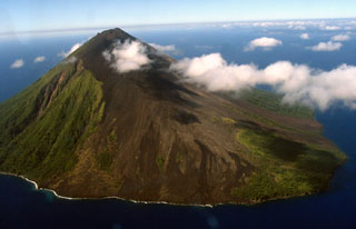
Geological Summary. The small 7-km-wide conical island of Lopevi, known locally as Vanei Vollohulu, is one of Vanuatu's most active volcanoes. A small summit crater containing a cinder cone is breached to the NW and tops an older cone that is rimmed by the remnant of a larger crater. The basaltic-to-andesitic volcano has been active during historical time at both summit and flank vents, primarily along a NW-SE-trending fissure that cuts across the island, producing moderate explosive eruptions and lava flows that reached the coast. Historical eruptions at the 1413-m-high volcano date back to the mid-19th century. The island was evacuated following major eruptions in 1939 and 1960. The latter eruption, from a NW-flank fissure vent, produced a pyroclastic flow that swept to the sea and a lava flow that formed a new peninsula on the western coast.
Information Contacts: Wellington Volcanic Ash Advisory Center (VAAC), MetService, PO Box 722, Wellington, New Zealand (URL: http://vaac.metservice.com/); Australian Broadcasting Company, ABC Ultimo Centre, 700 Harris Street, GPO Box 9994, Sydney, NSW 2001, Australia (URL: http://www.abc.net.au/).

