Report on Rabaul (Papua New Guinea) — September 2003
Bulletin of the Global Volcanism Network, vol. 28, no. 9 (September 2003)
Managing Editor: Edward Venzke.
Rabaul (Papua New Guinea) Frequent ash plumes from March through early October 2003
Please cite this report as:
Global Volcanism Program, 2003. Report on Rabaul (Papua New Guinea) (Venzke, E., ed.). Bulletin of the Global Volcanism Network, 28:9. Smithsonian Institution. https://doi.org/10.5479/si.GVP.BGVN200309-252140
Rabaul
Papua New Guinea
4.2459°S, 152.1937°E; summit elev. 688 m
All times are local (unless otherwise noted)
Reports from the Rabaul Volcanological Observatory (RVO) over the period 20 March-9 October show that ash eruptions from the Tavurvur cone at Rabaul are continuing. Activity has been nearly continuous since the major September 1994 eruption (BGVN 19:08).
Eruptions during 20 March-6 April were characterized by discrete, slow, convoluted ash plumes occurring at long irregular intervals rising slowly to several hundred meters over the summit. The ash plumes were mainly light to pale gray, blowing to the SE. Seismicity was generally low, with low- to intermediate-frequency events of 1-5 minute duration associated with the ash emissions, and greater energy expended over the first 10 seconds of the more forceful eruptions. Ground deformation fluctuated without showing any real trends.
Short forceful and slow sub-continuous discrete ash emissions were reported for 7-29 April. Light to pale gray ash-laden plumes rose as high as 1,500 m over the summit, blowing NW and SE on variable winds, with ash accumulation in Rabaul Town to the NW. Seismicity was generally low and reflected the eruptive activity. Most activity involved low-frequency, low-amplitude short- to long-duration sub-continuous volcanic tremors. Some high-frequency earthquakes were recorded NE of Rabaul Town. Deformation measurements showed minor inflation.
Steady ash eruptions continued during 7-12 May. While the ash content in individual plumes was fairly low, the accumulation of ash on the ground became quite significant within 5 km of the volcano. Seismicity was generally low (low-frequency earthquakes with durations of several minutes), reflecting summit activity. This increased to moderate seismicity over 10-12 May. Short-term ground-deformation measurements were ambiguous; long-term trends showed minor inflation.
There was a noticeable decline in ash eruptions and seismicity during 19-30 June, from one every few minutes to less than one per hour and then complete cessation on 29 June. Very occasional low roaring noises were heard early in the period. Tavurvur released only variable amounts of thin white vapor through 9 August. It began to erupt again on 10 August, with slow convoluted emissions of mainly white to pale-gray ash at irregular intervals blowing to the NW, including over the Rabaul Town area. Discrete moderate to large explosions began to occur on 25 August (1-3 per day). Occasional low rumbling noises were heard. Seismic activity was low and there were no significant ground movements.
From 29 August to 11 September the level of eruptive activity was low to moderate, characterized by convoluted ash clouds at short irregular intervals. Moderate explosions (3-6 per day) produced thick columns of pale gray to dark ash clouds rising 2-4 km above the summit. The prevailing SE winds resulted in ashfall to the NW, including in the Rabaul Town area. Seismic activity was low, with some high-frequency earthquakes NE of Rabaul Caldera and no significant ground-deformation movements.
The level of eruptive activity was generally low during 12-25 September (figure 38), with light to pale gray ash clouds rising 500-1,500 m above the summit and light downwind ashfall in the early part of the reporting period. Over 22-25 September the ash cloud emissions became light gray, with high water vapor content. Low to moderate rumbling noises were heard, but seismic activity was low and ground deformation movements were not significant.
Eruptive activity continued at a low level from 26 September to 9 October, with light to pale gray emissions (containing some ash but mostly water vapor) rising 500-1,500 m. The emissions occurred at long, irregular intervals, and many were accompanied by low roaring and rumbling noises. Very fine ash was blown mainly to the N and NW. Seismic activity was low, with no high-frequency earthquakes inside the caldera or NE of the caldera. Ground-deformation measurements showed a long-term inflationary trend between May and September, but the magnitude of change was small.
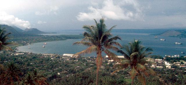
Geological Summary. The low-lying Rabaul caldera on the tip of the Gazelle Peninsula at the NE end of New Britain forms a broad sheltered harbor utilized by what was the island's largest city prior to a major eruption in 1994. The outer flanks of the asymmetrical shield volcano are formed by thick pyroclastic-flow deposits. The 8 x 14 km caldera is widely breached on the east, where its floor is flooded by Blanche Bay and was formed about 1,400 years ago. An earlier caldera-forming eruption about 7,100 years ago is thought to have originated from Tavui caldera, offshore to the north. Three small stratovolcanoes lie outside the N and NE caldera rims. Post-caldera eruptions built basaltic-to-dacitic pyroclastic cones on the caldera floor near the NE and W caldera walls. Several of these, including Vulcan cone, which was formed during a large eruption in 1878, have produced major explosive activity during historical time. A powerful explosive eruption in 1994 occurred simultaneously from Vulcan and Tavurvur volcanoes and forced the temporary abandonment of Rabaul city.
Information Contacts: Ima Itikarai and Steve Saunders, Rabaul Volcanological Observatory, P.O. Box 386, Rabaul, Papua New Guinea; William Kiene, UCLA, 405 Hilgard Avenue, Box 951361, Los Angeles, CA 90095-1361.


