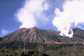
Report on Langila (Papua New Guinea) — June 2004
Bulletin of the Global Volcanism Network, vol. 29, no. 6 (June 2004)
Managing Editor: Richard Wunderman.
Langila (Papua New Guinea) Observed January 2004 lava ejections and four MODVOLC thermal alerts
Please cite this report as:
Global Volcanism Program, 2004. Report on Langila (Papua New Guinea) (Wunderman, R., ed.). Bulletin of the Global Volcanism Network, 29:6. Smithsonian Institution. https://doi.org/10.5479/si.GVP.BGVN200406-252010
Langila
Papua New Guinea
5.525°S, 148.42°E; summit elev. 1330 m
All times are local (unless otherwise noted)
Activity detected by MODVOLC at Langila was minimal, with only one alert pixel for 2003 (9 April) recorded just above the detection threshold, even though activity observed during January and February 2003 included weak lava projections (BGVN 28:03). Four alert pixels were recorded for 2004, on 20 (one each on Aqua and Terra), 25, and 27 January. All were 1-pixel alerts, with the highest alert ratio on 27 January at -0.764.
A thorough search of MODIS image data (i.e. original data, rather than the thresholded alert data on the MODVOLC website) was made for the period 20 May-25 October 2002, which revealed single-pixel sub-threshold thermal anomalies on Langila on a total of 25 dates, strengthening the case for the quasi-continuous or intermittent activity interpreted on the basis of MODVOLC alerts (BGVN 28:01).
Data acquisition and analysis. Reports from Diego Coppola and David A. Rothery provided analyses of MODIS thermal alerts during 2001 and 2002 (using the MODVOLC alert-detection algorithm) extracted from the MODIS Thermal Alerts website (http://modis.hgip.hawaii.edu/) maintained by the University of Hawaii HIGP MODIS Thermal Alerts team (BGVN 28:01). Rothery and Charlotte Saunders provided updates to 31 May 2004. MODVOLC data are now routinely available from the Aqua satellite (equator crossing times 0230 and 1430 local time) in addition to the original Terra satellite (equator crossing times 1030 and 2230 local time).
Geological Summary. Langila, one of the most active volcanoes of New Britain, consists of a group of four small overlapping composite basaltic-andesitic cones on the lower E flank of the extinct Talawe volcano in the Cape Gloucester area of NW New Britain. A rectangular, 2.5-km-long crater is breached widely to the SE; Langila was constructed NE of the breached crater of Talawe. An extensive lava field reaches the coast on the N and NE sides of Langila. Frequent mild-to-moderate explosive eruptions, sometimes accompanied by lava flows, have been recorded since the 19th century from three active craters at the summit. The youngest and smallest crater (no. 3 crater) was formed in 1960 and has a diameter of 150 m.
Information Contacts: David A. Rothery and Charlotte Saunders, Department of Earth Sciences, The Open University, Milton Keynes, MK7 6AA, United Kingdom.

