Report on Kerinci (Indonesia) — August 2004
Bulletin of the Global Volcanism Network, vol. 29, no. 8 (August 2004)
Managing Editor: Richard Wunderman.
Kerinci (Indonesia) Dark ash plumes in late July-early August 2004
Please cite this report as:
Global Volcanism Program, 2004. Report on Kerinci (Indonesia) (Wunderman, R., ed.). Bulletin of the Global Volcanism Network, 29:8. Smithsonian Institution. https://doi.org/10.5479/si.GVP.BGVN200408-261170
Kerinci
Indonesia
1.697°S, 101.264°E; summit elev. 3800 m
All times are local (unless otherwise noted)
Although frequently active, the most recent eruptive period at Kerinci had ended by late 2002 (BGVN 27:08 and 27:12). A new eruptive episode was reported by the Directorate of Volcanology and Geological Hazard Mitigation (DVGHM) starting in late July. However, the Darwin Volcanic Ash Advisory Centre (VAAC) issued an advisory on 22 June after receiving a report of ash from Kerinci at ~ 3.8 km altitude (summit level) drifting W; no ash was visible on satellite imagery.
During 24-31 July 2004 observers reported seeing a "white, thick blackish" plume rising 100-600 m above the crater rim and drifting WSW. Ashfall deposits as thick as 1 cm were identified at distances of 3 km from the summit. The number of volcanic earthquakes recorded rose during this week and remained high through the week ending on 8 August (table 5). Another eruption on the morning of 6 August sent a gray ash plume 600 m above the summit. Based on the increased activity, DVGHM raised the hazard status to Alert Level II (yellow).
Table 5. Seismicity at Kerinci, 12 July-29 August 2004. Courtesy of DVGHM.
| Date | Volcanic A | Volcanic B | Local Tectonic | Emission |
| 12 Jul-18 Jul 2004 | 2 | 1 | -- | continuous |
| 19 Jul-25 Jul 2004 | 5 | 3 | 2 | continuous |
| 26 Jul-01 Aug 2004 | 6 | 3 | 1 | continuous |
| 02 Aug-08 Aug 2004 | 5 | 2 | 2 | continuous |
| 09 Aug-15 Aug 2004 | 1 | 1 | -- | continuous |
| 16 Aug-22 Aug 2004 | 2 | 2 | -- | continuous |
| 23 Aug-29 Aug 2004 | -- | 1 | -- | continuous |
Volcanic earthquakes decreased during 9-15 August, although continuous emission signals were still being recorded and thin white plumes were seen rising 50-300 m above the summit. Similar activity continued the following week. A thick gray plume rising 50 m was reported the week of 23-29 August, but there was no change in seismicity.
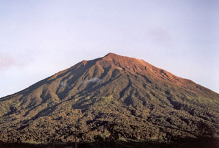
Geological Summary. Gunung Kerinci in central Sumatra forms Indonesia's highest volcano and is one of the most active in Sumatra. It is capped by an unvegetated young summit cone that was constructed NE of an older crater remnant. There is a deep 600-m-wide summit crater often partially filled by a small crater lake that lies on the NE crater floor, opposite the SW-rim summit. The massive 13 x 25 km wide volcano towers 2400-3300 m above surrounding plains and is elongated in a N-S direction. Frequently active, Kerinci has been the source of numerous moderate explosive eruptions since its first recorded eruption in 1838.
Information Contacts: Dali Ahmad, Hetty Triastuty, Nia Haerani, and Sri Kisyati, Directorate of Volcanology and Geological Hazard Mitigation, Jalan Diponegoro No. 57, Bandung 40122, Indonesia, URL: http://www.vsi.esdm.go.id/); Darwin Volcanic Ash Advisory Centre (VAAC), Bureau of Meteorology, Northern Territory Regional Office, PO Box 40050, Casuarina, NT 0811, Australia (URL: http://www.bom.gov.au/info/vaac/).

