Report on Papandayan (Indonesia) — August 2004
Bulletin of the Global Volcanism Network, vol. 29, no. 8 (August 2004)
Managing Editor: Richard Wunderman.
Papandayan (Indonesia) Increased seismicity and elevated crater temperatures in July
Please cite this report as:
Global Volcanism Program, 2004. Report on Papandayan (Indonesia) (Wunderman, R., ed.). Bulletin of the Global Volcanism Network, 29:8. Smithsonian Institution. https://doi.org/10.5479/si.GVP.BGVN200408-263100
Papandayan
Indonesia
7.32°S, 107.73°E; summit elev. 2665 m
All times are local (unless otherwise noted)
Volcanic activity increased at Papandayan beginning 17 July 2004. On 13 July, volcanic earthquakes increased from a range of between 1-3 events per day to 7-9 events per day and increased to 57 events on 16 July (table 3). The temperature on Baru Crater I increased from 84 to 88.5°C, and at Baru Crater II the temperature increased from 89 to 102°C. A visible thin white plume rose 25-100 m. This activity prompted a rise in the hazard status to Alert Level II. During the following week volcanic and local tectonic earthquakes increased, but there were no emissions. A white thin plume rose to 50-150 m above the summit. After 26 July seismicity declined and remained low through at least mid-August. The thin white plume was observed throughout this time, but its maximum height decreased each week until it was only 25-75 m above the summit during 9-15 August.
Table 3. Seismicity at Papandayan, 5 July-15 August 2004. Courtesy of DVGHM.
| Date | Volcanic A | Volcanic B | Local Tectonic | Emission |
| 05 Jul-11 Jul 2004 | -- | 21 | -- | -- |
| 12 Jul-18 Jul 2004 | 20 | 101 | 4 | 2 |
| 19 Jul-25 Jul 2004 | 65 | 129 | 10 | -- |
| 26 Jul-01 Aug 2004 | 8 | 44 | 8 | -- |
| 02 Aug-08 Aug 2004 | 4 | 32 | 3 | -- |
| 09 Aug-15 Aug 2004 | 1 | 46 | 4 | -- |
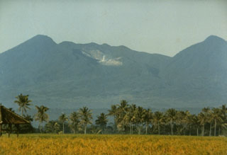
Geological Summary. Papandayan is a complex stratovolcano with four large summit craters, the youngest of which was breached to the NE by collapse during a brief eruption in 1772 and contains active fumarole fields. The broad 1.1-km-wide, flat-floored Alun-Alun crater truncates the summit of Papandayan, and Gunung Puntang to the north gives a twin-peaked appearance. Several episodes of collapse have created an irregular profile and produced debris avalanches that have impacted lowland areas. A sulfur-encrusted fumarole field occupies historically active Kawah Mas ("Golden Crater"). After its first historical eruption in 1772, in which collapse of the NE flank produced a catastrophic debris avalanche that destroyed 40 villages and killed nearly 3000 people, only small phreatic eruptions had occurred prior to an explosive eruption that began in November 2002.
Information Contacts: Dali Ahmad, Hetty Triastuty, Nia Haerani, Suswati, and Sri Kisyati, Directorate of Volcanology and Geological Hazard Mitigation, Jalan Diponegoro No. 57, Bandung 40122, Indonesia, URL: http://www.vsi.esdm.go.id/).

