Report on Taal (Philippines) — December 2004
Bulletin of the Global Volcanism Network, vol. 29, no. 12 (December 2004)
Managing Editor: Richard Wunderman.
Taal (Philippines) New episode of seismic unrest began in September 2004
Please cite this report as:
Global Volcanism Program, 2004. Report on Taal (Philippines) (Wunderman, R., ed.). Bulletin of the Global Volcanism Network, 29:12. Smithsonian Institution. https://doi.org/10.5479/si.GVP.BGVN200412-273070
Taal
Philippines
14.0106°N, 120.9975°E; summit elev. 311 m
All times are local (unless otherwise noted)
The Taal seismic monitoring network began to record significant volcanic earthquakes on 23 September 2004. In general, the numbers of these events occurring through 29 October increased, with a maximum 13 earthquakes on 15 October. Some of these earthquakes were instrumentally recorded with relatively large amplitudes although none were felt by residents on Volcano Island. Initial earthquake locations showed epicenters dispersed in the vicinity of Main Crater, to the NNW near Binintiang Malaki, and to the SSE near Calauit. Surface observations, however, did not indicate any significant change in the thermal and steam emission characteristics of the Main Crater lake area. The increased seismicity is an indication of a low-level episode of unrest, although at this time there is no clear indication of an impending eruption. A series of volcanic earthquakes was recorded on 9 January 2005. Two of these earthquakes, only one minute apart, were felt in Pira-piraso.
PHIVOLCS raised the hazard status on 29 October from Alert Level 0 to Alert Level 1, meaning that there was a slight increase in seismic activity but no eruption is imminent. PHIVOLCS recommend as off-limits the Main Crater area because sudden steam explosions may occur or high concentrations of noxious gases may accumulate. Several fissures traversing the Daang Kastila Trail are also potentially hazardous as possible sites of future steam emission. PHIVOLCS is conducting several enhancements of the monitoring system at Taal with deployment of more seismometers and ground-deformation surveillance equipment. The entire Volcano Island is a Permanent Danger Zone and permanent settlement is strictly prohibited.
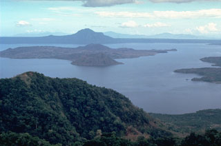
Geological Summary. Taal is one of the most active volcanoes in the Philippines and has produced some powerful eruptions. The 15 x 20 km Talisay (Taal) caldera is largely filled by Lake Taal, whose 267 km2 surface lies only 3 m above sea level. The maximum depth of the lake is 160 m, with several submerged eruptive centers. The 5-km-wide Volcano Island in north-central Lake Taal is the location of all observed eruptions. The island is composed of coalescing small stratovolcanoes, tuff rings, and scoria cones. Powerful pyroclastic flows and surges have caused many fatalities.
Information Contacts: Philippine Institute of Volcanology and Seismology (PHIVOLCS), Department of Science and Technology, PHIVOLCS Building, C.P. Garcia Avenue, Univ. of the Philippines Campus, Diliman, Quezon City, Philippines (URL: http://www.phivolcs.dost.gov.ph/).

