Report on Lopevi (Vanuatu) — January 2006
Bulletin of the Global Volcanism Network, vol. 31, no. 1 (January 2006)
Managing Editor: Richard Wunderman.
Lopevi (Vanuatu) Correction to previously published MODIS hotspot data
Please cite this report as:
Global Volcanism Program, 2006. Report on Lopevi (Vanuatu) (Wunderman, R., ed.). Bulletin of the Global Volcanism Network, 31:1. Smithsonian Institution. https://doi.org/10.5479/si.GVP.BGVN200601-257050
Lopevi
Vanuatu
16.507°S, 168.346°E; summit elev. 1413 m
All times are local (unless otherwise noted)
An error occurred in the March 2005 issue of BGVN (30:03). The table [now deleted online] had listed MODVOLC thermal anomalies, but it mistakenly included those for both Lopevi and Ambrym. The corrected table for Lopevi thermal anomalies only is provided here (table 1).
Table 1. MODVOLC thermal anomalies as observed from the MODIS satellite for Lopevi volcano for the period July 2003 to March 2005. The fourth column shows radiance in watts per square meter, per steradian, per micron (W m-2 sr-1 µm-1) in MODIS band 21 (central wavelength of 3.959 µm). Courtesy of the Hawai'i Institute of Geophysics and Planetology.
| Date | Time (UTC) | Sensor | Spectral radiance |
| 28 Sep 2004 | 1410 | Aqua | 0.937 |
| 28 Sep 2004 | 1410 | Aqua | 1.052 |
| 30 Jan 2005 | 1130 | Terra | 0.710 |
| 05 Feb 2005 | 1355 | Aqua | 0.983 |
| 05 Feb 2005 | 1355 | Aqua | 1.426 |
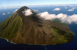
Geological Summary. The small 7-km-wide conical island of Lopevi, known locally as Vanei Vollohulu, is one of Vanuatu's most active volcanoes. A small summit crater containing a cinder cone is breached to the NW and tops an older cone that is rimmed by the remnant of a larger crater. The basaltic-to-andesitic volcano has been active during historical time at both summit and flank vents, primarily along a NW-SE-trending fissure that cuts across the island, producing moderate explosive eruptions and lava flows that reached the coast. Historical eruptions at the 1413-m-high volcano date back to the mid-19th century. The island was evacuated following major eruptions in 1939 and 1960. The latter eruption, from a NW-flank fissure vent, produced a pyroclastic flow that swept to the sea and a lava flow that formed a new peninsula on the western coast.
Information Contacts: MODVOLC Alerts Team, Hawai'i Institute of Geophysics and Planetology (HIGP), University of Hawaii and Manoa, 168 East-West Road, Post 602, Honolulu, HI 96822, USA (URL: http://modis.higp.hawaii.edu/).

