Report on Langila (Papua New Guinea) — February 2006
Bulletin of the Global Volcanism Network, vol. 31, no. 2 (February 2006)
Managing Editor: Richard Wunderman.
Langila (Papua New Guinea) Crater 2 continues activity in November 2005-January 2006
Please cite this report as:
Global Volcanism Program, 2006. Report on Langila (Papua New Guinea) (Wunderman, R., ed.). Bulletin of the Global Volcanism Network, 31:2. Smithsonian Institution. https://doi.org/10.5479/si.GVP.BGVN200602-252010
Langila
Papua New Guinea
5.525°S, 148.42°E; summit elev. 1330 m
All times are local (unless otherwise noted)
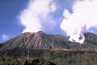
Vulcanian eruptions continued at Langila's Crater 2 during 21-27 November 2005, with a slight increase in the level of activity compared to the previous week. The increase in activity was marked by light to dark gray ash emissions that sometimes rose to heights between 1 and 2 km above the summit crater (7,650-10,900 feet altitude). The ash clouds drifted W, SW, SE, and NW, depositing ash in those areas. Incandescence and projections of volcanic material were visible at the volcano during the nights of 21, 23, and 25-27 November along with weak to loud noises. Crater 3 was quiet during the report period. Seismicity was at low-to-moderate levels, consisting of low-frequency earthquakes associated with the Vulcanian activity and periodic volcanic tremor.
A slight increase in vulcanian activity occurred at Langila's Crater 2 during 1-15 January. The increase was characterized by nearly continuous ash emissions that rose to 1-2 km above the summit (7,650-10,900 feet altitude) and drifted WSW. Occasionally during the report period observers noted loud noises, incandescence, and weak emissions of glowing lava fragments. Crater 3 continued to be quiet during this period.
Geological Summary. Langila, one of the most active volcanoes of New Britain, consists of a group of four small overlapping composite basaltic-andesitic cones on the lower E flank of the extinct Talawe volcano in the Cape Gloucester area of NW New Britain. A rectangular, 2.5-km-long crater is breached widely to the SE; Langila was constructed NE of the breached crater of Talawe. An extensive lava field reaches the coast on the N and NE sides of Langila. Frequent mild-to-moderate explosive eruptions, sometimes accompanied by lava flows, have been recorded since the 19th century from three active craters at the summit. The youngest and smallest crater (no. 3 crater) was formed in 1960 and has a diameter of 150 m.
Information Contacts: Ima Itikarai, Rabaul Volcano Observatory (RVO), P.O. Box 386, Rabaul, Papua New Guinea; Andrew Tupper, Darwin Volcanic Ash Advisory Centre (VAAC), Bureau of Meteorology, Northern Territory Regional Office, PO Box 40050, Casuarina, Northern Territory 0811, Australia (URL: http://www.bom.gov.au/info/vaac/).

