Report on Aira (Japan) — June 2006
Bulletin of the Global Volcanism Network, vol. 31, no. 6 (June 2006)
Managing Editor: Richard Wunderman.
Aira (Japan) First eruption outside of the summit crater in 58 years
Please cite this report as:
Global Volcanism Program, 2006. Report on Aira (Japan) (Wunderman, R., ed.). Bulletin of the Global Volcanism Network, 31:6. Smithsonian Institution. https://doi.org/10.5479/si.GVP.BGVN200606-282080
Aira
Japan
31.5772°N, 130.6589°E; summit elev. 1117 m
All times are local (unless otherwise noted)
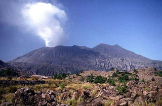
According to Yukio Hayakawa, on 4 June 2006 Sakura-jima erupted. The vent, which was outside the summit crater, was near or within the crater which issued the 1946 (Showa) lava flow, on the E slope of Minami-dake summit. The eruption continued intermittently until the next morning. A small amount of ash fell in Kagoshima city. In the following days it became calm.
Aviation reports noted that ash clouds that reached unknown heights. No ash was visible on satellite imagery.
On 10 June, the Sakura-jima Volcano Research Center reported an increase in low-frequency earthquakes since mid-March and in small tremors with a less than 2 minute duration since mid-May 2006. A thermal anomaly at the volcano grew in size after February 2006.
This was the first reported Sakura-jima eruption from a vent outside the summit crater in 58 years. The 1946 vent was the source of major lava flows that reached the E and S coasts of the former island.
Our last Sakura-jima report noted the frequent ash plumes and eruptions through May 2004 (BGVN 29:05). The Tokyo Volcanic Ash Advisory Center's reports enabled an overview of ash plumes during mid-2005 to mid-2006 (table 13).
Table 13. Sakura-jima plumes during 2 June 2005-19 June 2006. Courtesy of the Tokyo VAAC.
| Date | Event | Plume Type, Height, and Drift |
| 02 Jun 2005 | explosion | Ash; unknown height |
| 08 Jul 2005 | explosion | -- |
| 10 Jul 2005 | explosion | -- |
| 13-19 Jul 2005 | explosion | ~1.8 km height; drifting N |
| 21 Jul 2005 | explosion | -- |
| 22 Jul 2005 | explosion | -- |
| 02 Sep 2005 | eruption | Ash; ~2.1 km high; drifting NW |
| 09 Dec 2005 | explosion | ~2.7 km height; drifting S |
| 05 Feb 2006 | explosion | ~1.8 km height; drifting N |
| 19 Apr 2006 | explosion | ~2.4 km height; drifting NE |
| 28 Apr 2006 | explosion | Ash; 2.1 km height |
| 01 May 2006 | explosion | -- |
| 04-05 Jun 2006 | intermittent | Ash clouds; 200-300 m height, unknown drift eruptions |
| 07-12 Jun 2006 | -- | Ash; unknown height, drift |
| 14, 16, 19 Jun 2006 | -- | Ash; 2.1 km height |
Geological Summary. The Aira caldera in the northern half of Kagoshima Bay contains the post-caldera Sakurajima volcano, one of Japan's most active. Eruption of the voluminous Ito pyroclastic flow accompanied formation of the 17 x 23 km caldera about 22,000 years ago. The smaller Wakamiko caldera was formed during the early Holocene in the NE corner of the caldera, along with several post-caldera cones. The construction of Sakurajima began about 13,000 years ago on the southern rim and built an island that was joined to the Osumi Peninsula during the major explosive and effusive eruption of 1914. Activity at the Kitadake summit cone ended about 4,850 years ago, after which eruptions took place at Minamidake. Frequent eruptions since the 8th century have deposited ash on the city of Kagoshima, located across Kagoshima Bay only 8 km from the summit. The largest recorded eruption took place during 1471-76.
Information Contacts: Hayakawa Yukio, Gunma University, 4-2 Aramaki-machi, Maebashi City, Gunma, 371-8510, Japan; Tokyo Volcanic Ash Advisory Center (VAAC), Japan Meteorological Agency (JMA), 1-3-4 Ote-machi, Chiyoda-ku, Tokyo 100, Japan (URL: https://ds.data.jma.go.jp/svd/vaac/data/); Sakura-jima Volcano Research Center, Disaster Prevention Research Institute (DPRI), Kyoto University, Gokasho, Uji, Kyoto 611-0011, Japan (URL: http://www.dpri.kyoto-u.ac.jp/).

