Report on Ubinas (Peru) — January 2008
Bulletin of the Global Volcanism Network, vol. 33, no. 1 (January 2008)
Managing Editor: Richard Wunderman.
Ubinas (Peru) Continuing ashfall during 2006-2007
Please cite this report as:
Global Volcanism Program, 2008. Report on Ubinas (Peru) (Wunderman, R., ed.). Bulletin of the Global Volcanism Network, 33:1. Smithsonian Institution. https://doi.org/10.5479/si.GVP.BGVN200801-354020
Ubinas
Peru
16.345°S, 70.8972°W; summit elev. 5608 m
All times are local (unless otherwise noted)
Ubinas began erupting ash on 25 March 2006 (BGVN 31:03 and 31:05). As reported in BGVN 31:10, ash eruptions and steam emissions continued through 31 October 2006. This report discusses ongoing eruptions through December 2007 as drawn from Buenos Aires Volcanic Ash Advisory Center (VAAC) reports and the Instituto Geológical Minero y Metalúrgico (INGEMMET).
From November 2006 through December 2007, emissions of volcanic ash, rocks, and gases with water and steam were essentially continuous. INGEMMET authorities indicated that during March 2007 the volcano generated increased ashfall behavior that significantly affected people and the environment. At the beginning of the month, small explosions occurred every 6-8 days but the rate of activity increased toward the end. On 30 March 2007, nearby residents felt a strong explosion. A large ash plume vented from the volcano's summit and local communities were blanketed beneath falling ash. According to INGEMMET authorities, most of Querapi, a town ~ 4.5 km SE of the crater's active vent, was covered in volcanic ash, and the town of Anascapa, 6 km E, also experienced ashfall.
Volcanic ash clouds blown into the atmosphere also presented a hazard to aviation. As summarized in table 3, ash clouds were nearly continuously reported by the Buenos Aires VAAC and the INGEMMET. Plume heights reached as high as 9.1 km in May and again in November 2007. The aviation warning color code was generally Red through the period. The reports were based on satellite imagery and pilot reports. No thermal alerts were noted from the University of Hawaii's Institute of Geophysics and Planetology (HIGP) MODIS satellite-based thermal alert system during 2006 or 2007.
Table 3. Compilation of Volcanic Ash Advisories for aviation from Ubinas during November 2006 through December 2007. Courtesy of the Buenos Aires Volcanic Ash Advisory Center (VAAC) and the Instituto Geológical Minero y Metalúrgico (INGEMMET).
| Date | Altitude of Plume (km) | Flight Level (thousands of feet) | Direction of Plume |
| 3-16 Nov 2006 | 5.5-7.3 | 190-260 | SW, S, SW |
| 25 Nov 2006 | 5.5 | 180 | NE |
| 2 Dec 2006 | 5.5 | 180 | N |
| 27-30 Dec 2006 | 4.9-8.5 | 160-280 | E |
| 28 Jan 2007 | 5.5-6.9 | 180-220 | SE |
| 2-5 Feb 2007 | 5.5 | 180 | S, SW |
| 18-21 Feb 2007 | 5.5-7.0 | 180-230 | E, SW |
| 11, 14 Mar 2007 | 5.5-6.4 | 180-210 | N, SW |
| 30 Mar 2007 | 5.5 | 180 | E |
| 5, 7-9, 10-11 Apr 2007 | 5.5-7.8 | 180-270 | E, SE, S, SW, W |
| 17-18, 22, 24 Apr 2007 | 5.5-7.2 | 180-280 | NW, SW, SE |
| 2-5 May 2007 | 5.5-9.1 | 180/300 | N, S, SE, SW |
| 12, 15-16 May 2007 | 5.5-8.2 | 180-270 | SE, N, SW |
| 17, 19-22 May 2007 | 5.5-9.1 | 180-300 | E, SE |
| 22-28 May 2007 | 5.5-7.3 | 180-240 | NE, SE |
| 30 May-6 Jun 2007 | 3.7-7.6 | 120-250 | NE, SE |
| 12-17 Jun 2007 | 5.5-6.7 | 180-230 | NE, E, SW, W |
| 27-28 Jun 2007 | 5.5-6.7 | 180-230 | SW, NW, E |
| 4 Jul 2007 | 5.5-6.1 | 180-200 | S |
| 23-25 Jul 2007 | 5.9-6.1 | 190-200 | SE, S |
| 9 Aug 2007 | 6.1 | 200 | SE |
| 11-14 Sep 2007 | 5.5-7.6 | 180-250 | E, SE |
| 20 Sep 2007 | 5.5-6.4 | 180-210 | E |
| 5-7 Oct 2007 | 5.5-6.4 | 180-210 | N, S |
| 11-13, 15 Oct 2007 | 5.5-7.6 | 180-250 | N, SE |
| 19-27 Oct 2007 | 5.5-8.5 | 180-280 | NW, NE |
| 1, 3-6 Nov 2007 | 5.5-7.6 | 180-250 | NE, SE |
| 11-12 Nov 2007 | 5.5-6.7 | 180-220 | NE |
| 16, 18, 20 Nov 2007 | 5.5-7.9 | 180-260 | NE |
| 24-27 Nov 2007 | 6.1-9.1 | 200-300 | SE, E, SW |
| 28-29 Nov 2007 | 6.7-7.6 | 220-250 | SW, NE |
| 4-7, 10 Dec 2007 | 5.5-8.5 | 180-280 | NE |
| 17 Dec 2007 | 5.5-6.7 | 180-220 | N |
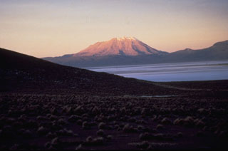
Geological Summary. The truncated appearance of Ubinas, Perú's most active volcano, is a result of a 1.4-km-wide crater at the summit. It is the northernmost of three young volcanoes located along a regional structural lineament about 50 km behind the main volcanic front. The growth and destruction of Ubinas I was followed by construction of Ubinas II beginning in the mid-Pleistocene. The upper slopes of the andesitic-to-rhyolitic Ubinas II stratovolcano are composed primarily of andesitic and trachyandesitic lava flows and steepen to nearly 45°. The steep-walled, 150-m-deep summit crater contains an ash cone with a 500-m-wide funnel-shaped vent that is 200 m deep. Debris-avalanche deposits from the collapse of the SE flank about 3,700 years ago extend 10 km from the volcano. Widespread Plinian pumice-fall deposits include one from about 1,000 years ago. Holocene lava flows are visible on the flanks, but activity documented since the 16th century has consisted of intermittent minor-to-moderate explosive eruptions.
Information Contacts: Instituto Geológical Minero y Metalúrgico (INGEMMET), Av. Canadá 1470, San Borja, Lima 41, Perú (URL: http://www.ingemmet.gob.pe/); Buenos Aires Volcanic Ash Advisory Center (VAAC), Argentina (URL: http://www.smn.gov.ar/vaac/buenosaires/productos.php).

