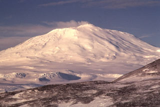
Report on Erebus (Antarctica) — March 2008
Bulletin of the Global Volcanism Network, vol. 33, no. 3 (March 2008)
Managing Editor: Richard Wunderman.
Erebus (Antarctica) Significant eruptions tabulated for 2007
Please cite this report as:
Global Volcanism Program, 2008. Report on Erebus (Antarctica) (Wunderman, R., ed.). Bulletin of the Global Volcanism Network, 33:3. Smithsonian Institution. https://doi.org/10.5479/si.GVP.BGVN200803-390020
Erebus
Antarctica
77.53°S, 167.17°E; summit elev. 3794 m
All times are local (unless otherwise noted)
The Mt. Erebus Volcano Observatory (MEVO) website activity log gives information on each eruption of the volcano detected. Daily activity that usually includes several eruptions. Erebus eruption sizes are measured in the pressure unit of Pascals (Pa) from the infrasonic overpressure (at Station E1S.IS1). The eruption size index scale is divided into events classified as small (0-19 Pa), medium (20-39 Pa), large (40-59 Pa), and very large (>= 60 Pa).
Table 2 lists large and very large eruptions for the period December 2006 through 23 October 2007 (BGVN 31:12 gave a similar list for the year 2006 through November). The absence of recorded eruptions from 13 April 2007 to 29 August 2007 is notable. No eruptions were reported on the website during 23 October 2007 to 29 April 2008.
Table 2. Eruptions recorded at Erebus in the instrumentally derived categories "large" and "very large" during December 2006-23 October 2007. Courtesy of MEVO.
| Month | Large Eruptions | Very Large Eruptions |
| Dec 2006 | 2 | 0 |
| Jan 2007 | 29 | 24 |
| Feb 2007 | 8 | 39 |
| Mar 2007 | 7 | 11 |
| Apr 2007 | 2 | 7 |
| May 2007 | 0 | 0 |
| Jun 2007 | 0 | 0 |
| Jul 2007 | 0 | 0 |
| Aug 2007 | 0 | 1 |
| Sep 2007 | 0 | 2 |
| Oct 2007 | 1 | 1 |
Thermal anomalies over Erebus, measured from the MODIS (Moderate Resolution Imaging Spectroradiometer) satellite images were analyzed by the Hawai'i Institute of Geophysics and Planetology (HIGP) MODVOLC algorithm. They commonly appeared throughout the 2007 due to the presence of a molten lava lake within the crater.
Geological Summary. Mount Erebus, the world's southernmost historically active volcano, overlooks the McMurdo research station on Ross Island. It is the largest of three major volcanoes forming the crudely triangular Ross Island. The summit of the dominantly phonolitic volcano has been modified by one or two generations of caldera formation. A summit plateau at about 3,200 m elevation marks the rim of the youngest caldera, which formed during the late-Pleistocene and within which the modern cone was constructed. An elliptical 500 x 600 m wide, 110-m-deep crater truncates the summit and contains an active lava lake within a 250-m-wide, 100-m-deep inner crater; other lava lakes are sometimes present. The glacier-covered volcano was erupting when first sighted by Captain James Ross in 1841. Continuous lava-lake activity with minor explosions, punctuated by occasional larger Strombolian explosions that eject bombs onto the crater rim, has been documented since 1972, but has probably been occurring for much of the volcano's recent history.
Information Contacts: Philip R. Kyle and Kyle Jones, Mt. Erebus Volcano Observatory (MEVO), New Mexico Institute of Mining and Technology, Socorro, NM 87801, USA (URL: https://nmtearth.com/); Hawai'i Institute of Geophysics and Planetology (HIGP) MODIS Thermal Alerts, School of Ocean and Earth Science and Technology (SOEST), Univ of Hawai'i, 2525 Correa Road, Honolulu, HI 96822, USA (URL: http://modis.higp.hawaii.edu/).

