Report on Raung (Indonesia) — June 2008
Bulletin of the Global Volcanism Network, vol. 33, no. 6 (June 2008)
Managing Editor: Richard Wunderman.
Raung (Indonesia) New eruption during 12-17 June sends ash plumes to 4.5 km altitude
Please cite this report as:
Global Volcanism Program, 2008. Report on Raung (Indonesia) (Wunderman, R., ed.). Bulletin of the Global Volcanism Network, 33:6. Smithsonian Institution. https://doi.org/10.5479/si.GVP.BGVN200806-263340
Raung
Indonesia
8.119°S, 114.056°E; summit elev. 3260 m
All times are local (unless otherwise noted)
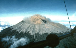
In an Antara News report, Balok Suryadi, an observer at the Center of Volcanology and Geological Hazard Mitigation (CVGHM) Raung monitoring post at Sumber Arum village, described clouds of "smoke and ash" that occurred on 12 and 13 June. He was also quoted in the 19 June article as saying that activity was "likely" continuing but that it could not be clearly monitored from the observation post.
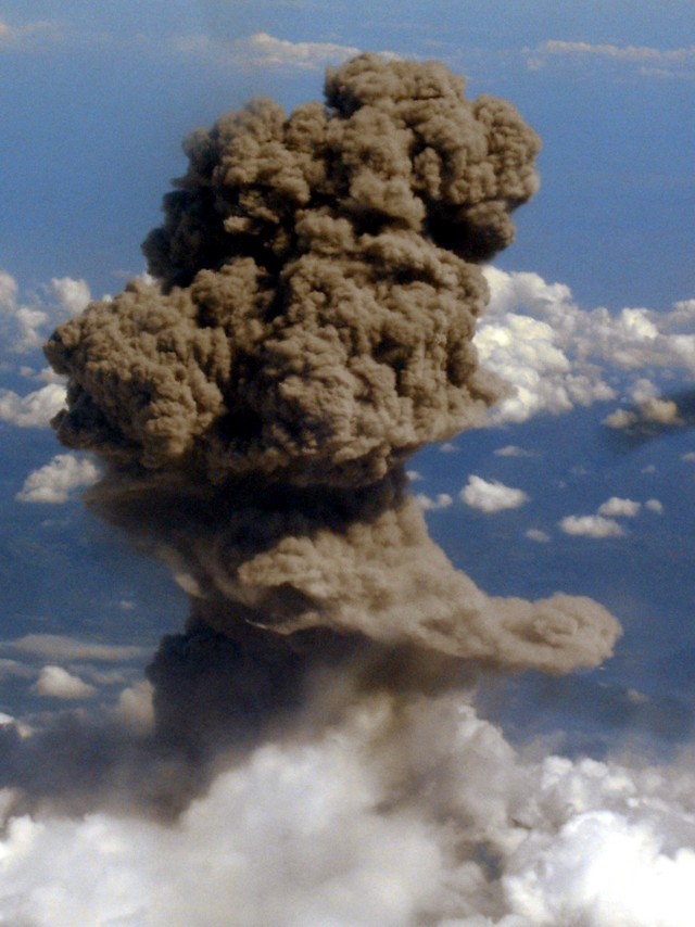
Another ash eruption was seen rising through the clouds on 17 June 2008 around 1500. This event was photographed by Karim Kebaili while flying from Bali to Jakarta approximately 30 minutes after take-off (figure 4). The same eruption was seen at 1430 by pilot Nigel Demery, who stated that the ash cloud initially rose to about 4.5 km altitude but had dissipated on his return flight about two hours later. The Darwin VAAC was unable to identify the plume in satellite imagery due to meteorological clouds.
Thermal anomalies were detected by the MODIS instrument aboard the Terra satellite on 23 July 2005 and 15 August 2005. No additional thermal anomalies were detected through the end of June 2008. However, ash plumes were reported by pilots on 26 July 2007 and seen in satellite imagery on 26 August 2007 (BGVN 32:09).
Geological Summary. Raung, one of Java's most active volcanoes, is a massive stratovolcano in easternmost Java that was constructed SW of the rim of Ijen caldera. The unvegetated summit is truncated by a dramatic steep-walled, 2-km-wide caldera that has been the site of frequent historical eruptions. A prehistoric collapse of Gunung Gadung on the W flank produced a large debris avalanche that traveled 79 km, reaching nearly to the Indian Ocean. Raung contains several centers constructed along a NE-SW line, with Gunung Suket and Gunung Gadung stratovolcanoes being located to the NE and W, respectively.
Information Contacts: Rebecca Patrick, Darwin Volcanic Ash Advisory Centre (VAAC), Bureau of Meteorology, Northern Territory Regional Office, PO Box 40050, Casuarina, Northern Territory 0811, Australia (URL: http://www.bom.gov.au/info/vaac); Center of Volcanology and Geological Hazard Mitigation (CVGHM), Jalan Diponegoro 57, Bandung 40122, Indonesia (URL: http://www.vsi.esdm.go.id/); Nigel Demery, Indonesia; Karim Kebaili, Indonesia; Antara News (URL: http://www.antara.co.id/); Hawai'i Institute of Geophysics and Planetology (HIGP) Thermal Alerts System, School of Ocean and Earth Science and Technology (SOEST), Univ. of Hawai'i, 2525 Correa Road, Honolulu, HI 96822, USA (URL: http://modis.higp.hawaii.edu/).


