Report on Manam (Papua New Guinea) — September 2008
Bulletin of the Global Volcanism Network, vol. 33, no. 9 (September 2008)
Managing Editor: Richard Wunderman.
Manam (Papua New Guinea) Low level eruptions continue in 2008
Please cite this report as:
Global Volcanism Program, 2008. Report on Manam (Papua New Guinea) (Wunderman, R., ed.). Bulletin of the Global Volcanism Network, 33:9. Smithsonian Institution. https://doi.org/10.5479/si.GVP.BGVN200809-251020
Manam
Papua New Guinea
4.08°S, 145.037°E; summit elev. 1807 m
All times are local (unless otherwise noted)
Table 5 characterizes plumes from Manam during 2 April 2008 to 7 October 2008 (BGVN 33:04 listed plume activity through mid-May 2008). The International Civil Aviation Organization (2008) noted that during July 2007-June 2008, the Darwin Volcanic Ash Advisory Centre issued 23 Volcanic Ash Advisories resulting from 10 Manam eruptions.
Table 5. Plumes from Manam from 2 April to 7 October 2008. Courtesy of Darwin Volcanic Ash Advisory Centre.
| Date | Observation |
| 02 Apr 2008 | Low-level plume drifted SW. |
| 14-15 Apr 2008 | Low-level ash-and-steam plume drifted WNW. |
| 23-29 Apr 2008 | Diffuse plume below 3 km altitude; drifted NW. |
| 11-12 May 2008 | Plumes to 3 km altitude; drifted SE. |
| 29 Jul 2008 | Plumes to 2.4 km altitude; drifted WNW. |
| 30 Jul 2008 | Plume to 2.4 km altitude; drifted NW. |
| 16-17 Aug 2008 | Ash plumes to 1.5 km altitude; drifted NW. |
| 19 Sep 2008 | Ash plumes to 1.8 km altitude; drifted NW. |
| 07 Oct 2008 | Ash plumes to 2.4 km altitude; drifted NW. |
According to the Rabaul Volcano Observatory, people watching Manam described it as generally quiet from April through October 2008. Occasional ash plumes in this period resulted in aviation ash advisories (table 5). Both craters released variable amounts of white vapor. No audible noises were heard during this period and no glow was visible at night except for a weak steady glow visible at night during 18-22 May.
Seismic activity was low to moderate, dominated by low frequency volcanic earthquakes (numbers fluctuated daily between 650 and 1,000). No high frequency earthquakes were recorded during the period and no significant movement was recorded by the tiltmeter.
The only MODIS/MODVOLC satellite thermal anomaly for Manam during 2008 as late as 6 November was a 1-pixel anomaly measured 28 July at 1555 UTC from the Aqua satellite system.
Reference. International Civil Aviation Organization, 2008, Twelfth Meeting of the Communications/Navigation/Surveillance and Meteorology Sub-Group of APANPIRG (CNS/MET/SG/12), Bangkok, Thailand, 21-25 July 2008: Information Paper 10, VAAC Darwin Report July 2007-June 2008, 12 p. (URL: http://www.icao.or.th/2008/cnsmet_sg12/).
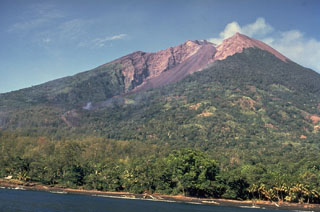
Geological Summary. The 10-km-wide island of Manam, lying 13 km off the northern coast of mainland Papua New Guinea, is one of the country's most active volcanoes. Four large radial valleys extend from the unvegetated summit of the conical basaltic-andesitic stratovolcano to its lower flanks. These valleys channel lava flows and pyroclastic avalanches that have sometimes reached the coast. Five small satellitic centers are located near the island's shoreline on the northern, southern, and western sides. Two summit craters are present; both are active, although most observed eruptions have originated from the southern crater, concentrating eruptive products during much of the past century into the SE valley. Frequent eruptions, typically of mild-to-moderate scale, have been recorded since 1616. Occasional larger eruptions have produced pyroclastic flows and lava flows that reached flat-lying coastal areas and entered the sea, sometimes impacting populated areas.
Information Contacts: Herman Patia and Steve Saunders, Rabaul Volcano Observatory (RVO), P.O. Box 386, Rabaul, Papua New Guinea; Darwin Volcanic Ash Advisory Centre (VAAC), Bureau of Meteorology, Northern Territory Regional Office, PO Box 40050, Casuarina, Northern Territory 0811, Australia (URL: http://www.bom.gov.au/info/vaac/).

