Report on Ibu (Indonesia) — May 2009
Bulletin of the Global Volcanism Network, vol. 34, no. 5 (May 2009)
Managing Editor: Richard Wunderman.
Ibu (Indonesia) Thermal data suggest dome growth continued into mid-2009
Please cite this report as:
Global Volcanism Program, 2009. Report on Ibu (Indonesia) (Wunderman, R., ed.). Bulletin of the Global Volcanism Network, 34:5. Smithsonian Institution. https://doi.org/10.5479/si.GVP.BGVN200905-268030
Ibu
Indonesia
1.488°N, 127.63°E; summit elev. 1325 m
All times are local (unless otherwise noted)
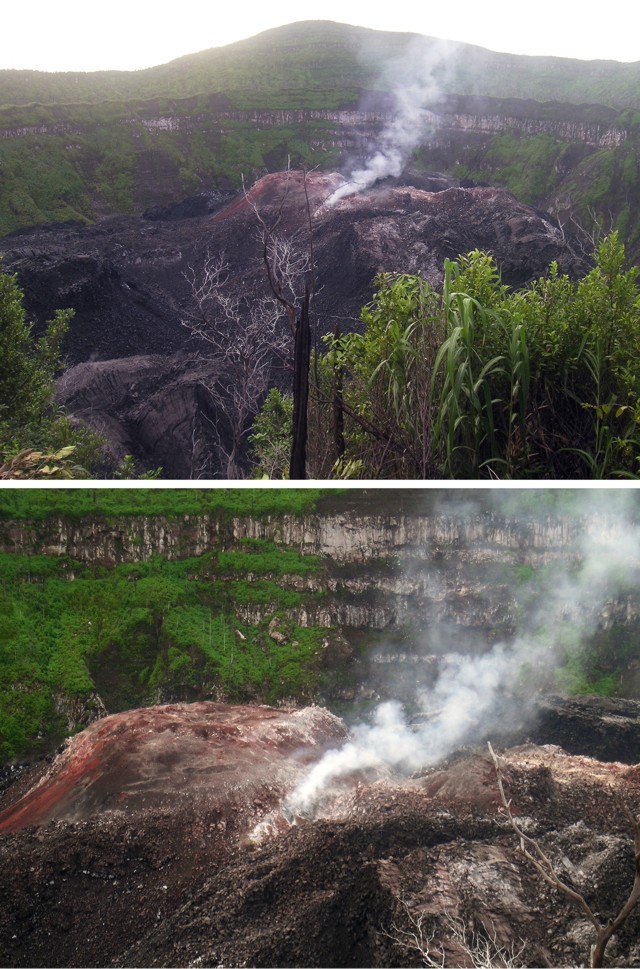
Our last report on Ibu summarized MODVOLC thermal alerts (satellite thermal anomalies) from mid-May through late October 2008 (BGVN 33:09); those anomalies continued to be recorded almost monthly through June 2009. The anomalies suggest continued growth of a lava dome in the crater, an event previously documented by a photograph taken May 2000 and mentioned in BGVN 28:03. Authorities raised the hazard alert to Level 3 during June 2008. Several photos of Ibu in 2007 were taken by Arnold Binas (figure 2).
Geological Summary. The truncated summit of Gunung Ibu stratovolcano along the NW coast of Halmahera Island has large nested summit craters. The inner crater, 1 km wide and 400 m deep, has contained several small crater lakes. The 1.2-km-wide outer crater is breached on the N, creating a steep-walled valley. A large cone grew ENE of the summit, and a smaller one to the WSW has fed a lava flow down the W flank. A group of maars is located below the N and W flanks. The first observed and recorded eruption was a small explosion from the summit crater in 1911. Eruptive activity began again in December 1998, producing a lava dome that eventually covered much of the floor of the inner summit crater along with ongoing explosive ash emissions.
Information Contacts: Center of Volcanology and Geological Hazard Mitigation (CVGHM), Saut Simatupang, 57, Bandung 40122, Indonesia (URL: http://vsi.esdm.go.id/); Hawai'i Institute of Geophysics and Planetology (HIGP) Thermal Alerts System, School of Ocean and Earth Science and Technology (SOEST), Univ. of Hawai'i, 2525 Correa Road, Honolulu, HI 96822, USA (URL: http://modis.higp.hawaii.edu/); Arnold Binas, Toronto, Canada (URL: http://www.summitpost.org/user_page.php?user_id=42443, http://www.flickr.com/photos/hshdude/collections/72157600584144439/).


