Report on Manam (Papua New Guinea) — February 2010
Bulletin of the Global Volcanism Network, vol. 35, no. 2 (February 2010)
Managing Editor: Richard Wunderman.
Manam (Papua New Guinea) Intermittent ash plumes continue; ~14,000 people still displaced
Please cite this report as:
Global Volcanism Program, 2010. Report on Manam (Papua New Guinea) (Wunderman, R., ed.). Bulletin of the Global Volcanism Network, 35:2. Smithsonian Institution. https://doi.org/10.5479/si.GVP.BGVN201002-251020
Manam
Papua New Guinea
4.08°S, 145.037°E; summit elev. 1807 m
All times are local (unless otherwise noted)
Intermittent ash plumes and steam emissions at Manam have been reported between 2 April 2008 and 2 November 2009, but the volcano has been relatively quiet (BGVN 34:01 and 34:11). Based on analyses of satellite imagery, the Darwin Volcanic Ash Advisory Centre reported that on 12 December 2009 an eruption produced a plume that rose to an altitude of 3 km and drifted 75 km N. According to a report by the Rabaul Volcano Observatory, the volcano was quiet again throughout February 2010. However, steam emissions were reported, and a dull glow from the Main Crater was visible on the night of 16 February. There were no MODVOLC thermal alerts between 3 October 2009 and mid-April 2010.
A January 2010 report by the United Nations Office for the Coordination of Humanitarian Affairs discussed refugees originally evacuated from Manam Island in November 2004 after several deadly eruptions (BGVN 29:11). In early 2010 there remained ~ 14,000 people living in camps on the nearby mainland unable to return home because of ongoing volcanic hazards. In addition, "a government plan to permanently resettle the [evacuees] inland was never realized and local and international assistance has all but disappeared."
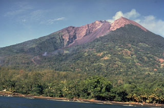
Geological Summary. The 10-km-wide island of Manam, lying 13 km off the northern coast of mainland Papua New Guinea, is one of the country's most active volcanoes. Four large radial valleys extend from the unvegetated summit of the conical basaltic-andesitic stratovolcano to its lower flanks. These valleys channel lava flows and pyroclastic avalanches that have sometimes reached the coast. Five small satellitic centers are located near the island's shoreline on the northern, southern, and western sides. Two summit craters are present; both are active, although most observed eruptions have originated from the southern crater, concentrating eruptive products during much of the past century into the SE valley. Frequent eruptions, typically of mild-to-moderate scale, have been recorded since 1616. Occasional larger eruptions have produced pyroclastic flows and lava flows that reached flat-lying coastal areas and entered the sea, sometimes impacting populated areas.
Information Contacts: Ima Itikarai, Rabaul Volcano Observatory (RVO), PO Box 386, Rabaul, Papua New Guinea; Darwin Volcanic Ash Advisory Centre (VAAC), Bureau of Meteorology, Northern Territory Regional Office, PO Box 40050, Casuarina, NT 0811, Australia (URL: http://www.bom.gov.au/info/vaac/); Hawai'i Institute of Geophysics and Planetology (HIGP) Thermal Alerts System, School of Ocean and Earth Science and Technology (SOEST), Univ. of Hawai'i, 2525 Correa Road, Honolulu, HI 96822, USA (URL: http://modis.higp.hawaii.edu/); ReliefWeb, UN Office for the Coordination of Humanitarian Affairs (OCHA) (URL: https://reliefweb.int/).

