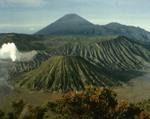
Report on Tengger Caldera (Indonesia) — October 2012
Bulletin of the Global Volcanism Network, vol. 37, no. 10 (October 2012)
Managing Editor: Richard Wunderman.
Tengger Caldera (Indonesia) Modest April 2011 eruption at Bromo followed by increasing tremor
Please cite this report as:
Global Volcanism Program, 2012. Report on Tengger Caldera (Indonesia) (Wunderman, R., ed.). Bulletin of the Global Volcanism Network, 37:10. Smithsonian Institution. https://doi.org/10.5479/si.GVP.BGVN201210-263310
Tengger Caldera
Indonesia
7.942°S, 112.95°E; summit elev. 2329 m
All times are local (unless otherwise noted)
This report discusses Bromo's behavior during April 2011 to early October 2012, an interval of ongoing seismicity. The Bromo cone, located within the Tengger caldera, has erupted repeatedly since about the year 1590. Under normal conditions in recent decades, Bromo emits a white, sulfurous, diffuse-to-dense vapor plume reaching heights of about 75-150 m above the rim. Observations of Bromo are carried out both visually and with instruments. Visual observation is aided by a closed circuit TV (CCTV) camera. A seismic station incorporates both analog and digital recordings. Observations of deformation are carried out with one tiltmeter station.
Our last report on Bromo (BGVN 36:03) presented activity through March 2011, which could be differentiated into largely Strombolian phases accompanied by little ash and variable levels of degassing, and phases during which significant amounts of ash were released (Roscoe, 2011). Strombolian phases were sometimes accompanied by powerful shockwaves, often after short periods (10-30 seconds) of complete calm (Roscoe, 2011).
During most of April 2011, the Bromo cone was relatively quiet until 27 April when the Darwin Volcanic Ash Advisory Centre (VAAC) reported an ash plume rising to an altitude of ~4.3 km and drifting ~75 km WSW. From 1-10 May the Center of Volcanology and Geological Hazard Mitigation (CVGHM) reported white-to-gray ash plumes rising ~400-600 m above the crater and drifting ENE, and incandescence emanating from the crater. On 2 May the Darwin VAAC reported that a significant ash plume rose to an altitude of ~3 km and drifted ~75 km N. Based on analyses of satellite imagery, the Darwin VAAC again reported that during 9-10 May ash plumes from Bromo rose to an altitude of ~2.7 km and drifted 45-75 km NE and E. During 11-20 May white-to-gray ash plumes rose ~200-400 m above the crater and drifted E.
Ash plumes continued to rise from the crater during 1-13 June, reaching heights of ~100-200 m above the crater and drifting E. Ash fell in areas within 2 km to the E and NE during May and June. On 13 June the Alert Level was lowered to 2 (on a scale of 1-4). During the rest of 2011 Bromo was quiet.
From 1 January-29 March 2012 CVGHM reported that white plumes from the Bromo cone rose ~50 m above the crater; background seismicity declined. On 30 March the Alert Level was lowered to 1. This modest activity continued until 1 September when diffuse white plumes from the Bromo cone rose 50 m above the crater. During 1-28 September 2012, the following seismic events were recorded: 6 deep volcanic, 1 shallow volcanic, and 57 long-distance tectonic earthquakes. Tremor continued with a maximum amplitude of 0.5 mm. From 29 September to 1 October 2012 continuous tremor was recorded, reaching a maximum amplitude of 11 mm. The dominant reading was 0.5 mm.
Seismicity increased on 1 October, and during 1-3 October a sulfur odor was occasionally noted at the Bromo Observation Post. On 2 October 2012, continuous tremor reached a maximum amplitude of 11 mm with a dominant reading of 7 mm. On 3 October the tremor rose continuously, reaching 22 mm. Accordingly, on 3 October the Alert Level was raised to 2.
Reference. Roscoe, R., 2011, Bromo Volcano (Tengger Caldera), Photovolcanica, 86 photographs, Updated 21 August 2011, Accessed 21 November 2012 (URL: http://www.photovolcanica.com/VolcanoInfo/Bromo/Bromo.html).
Geological Summary. The 16-km-wide Tengger caldera is located at the northern end of a volcanic massif extending from Semeru volcano. The massive volcanic complex dates back to about 820,000 years ago and consists of five overlapping stratovolcanoes, each truncated by a caldera. Lava domes, pyroclastic cones, and a maar occupy the flanks of the massif. The Ngadisari caldera at the NE end of the complex formed about 150,000 years ago and is now drained through the Sapikerep valley. The most recent of the calderas is the 9 x 10 km wide Sandsea caldera at the SW end of the complex, which formed incrementally during the late Pleistocene and early Holocene. An overlapping cluster of post-caldera cones was constructed on the floor of the Sandsea caldera within the past several thousand years. The youngest of these is Bromo, one of Java's most active and most frequently visited volcanoes.
Information Contacts: Center of Volcanology and Geological Hazard Mitigation (CVGHM), Jalan Diponegoro 57, Bandung 40122, Indonesia (URL: http://vsi.esdm.go.id/); Darwin Volcanic Ash Advisory Centre (VAAC), Bureau of Meteorology, Northern Territory Regional Office, PO Box 40050, Casuarina, NT 0811, Australia (URL: http://www.bom.gov.au/info/vaac/).

