Report on Barren Island (India) — July 2014
Bulletin of the Global Volcanism Network, vol. 39, no. 7 (July 2014)
Managing Editor: GVP Staff.
Barren Island (India) Ongoing intermittent ash plumes and thermal anomalies through June 2014
Please cite this report as:
Global Volcanism Program, 2014. Report on Barren Island (India) (GVP Staff, ed.). Bulletin of the Global Volcanism Network, 39:7. Smithsonian Institution. https://doi.org/10.5479/si.GVP.BGVN201407-260010
Barren Island
India
12.278°N, 93.858°E; summit elev. 354 m
All times are local (unless otherwise noted)
Renewed activity at Barren Island that began in October 2013 (BGVN 38:10) continued at least through June 2014. Ongoing low-level eruptive activity was indicated by intermittent reports of ash plumes and MODIS infrared satellite observations.
Ash plumes seen in satellite imagery on 17 October 2013 corresponded to an episode of MODVOLC thermal alerts that began on 10 October (10 pixels) and continued through 23 October. Additional extended periods of eruptive activity indicated by frequent thermal alerts took place from 12-19 December 2013 and 20 January-12 February 2014. Isolated anomalies were also identified on 13 and 15 November and 1 December 2013, and 1 January, 12 March, and 20 April 2014.
Low-level ash plumes that rose to altitudes as high as ~1.5 km were reported in February 2014. Darwin VAAC reports stated that an ash plume on 6 February rose to ~1.5 km altitude and drifted more than 35 km SW. On 9 February another low-level plume rose from the vent.
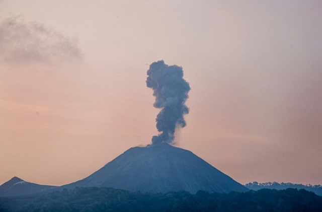
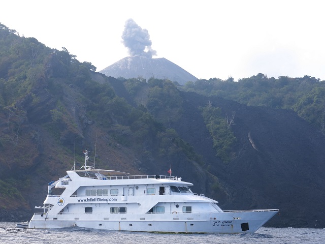
Although plumes were infrequently noted on satellite imagery, the crew of the Infiniti Live Aboard dive boat noted that there was a plume visible during each of six visits to the island between January and April 2014 (figures 22 and 23).
Thermal infrared MODIS data processed by the MIROVA system, which uses middle infrared radiation to identify possible volcanic activity, revealed frequent anomalies in April through early May 2014, and in late May to early June; another anomaly was seen in mid-June 2014.
 |
Figure 23. Barren Island released a plume that rose a few hundred meters high in April 2014. A previous plume can be seen at left drifting downwind. Courtesy of Infiniti Live Aboard (2014). |
References. Infiniti Live Aboard; 4 July 2014 (URL: http://www.infinitiliveaboard.com/blog/dive-sites-of-barren-island-7) [accessed in February 2015]
Sharma, Jayanth; 2014; Diving in the Barren Islands, Andaman; Wildlife Times (URL: http://www.wildlifetimes.com/photo-story/diving-barren-island-andamans/) [accessed in February 2015]
Geological Summary. Barren Island, a possession of India in the Andaman Sea about 135 km NE of Port Blair in the Andaman Islands, is the only historically active volcano along the N-S volcanic arc extending between Sumatra and Burma (Myanmar). It is the emergent summit of a volcano that rises from a depth of about 2250 m. The small, uninhabited 3-km-wide island contains a roughly 2-km-wide caldera with walls 250-350 m high. The caldera, which is open to the sea on the west, was created during a major explosive eruption in the late Pleistocene that produced pyroclastic-flow and -surge deposits. Historical eruptions have changed the morphology of the pyroclastic cone in the center of the caldera, and lava flows that fill much of the caldera floor have reached the sea along the western coast.
Information Contacts: Darwin Volcanic Ash Advisory Centre (VAAC) (URL: http://www.bom.gov.au/info/vaac/); Hawai'i Institute of Geophysics and Planetology (HIGP) Thermal Alerts System, School of Ocean and Earth Science and Technology (SOEST) University of Hawai'i at Manoa, 1680 East-West Road, Pacific Ocean Science & Technology (POST) Building Room 602, Honolulu, HI 96822, USA (URL: http://modis.higp.hawaii.edu/); MIROVA, a collaborative project between the Universities of Turin and Florence (Italy) and is supported by the Centre for Volcanic Risk of the Italian Civil Protection Department (URL: http://www.mirovaweb.it/).


