Report on Piton de la Fournaise (France) — December 2018
Bulletin of the Global Volcanism Network, vol. 43, no. 12 (December 2018)
Managing Editor: Edward Venzke.
Edited by Janine B. Krippner.
Piton de la Fournaise (France) Eruption from 15 September to 1 November produced a lava flow to the E
Please cite this report as:
Global Volcanism Program, 2018. Report on Piton de la Fournaise (France) (Krippner, J.B., and Venzke, E., eds.). Bulletin of the Global Volcanism Network, 43:12. Smithsonian Institution. https://doi.org/10.5479/si.GVP.BGVN201812-233020
Piton de la Fournaise
France
21.244°S, 55.708°E; summit elev. 2632 m
All times are local (unless otherwise noted)
Piton de la Fournaise, located in the SE part of La Réunion Island in the Indian Ocean, has been producing frequent effusive basaltic eruptions on average twice a year since 1998. The activity is characterized by lava fountains and lava flows, and occasional explosive eruptions that shower blocks over the summit area and produce ash plumes. Almost all of the recent activity has occurred within the Enclos Fouqué caldera, with recent eruptions in 1977, 1986, and 1998 at vents outside of the caldera. The most recent eruptive episode lasted 18 hours on 13 July 2018. This report summarizes activity during September-November 2018 and is based on reports by Observatoire Volcanologique du Piton de la Fournaise (OVPF) and satellite data.
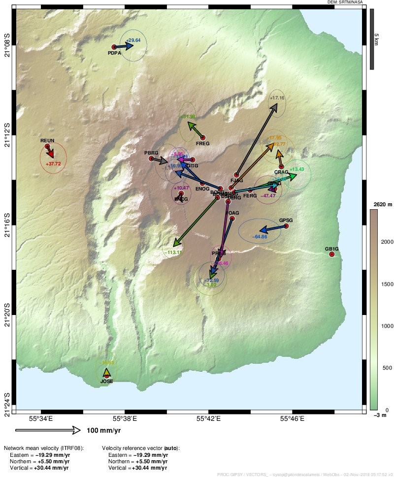
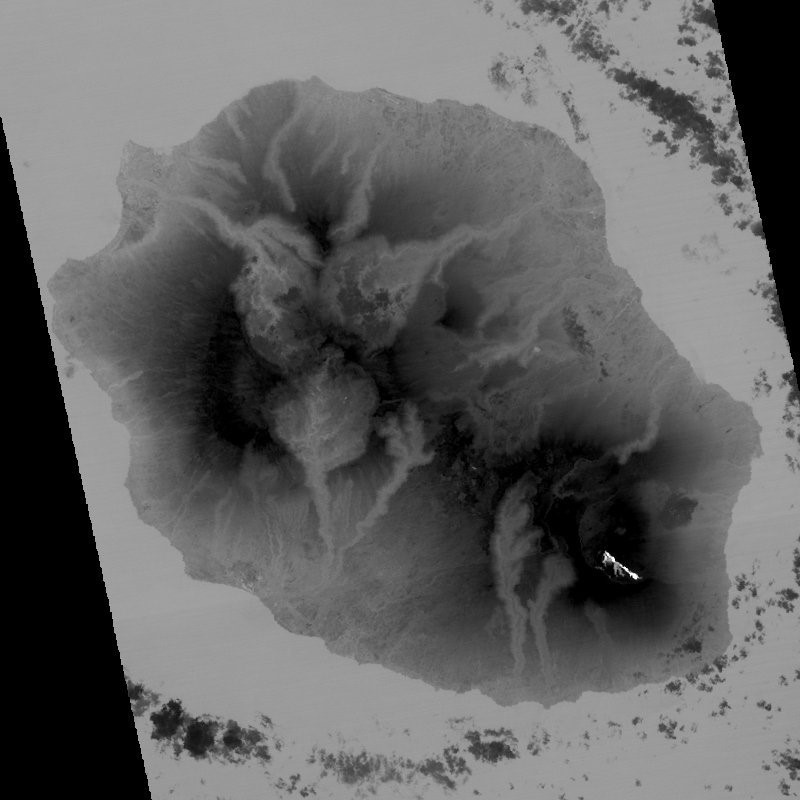
After deformation had ceased in early August, inflation resumed in the beginning of September (figure 145) accompanied by low-level seismicity. From 1 to 12 September CO2 concentrations at the summit had decreased, followed by an increase during 12-20 September. A seismic crisis was reported on 0145 on 15 September that included 995 shallow (less than 2 km depth) volcano-tectonic earthquakes recorded in less than four hours. This was accompanied by rapid deformation of up to 24 cm.
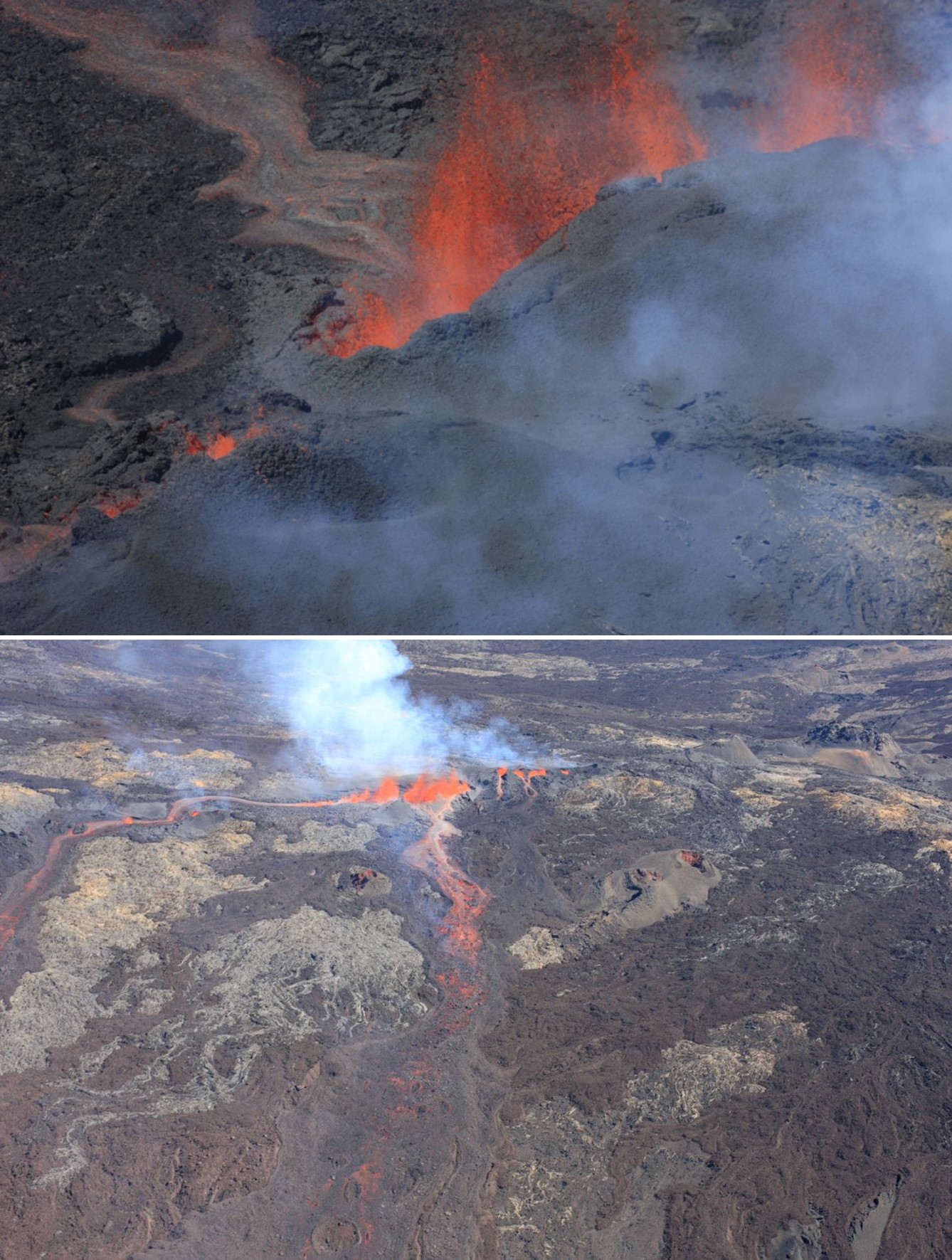
The eruption began at 0435 on 15 September with a fissure opening and erupting lava on the SW flank near Rivals crater. This new fissure was about 300 m downstream, and was a continuation of, the 27 April-1 June 2018 fissure. Volcanic tremor rapidly and steadily declined once the eruption began, which is commonly observed during eruptions of Piton de la Fournaise. An observation flight that day showed five fissures with lava fountains reaching 30 m high in the center of the fissure system (figure 146). By 1100 two main lava flows had merged further downflow and traveled 2 km from the fissures. During the first hours of the eruption the estimated time-averaged discharge rate was 22.7 and 44.7 m3/s.
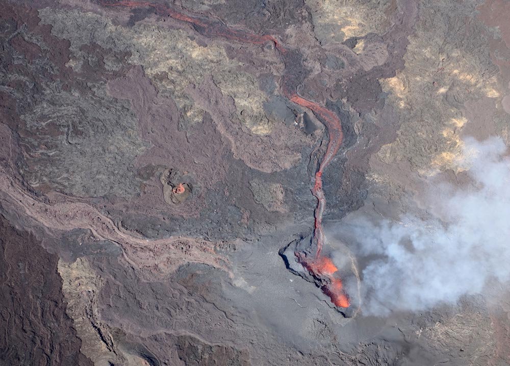
A survey on the 15th recorded multiple lobes at the end of the lava flow and flow rates of 1-5 m3/s (figures 147 and 148). Three vents remained active on 16 September and a spatter cone was being constructed around them. The lava effusion rate was measured at 2.5-7 m3/s. SO2 levels were elevated and the resulting gas plume was dispersed towards the W. On the 17th the lava flow was still high on the flank and moving E.
By 18 September a cone had developed and was open to the south, producing lava fountaining and feeding the lava flow (figure 149). The lava flow had extended to 2.8 km from the vent, with the active flow front about 500 m from the southern wall of the caldera. The flows advanced several hundred meters by the 21st and the height of the cone was 30 m on the eastern side where a near-vertical wall had formed (figure 150). The cone contained three active lava fountains.
Fallout of Pele's hair was reported in the Grand Coude area on 22 September. The cone remained open to the south and a deep channel had formed with lava tubes observed close to the cone (figure 151). Three lava fountains continued to feed the lava flow towards the S, then the SE, with a flow rate of 1-3 m3/s.
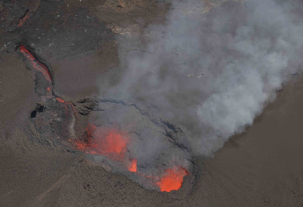 |
Figure 151. The eruption fissure at Piton de la Fournaise on 22 September at 1100 local time. Courtesy of and copyright by OVPF/IPGP (Bulletin d'activité du samedi 22 Septembre 2018 à 17h15). |
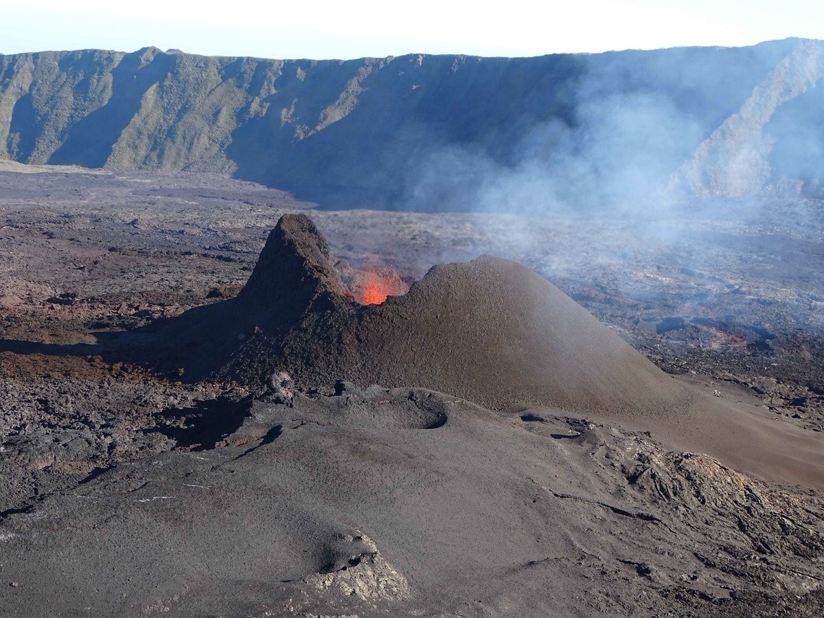
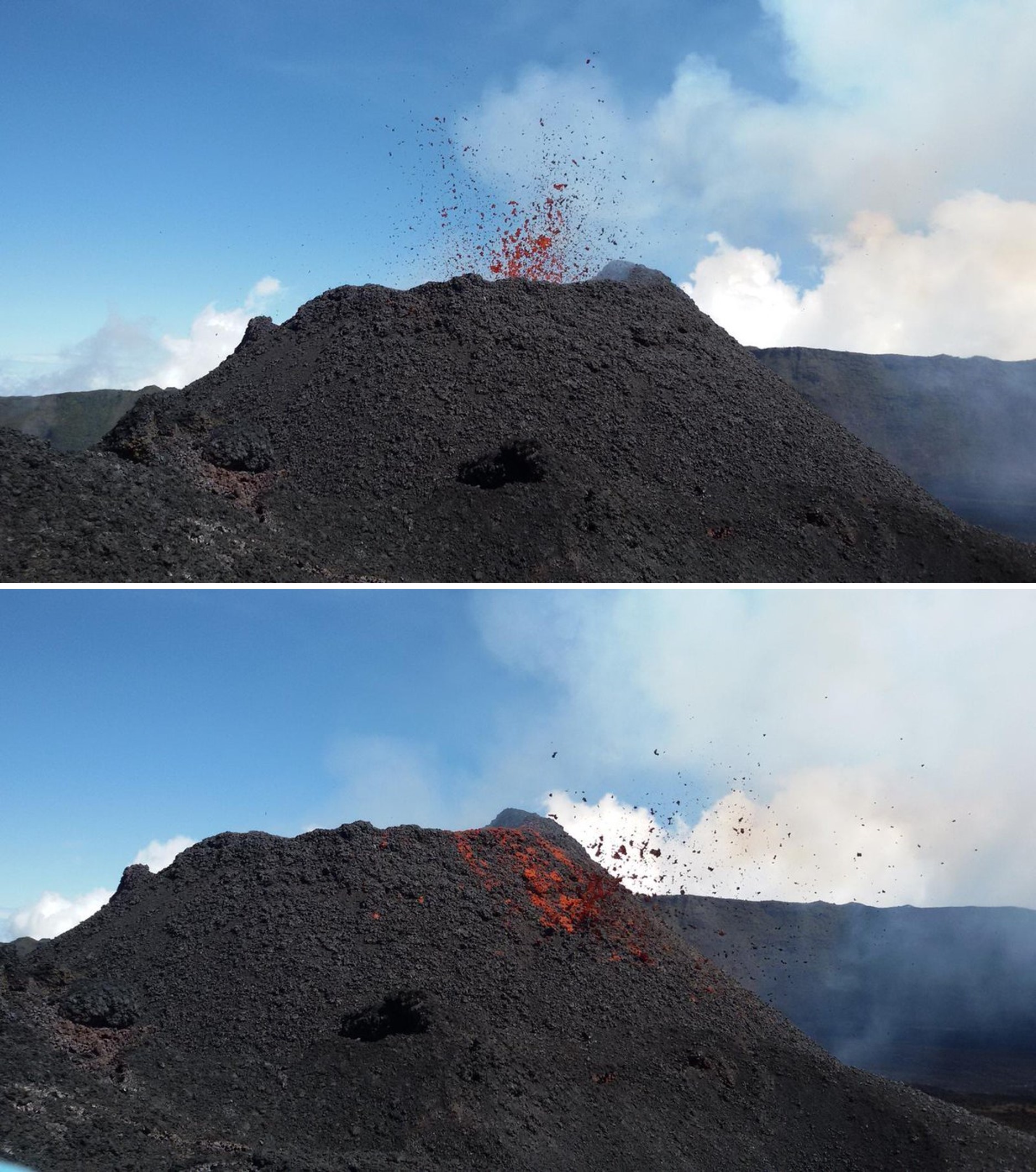
By 26 September the fissure system had evolved into a single cone and the opening towards the south had closed, leaving a circular vent and a lava lake (figure 152). Observations on the 26th showed that lava tubes were developing and feeding outbreak flows 150-300 m away from the cone. During 24-30 September the surface lava flow rate varied from 0.5 to 5.3 m/s, but this was expected to be higher in the lava tubes. By the 27th the majority of the lava was feeding from within the vent area into lava tubes that continued to feed breakout flows several hundred meters from the cone. On the 30th a small lava flow was also visible at the foot of the cone and spattering was seen low above the cone (figure 153).
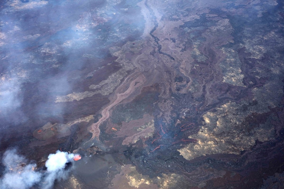 |
Figure 152. A view of the active cone and lava flow on Piton de la Fournaise on 25 September 2018. Courtesy of and copyright by OVPF/IPGP (Bulletin d'activité du samedi 26 Septembre 2018 à 17h00). |
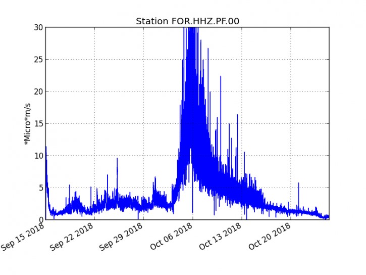
The surface lava flow rate ranged from less than 1 and up to 4 m3/s on 1-2 October, with the majority of the activity still taking place in lava tubes with some small breakout flows (figure 154). There was a reduction in surface activity on 2-3 October along with a change from continuous degassing to the emission of discrete gas plumes ("gas pistons") that were accompanied by a sharp increase in tremor (figure 155). Observations on the 4th noted that spattering at the vent was minor and rare. No breakouts were observed.
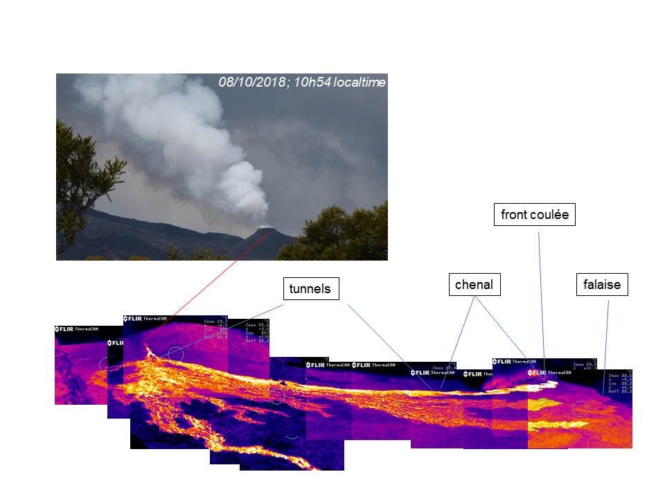
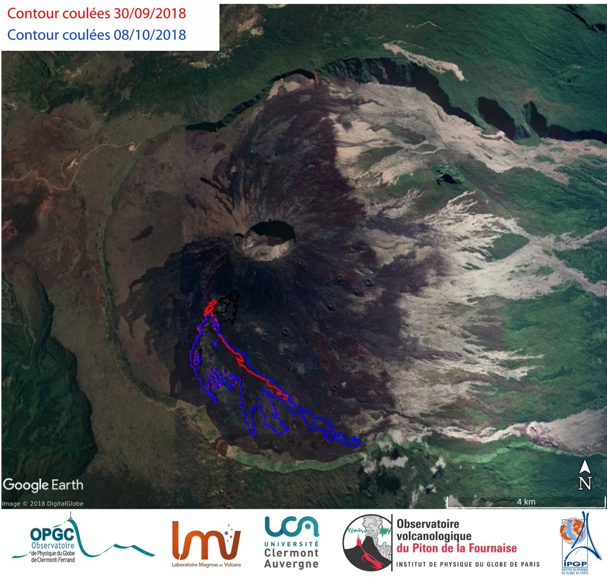
Limited activity continued from the 5 to 7 October surface activity remained low, with minor spattering and few breakouts. Lava continued to flow within the lava tubes and degassing was visible at the surface above them. From 30 September to 8 October the lava had traveled 1.8 km E within lava tubes and emerged as a breakout along the northern flow (figure 156). The south and central flow-fronts had not advanced during this time.
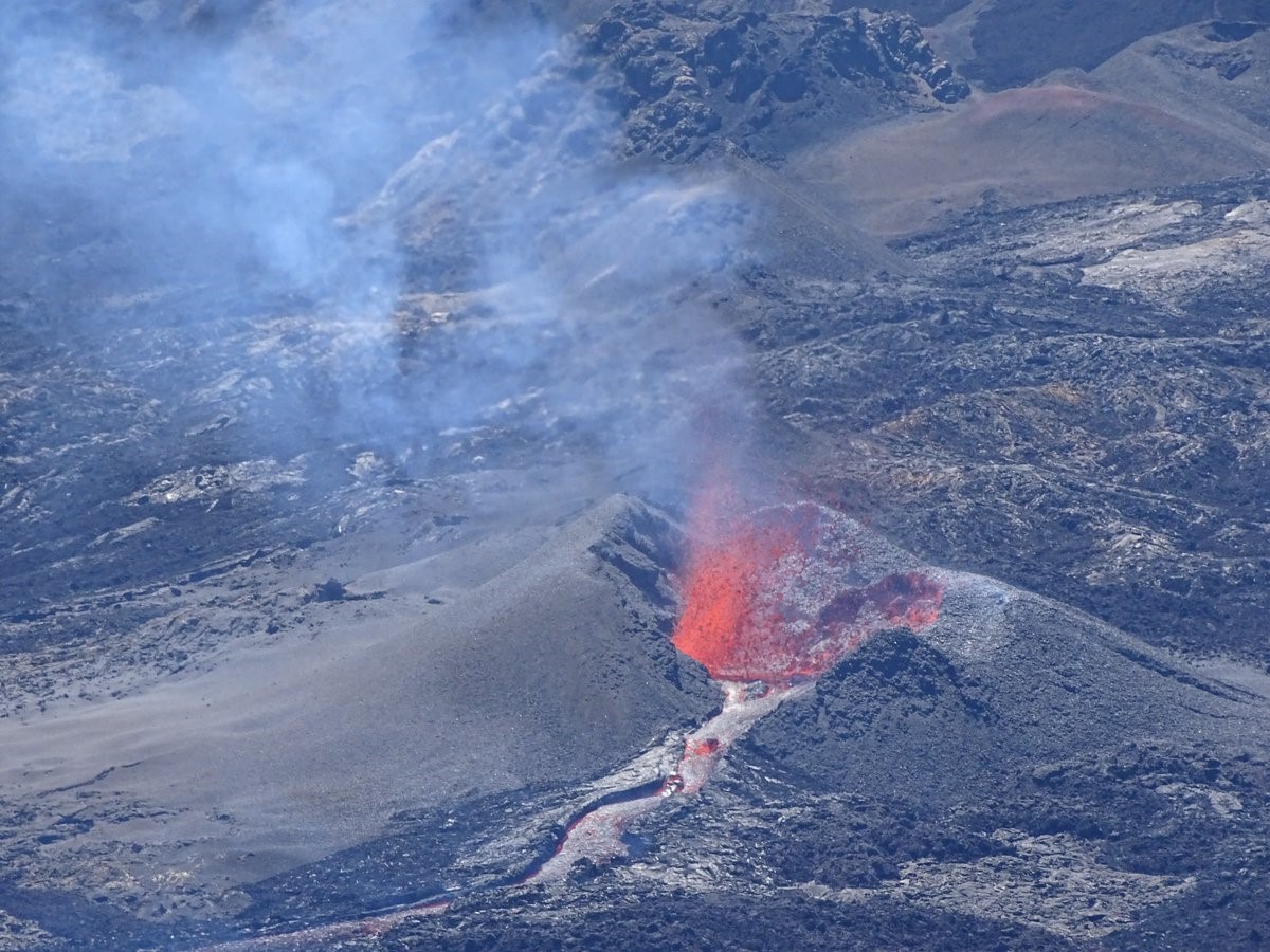
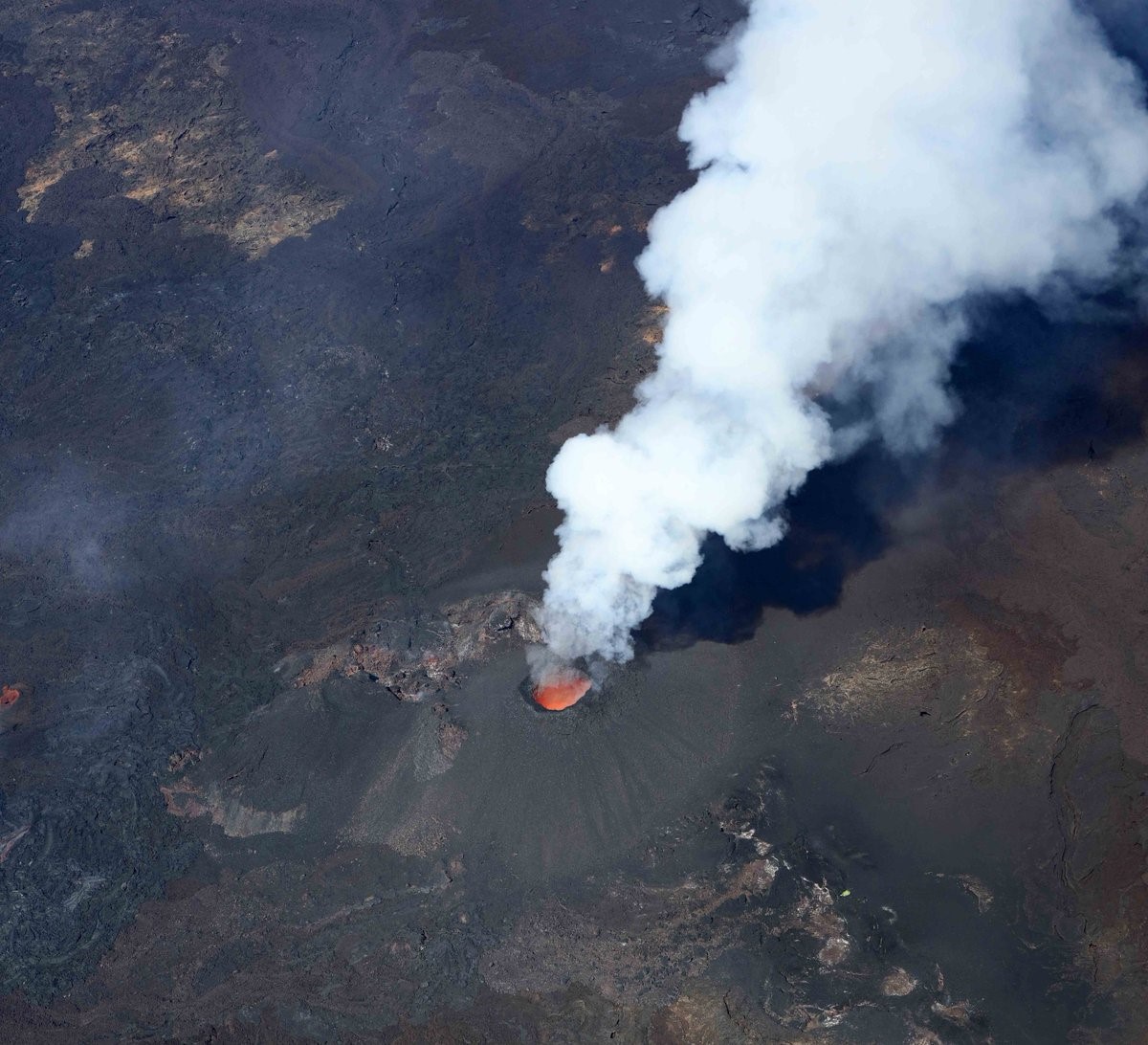
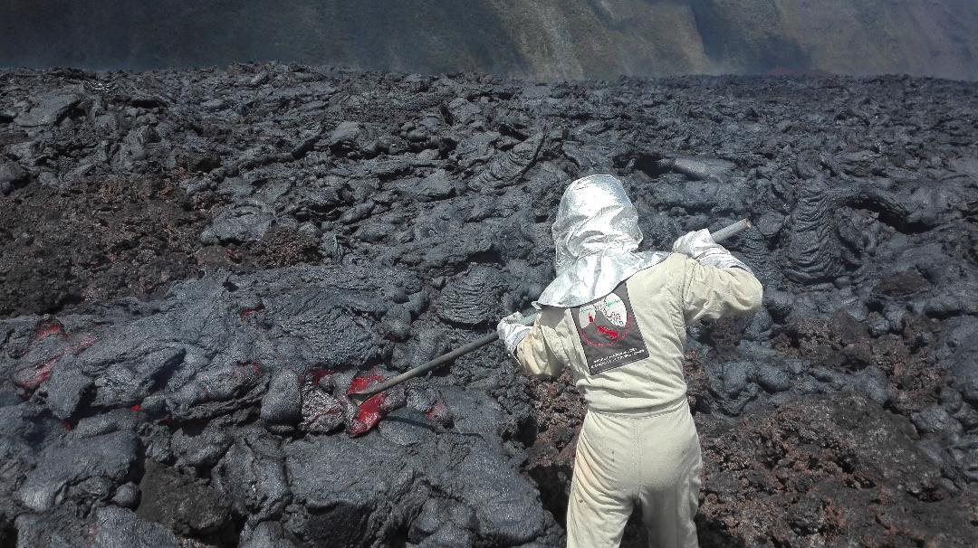
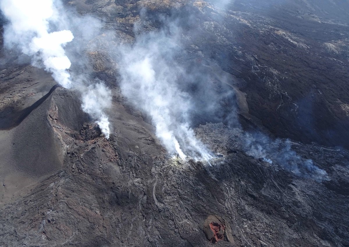
On 14 October no lava channels were visible on the surface and only small breakouts were observed (figure 157). Activity continued in lava tubes and strong degassing persisted from both the vent and main lava tubes (figure 158). On the 18th OVPF/IPGP reported continued strong degassing and a small lava channel that had formed out to a few tens of meters from the cone (figures 159 and 160).
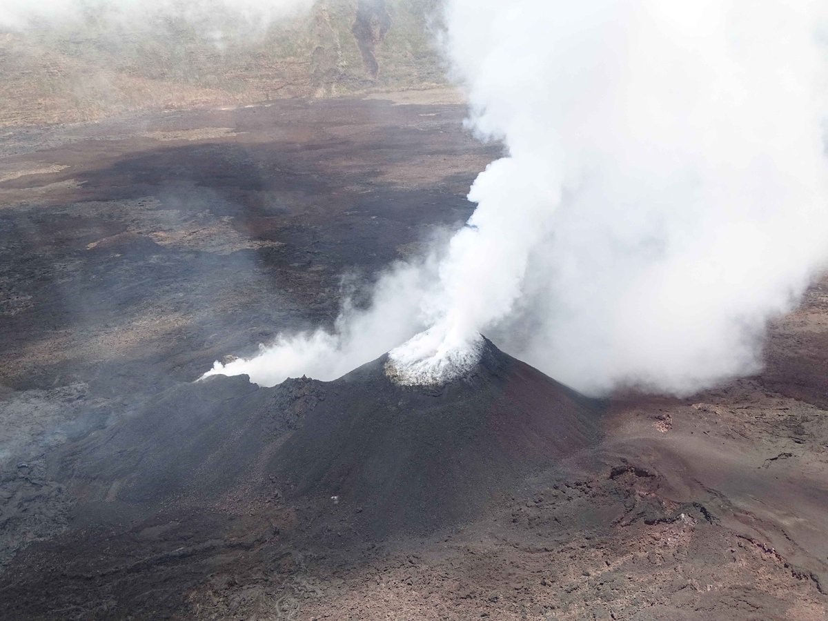 |
Figure 159. A white gas plume at the active vent of Piton de la Fournaise on 18 October 2018. Courtesy of OVPF/IPGP (Bulletin d'activité du samedi 18 Octobre 2018 à 17h00). |
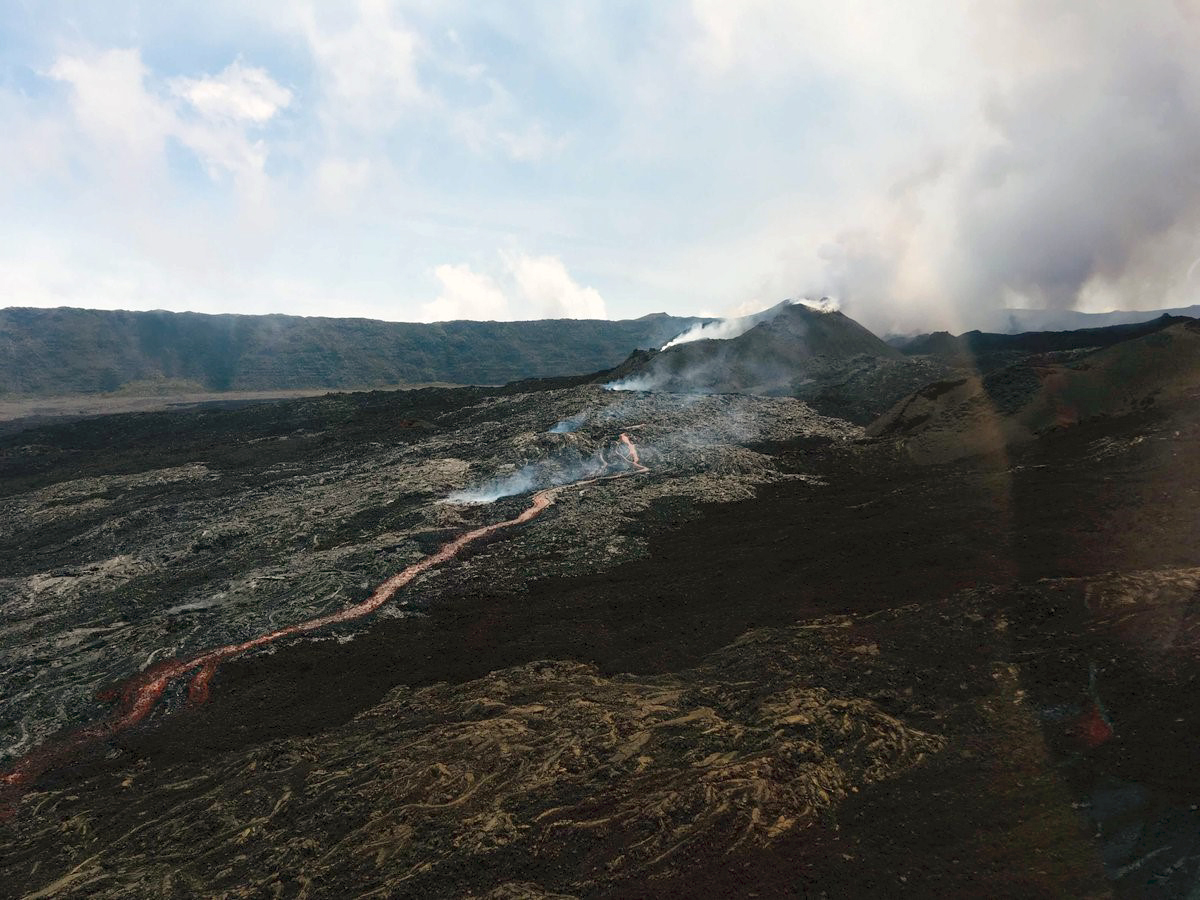 |
Figure 160. The eruptive vent and active lava flow on Piton de la Fournaise at 1130 on 18 October 2018. Courtesy of OVPF/IPGP (Bulletin d'activité du samedi 18 Octobre 2018 à 17h00). |
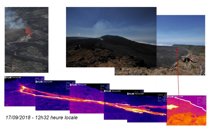
By 25 October the lava flow rate was still low with no further extension of the flow boundary, SO2 emission from the vent were low (close to or below the detection limit), CO2 levels were decreasing, and the intensity of the tremor had stabilized at a very low level for about 24 hours (figure 161). At this point the lava field was essentially composed of lava tubes with a maximum recorded surface temperature (maximum integrated pixel temperature) of 71°C (figure 162). This low level of activity continued during the 26-28th with a small amount of surface lava activity about 1 km from the vent. Over 29-31 October the surface activity was extremely low with no fresh lava observed and only degassing at the vent. The eruption was declared over at 0400 on 1 November after 47 days of activity.
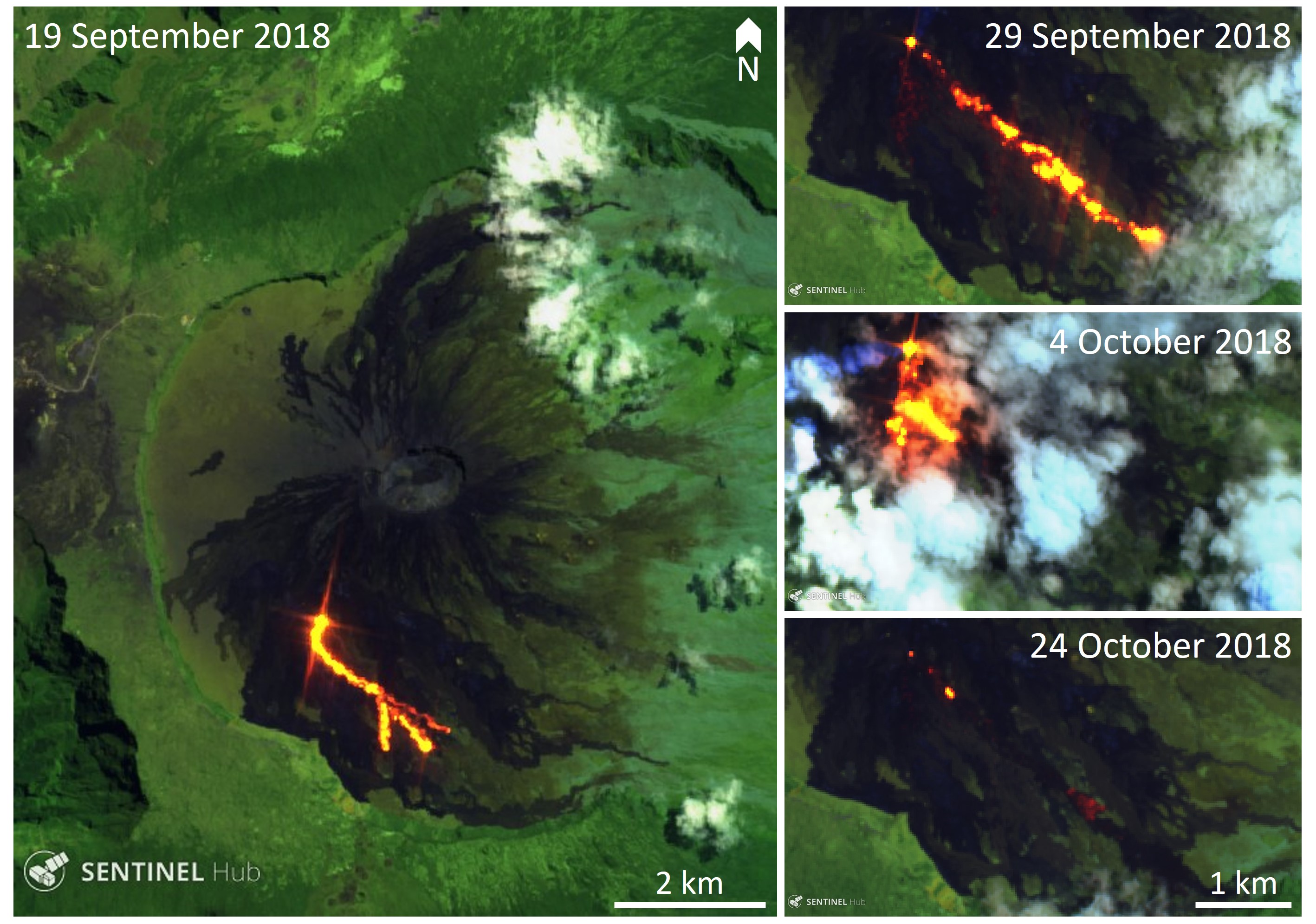
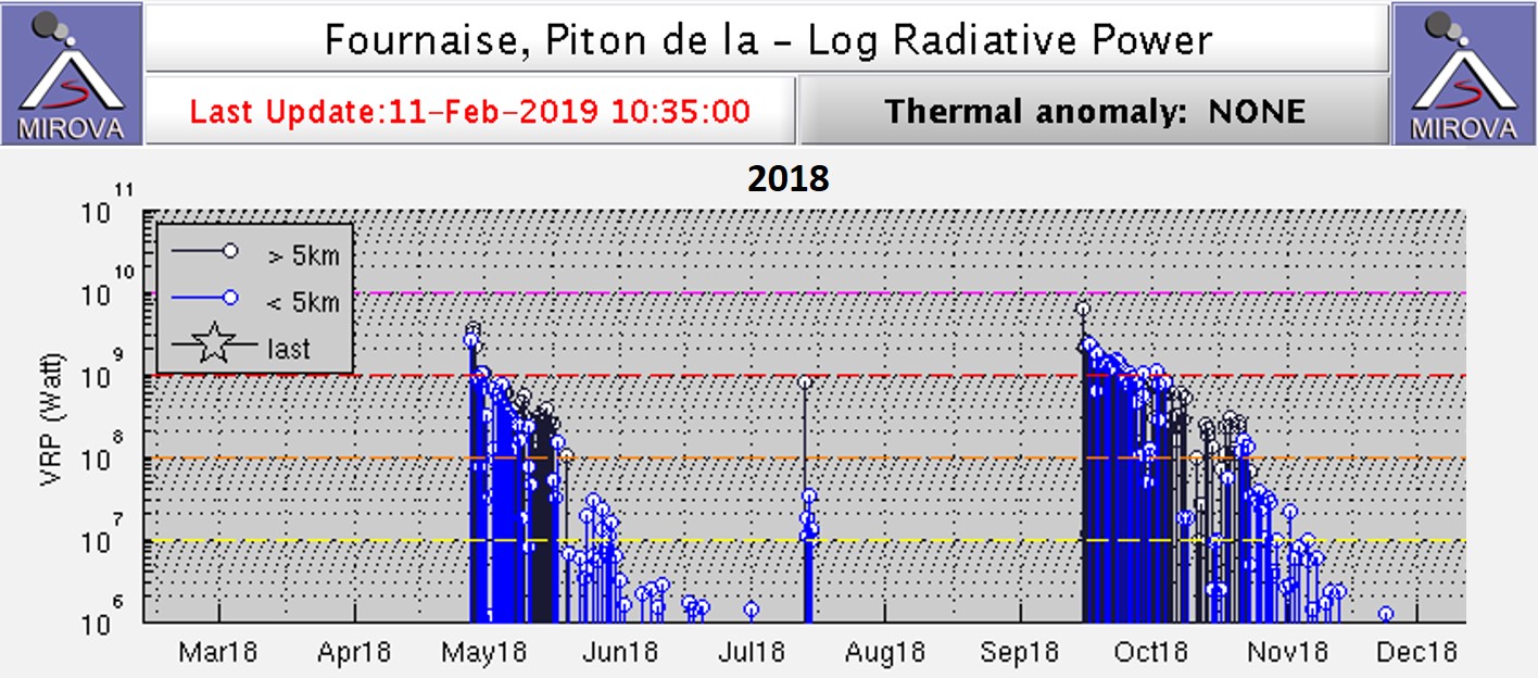
Thermal observations during the September-November eruption showed the evolution of the lava flow and the reduction in surface temperatures when the activity was dominated by lava tubes (figure 163). The sharp increase in thermal anomalies detected by the MIROVA algorithm showed the onset of lava effusion, and the anomalies tapered off as the flow field cooled down (figure 164). The estimated volume of lava produced from 15 September to 17 October was 9-19 million m3, but this is lower than the actual erupted volume due to the lava tube activity. There were 459 MODVOLC thermal alerts from 15 September to 25 October.
Geological Summary. Piton de la Fournaise is a massive basaltic shield volcano on the French island of Réunion in the western Indian Ocean. Much of its more than 530,000-year history overlapped with eruptions of the deeply dissected Piton des Neiges shield volcano to the NW. Three scarps formed at about 250,000, 65,000, and less than 5,000 years ago by progressive eastward slumping, leaving caldera-sized embayments open to the E and SE. Numerous pyroclastic cones are present on the floor of the scarps and their outer flanks. Most recorded eruptions have originated from the summit and flanks of Dolomieu, a 400-m-high lava shield that has grown within the youngest scarp, which is about 9 km wide and about 13 km from the western wall to the ocean on the E side. More than 150 eruptions, most of which have produced fluid basaltic lava flows, have occurred since the 17th century. Only six eruptions, in 1708, 1774, 1776, 1800, 1977, and 1986, have originated from fissures outside the scarps.
Information Contacts: Observatoire Volcanologique du Piton de la Fournaise, Institut de Physique du Globe de Paris, 14 route nationale 3, 27 ème km, 97418 La Plaine des Cafres, La Réunion, France (URL: http://www.ipgp.fr/fr; Twitter: https://twitter.com/ObsFournaise); MIROVA (Middle InfraRed Observation of Volcanic Activity), a collaborative project between the Universities of Turin and Florence (Italy) supported by the Centre for Volcanic Risk of the Italian Civil Protection Department (URL: http://www.mirovaweb.it/); Hawai'i Institute of Geophysics and Planetology (HIGP) - MODVOLC Thermal Alerts System, School of Ocean and Earth Science and Technology (SOEST), Univ. of Hawai'i, 2525 Correa Road, Honolulu, HI 96822, USA (URL: http://modis.higp.hawaii.edu/); Sentinel Hub Playground (URL: https://www.sentinel-hub.com/explore/sentinel-playground).


