Report on Copahue (Chile-Argentina) — January 2019
Bulletin of the Global Volcanism Network, vol. 44, no. 1 (January 2019)
Managing Editor: Edward Venzke.
Edited by Janine B. Krippner.
Copahue (Chile-Argentina) Frequent emissions and small ash plumes continue from July through 7 December 2018
Please cite this report as:
Global Volcanism Program, 2019. Report on Copahue (Chile-Argentina) (Krippner, J.B., and Venzke, E., eds.). Bulletin of the Global Volcanism Network, 44:1. Smithsonian Institution. https://doi.org/10.5479/si.GVP.BGVN201901-357090
Copahue
Chile-Argentina
37.856°S, 71.183°W; summit elev. 2953 m
All times are local (unless otherwise noted)
Copahue, on the border of Chile and Argentina, has frequent small ash eruptions and gas-and-steam plumes. The volcano alert was raised from Green to Yellow (on a scale going from green, yellow, orange, to red) on 24 March 2018 due to an increase in seismic activity and a phreatic explosion. Copahue has a dozen craters with recent activity focused at the Agrio crater, which contains a persistent fumarole field and a crater lake. This report summarizes activity from July through December 2018 and is based on reports issued by Servicio Nacional de Geología y Minería (SERNAGEOMIN) Observatorio Volcanológico de Los Andes del Sur, (OVDAS), Oficina Nacional de Emergencia - Ministerio del Interior (ONEMI), Buenos Aires Volcanic Ash Advisory Center (VAAC), and satellite data.
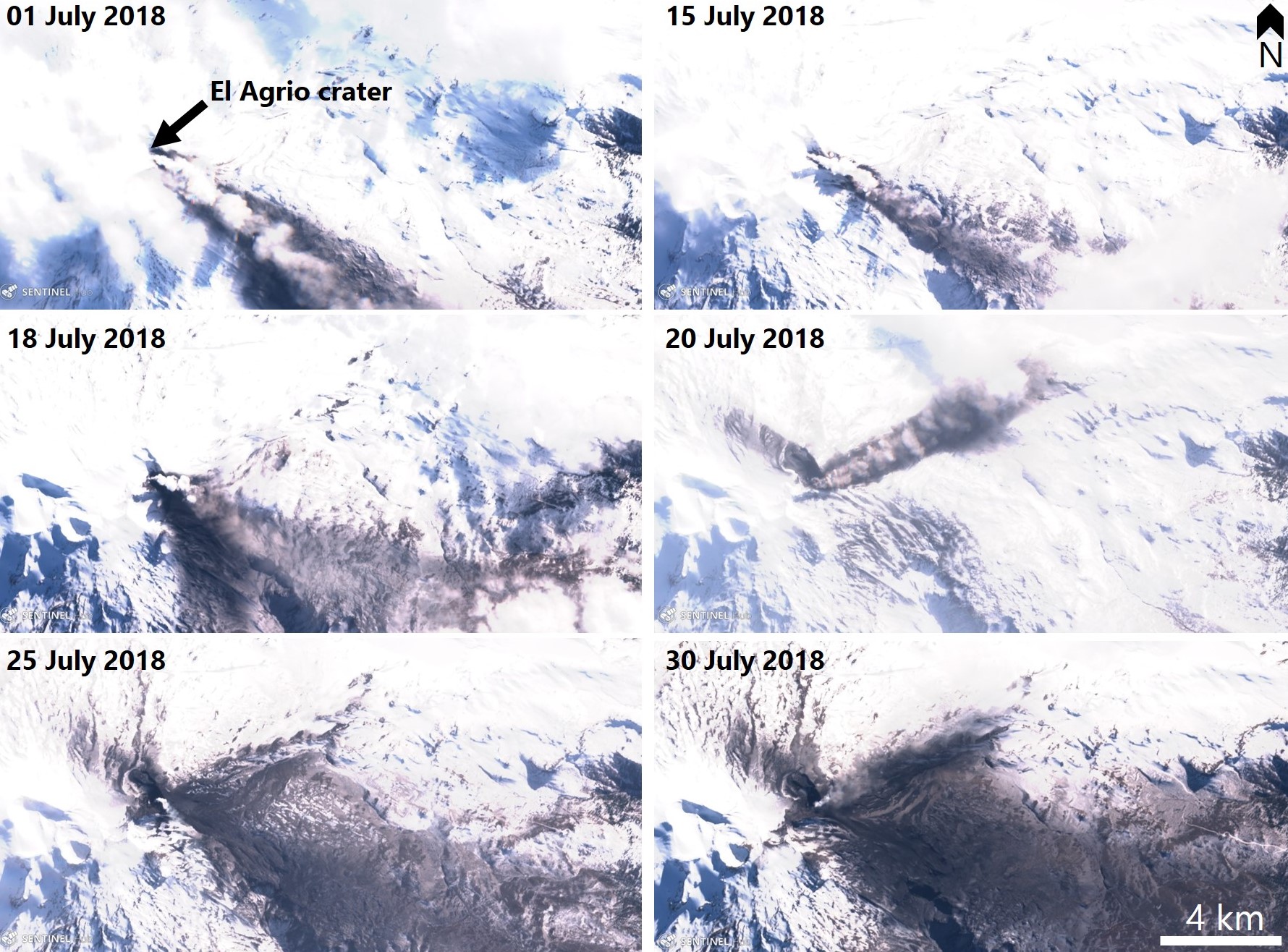
Throughout July, Copahue produced gas-and-steam and ash plumes that deposited ash on and away from the slopes of the volcano (figure 19). From 1 to 15 July degassing was continuous with a maximum plume height of 300 m above the crater. A more energetic gas-and-steam plume was produced on 18 July (figure 20). Persistent gas and ash plumes during 16-31 July rose up to 1,500 m above the crater. Nighttime incandescence was present throughout the month.
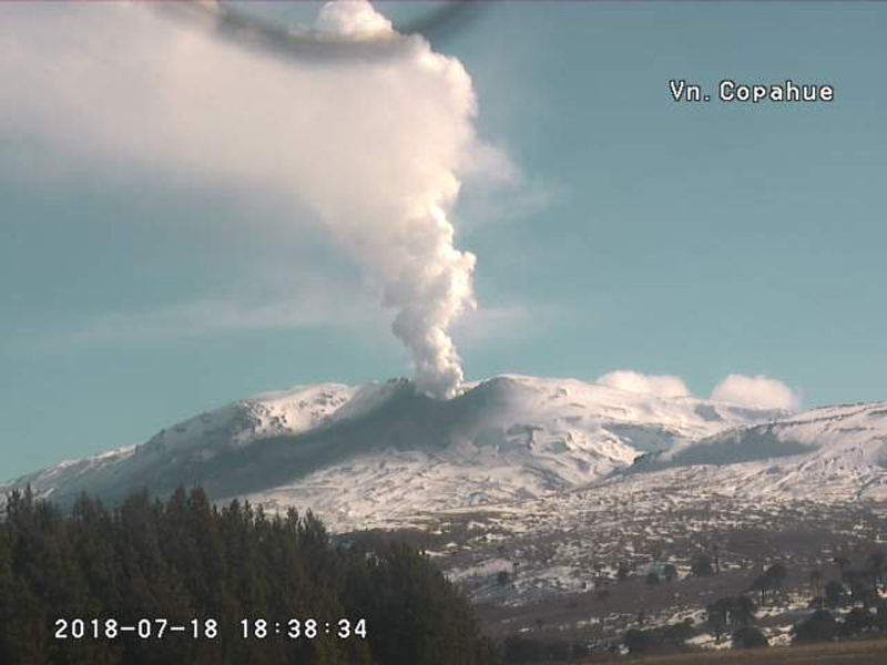 |
Figure 20. Energetic degassing at Copahue related to hydrothermal activity on 18 July 2018. Webcam image courtesy of SERNAGEOMIN-OVDAS. |
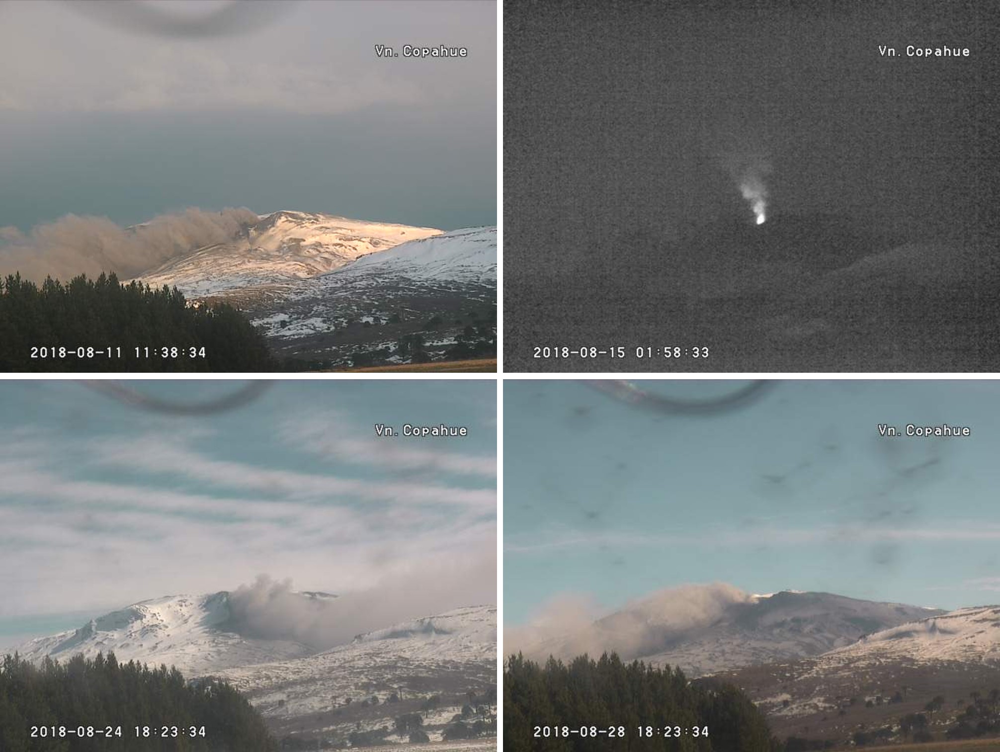
Throughout August intermittent gas-and-steam and ash plumes continued due to the interaction of the hydrothermal and magmatic system within the volcano (figure 21). Notices were issued by the Buenos Aires VAAC on 14 and 15 August for diffuse steam plumes possibly containing ash up to an altitude on 3.6 km. Constant degassing, intermittent ash plumes, and nighttime incandescence continued through September (figure 22).
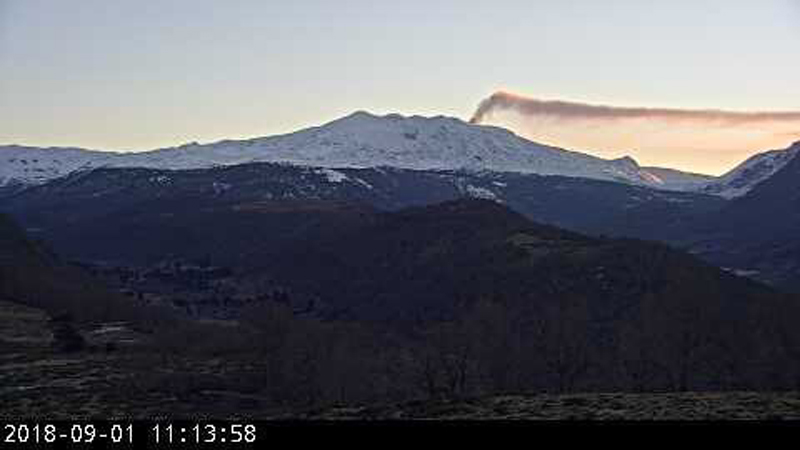 |
Figure 22. A plume from Copahue on 1 September 2018. Webcam image courtesy of SERNAGEOMIN-OVDAS via Roberto Impaglione. |
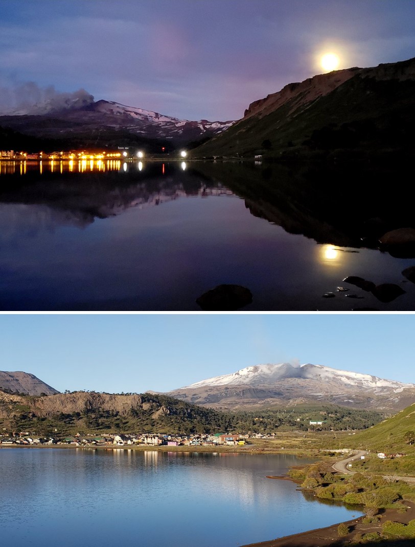
During September, October, and November, variable gas-and-steam and ash plumes were accompanied by visible incandescence at night. Continuous ash emission was observed from 16 to 30 November (figure 23); similar activity with plume heights up to 800 m from 1 to 6 December. On 2 December a Buenos Aires VAAC notice was issued for a narrow ash plume that drifted ESE. During 6-7 December an ash plume that rose up to 3 km altitude and drifted towards the SW was accompanied by a seismic swarm. No further ash emissions were noted through the end of the year.
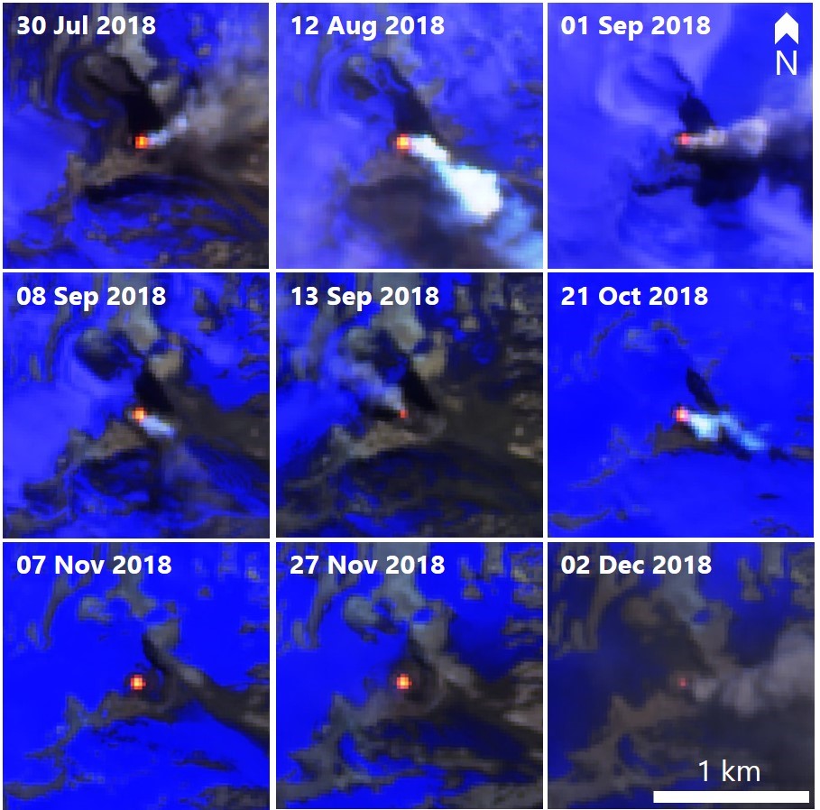
MIROVA (Middle InfraRed Observation of Volcanic Activity) data showed intermittent minor thermal activity at the summit from July through December. There were no thermal anomalies detected by the MODVOLC algorithm for this time period. Twenty cloud-free Sentinel-2 satellite images revealed elevated thermal activity (hotspots) within Agrio crater throughout the reporting period (figure 24).
Geological Summary. Volcán Copahue is an elongated composite cone constructed along the Chile-Argentina border within the 6.5 x 8.5 km wide Trapa-Trapa caldera that formed between 0.6 and 0.4 million years ago near the NW margin of the 20 x 15 km Pliocene Caviahue (Del Agrio) caldera. The eastern summit crater, part of a 2-km-long, ENE-WSW line of nine craters, contains a briny, acidic 300-m-wide crater lake (also referred to as El Agrio or Del Agrio) and displays intense fumarolic activity. Acidic hot springs occur below the eastern outlet of the crater lake, contributing to the acidity of the Río Agrio, and another geothermal zone is located within Caviahue caldera about 7 km NE of the summit. Infrequent mild-to-moderate explosive eruptions have been recorded since the 18th century. Twentieth-century eruptions from the crater lake have ejected pyroclastic rocks and chilled liquid sulfur fragments.
Information Contacts: Servicio Nacional de Geología y Minería (SERNAGEOMIN), Observatorio Volcanológico de Los Andes del Sur (OVDAS), Avda Sta María No. 0104, Santiago, Chile (URL: http://www.sernageomin.cl/); Oficina Nacional de Emergencia - Ministerio del Interior (ONEMI), Beaucheff 1637/1671, Santiago, Chile (URL: http://www.onemi.cl/); Buenos Aires Volcanic Ash Advisory Center (VAAC), Servicio Meteorológico Nacional-Fuerza Aérea Argentina, 25 de mayo 658, Buenos Aires, Argentina (URL: http://www.smn.gov.ar/vaac/buenosaires/inicio.php); Sentinel Hub Playground (URL: https://www.sentinel-hub.com/explore/sentinel-playground); MIROVA (Middle InfraRed Observation of Volcanic Activity), a collaborative project between the Universities of Turin and Florence (Italy) supported by the Centre for Volcanic Risk of the Italian Civil Protection Department (URL: http://www.mirovaweb.it/); Valentina (URL: https://twitter.com/valecaviahue, Twitter: @valecaviahue); Roberto Impaglione (URL: https://twitter.com/robimpaglione, Twitter: @robimpaglione); CultureVolcan (URL: https://twitter.com/CultureVolcan, Twitter: @CultureVolcan).

