Report on Aira (Japan) — July 2020
Bulletin of the Global Volcanism Network, vol. 45, no. 7 (July 2020)
Managing Editor: Edward Venzke.
Edited by A. Elizabeth Crafford.
Aira (Japan) Near-daily explosions with ash plumes continue, large block ejected 3 km from Minamidake crater on 4 June 2020
Please cite this report as:
Global Volcanism Program, 2020. Report on Aira (Japan) (Crafford, A.E., and Venzke, E., eds.). Bulletin of the Global Volcanism Network, 45:7. Smithsonian Institution. https://doi.org/10.5479/si.GVP.BGVN202007-282080
Aira
Japan
31.5772°N, 130.6589°E; summit elev. 1117 m
All times are local (unless otherwise noted)
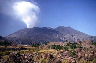
Sakurajima rises from Kagoshima Bay, which fills the Aira Caldera near the southern tip of Japan's Kyushu Island. Frequent explosive and occasional effusive activity has been ongoing for centuries. The Minamidake summit cone has been the location of persistent activity since 1955; the adjacent Showa crater on its E flank has also been intermittently active since 2006. Numerous explosions and ash-bearing emissions have been occurring each month at either Minamidake or Showa crater since the latest eruptive episode began in late March 2017. This report covers ongoing activity at Minamidake from January through June 2020; the Japan Meteorological Agency (JMA) provides regular reports on activity, and the Tokyo VAAC (Volcanic Ash Advisory Center) issues tens of reports each month about the frequent ash plumes.
Activity continued during January-June 2020 at Minamidake crater with tens of explosions each month. The Tokyo VAAC issued multiple daily reports of ash emissions during January and February. Less activity occurred during the first half of March but picked up again with multiple daily reports from mid-March through mid-April. Emissions were more intermittent but continued through early June, when activity decreased significantly. JMA reported explosions with ash plumes rising 2.5-4.2 km above the summit, and ejecta traveling generally up to 1,700 m from the crater, although a big explosion in early June send a large block of tephra 3 km from the crater (table 23). Thermal anomalies were visible in satellite imagery on a few days most months and were persistent in the MIROVA thermal anomaly data from November 2019 through early June 2020 (figure 94). Incandescence was often visible at night in the webcams through early June; the Showa crater remained quiet throughout the period.
Table 23. Monthly summary of eruptive events recorded at Sakurajima's Minamidake crater within the Aira Caldera, January through June 2020. The number of events that were explosive in nature are in parentheses. No events were recorded at the Showa crater during this time. Ashfall is measured at the Kagoshima Local Meteorological Observatory (KLMO), 10 km W of Showa crater. Data courtesy of JMA (January to June 2020 monthly reports).
| Month | Ash emissions (explosive) | Max plume height above crater | Max ejecta distance from crater | Total amount of ashfall (g/m2) | Total ashfall previous month |
| Jan 2020 | 104 (65) | 2.5 km | 1,700 m | 75 (12 days) | 280,000 tons |
| Feb 2020 | 129 (67) | 2.6 km | 1,800 m | 21 (14 days) | 230,000 tons |
| Mar 2020 | 26 (10) | 3.0 km | 1,700 m | 3 (8 days) | 360,000 tons |
| Apr 2020 | 51 (14) | 3.8 km | 1,700 m | less than 0.5 (2 days) | 160,000 tons |
| May 2020 | 51 (24) | 4.2 km | 1,300 m | 19 (8 days) | 280,000 tons |
| Jun 2020 | 28 (16) | 3.7 km | 3,000 m | 71 (9 days) | 150,000 tons |
Explosions continued at Minamidake crater during January 2020 with 65 ash plumes reported. The highest ash plume rose 2.5 km above the crater on 30 January, and incandescent ejecta reached up to 1,700 m from the Minamidake crater on 22 and 29 January (figure 95). Slight inflation of the volcano since September 2019 continued to be measured with inclinometers and extensometers on Sakurajima Island. Field surveys conducted on 15, 20, and 31 January measured the amount of sulfur dioxide gas released as very high at 3,400-4,700 tons per day, as compared with 1,000-3,000 tons in December 2019.
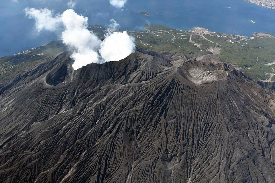
About the same number of explosions produced ash plumes during February 2020 (67) as in January (65) (figure 96). On 10 February a large block was ejected 1,800 m from the crater, the first to reach that far since 5 February 2016. The tallest plume, on 26 February rose 2.6 km above the crater. Sentinel-2 satellite imagery indicated two distinct thermal anomalies within the Minamidake crater on both 1 and 6 February (figure 97). Activity diminished during March 2020 with only 10 explosions out of 26 eruptive events. On 21 March a large bomb reached 1,700 m from the crater. The tallest ash plume rose 3 km above the crater on 17 March. Scientists noted during an overflight on 16 March that a small steam plume was rising from the inner wall on the south side of the Showa crater; a larger steam plume rose to 300 m above the Minamidake crater and drifted S (figure 98). Sulfur dioxide emissions were similar in February (1,900 to 3,100 tons) and March (1,300 to 3,400 tons per day).
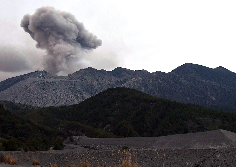
During April 2020, ejecta again reached as far as 1,700 m from the crater; 14 explosions were identified from the 51 reported eruptive events, an increase from March. The tallest plume, on 4 April, rose 3.8 km above the crater (figure 99). The same number of eruptive events occurred during May 2020, but 24 were explosive in nature. A large plume on 9 May rose to 4.2 km above the rim of Minamidake crater, the tallest of the period (figure 100). On 20 May, incandescent ejecta reached 1,300 m from the summit. Sulfur dioxide emissions during April (1,700-2,100 tons per day) and May (1,200-2,700 tons per day) were slightly lower than previous months.
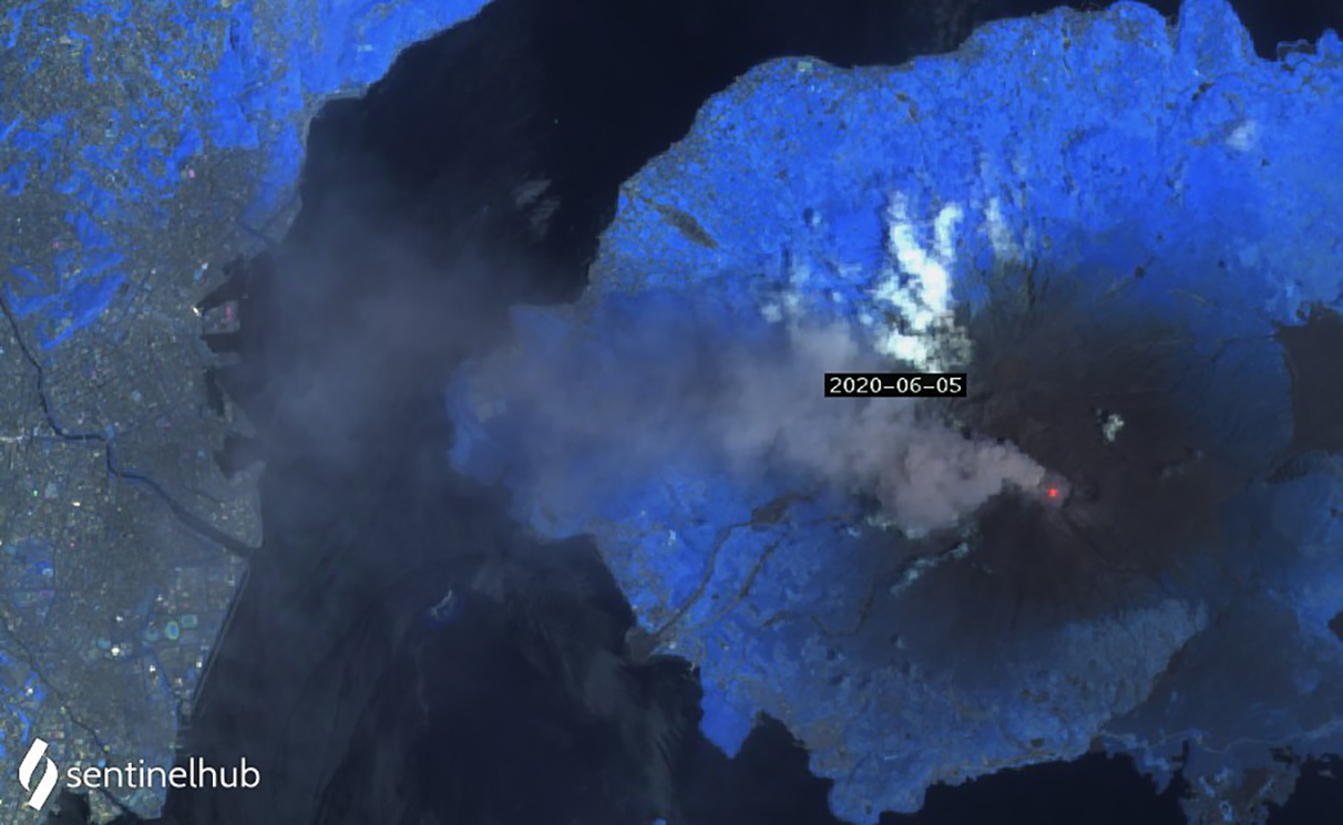
A major explosion on 4 June 2020 produced 137 Pa of air vibration at the Seto 2 observation point on Sakurajima Island. It was the first time that air vibrations exceeding 100 Pa have been observed at the Seto 2 station since the 21 May 2015 explosion at the Showa crater. The ash plume associated with the explosion rose 1.5 km above the crater rim. During an 8 June field survey conducted in Higashisakurajima-cho, Kagoshima City, a large impact crater believed to be associated with this explosion was located near the coast 3 km SSW from Minamidake. The crater formed by the ejected block was about 6 m in diameter and 2 m deep (figure 101); fragments found nearby were 10-20 cm in diameter (figure 102). A nearby roof was also damaged by the blocks. Smaller bombs were found in Kurokami-cho, Kagoshima City, around 4- 5 km E of Minamidake on 5 June; the largest fragment was 5 cm in diameter. Multiple ash plumes rose to 3 km or more above the summit during the first ten days of June; explosions on 4 and 5 June reached 3.7 km above the crater (figure 103). Larger than normal inflation and deflation before and after the explosions was recorded during early June in the inclinometers and extensometers located on the island. Incandescence at the summit was observed at night through the first half of June. The Tokyo VAAC issued multiple daily ash advisories during 1-10 June after which activity declined abruptly. Two brief explosions on 23 June and one on 28 June were the only two additional ash explosions reported in June.
Geological Summary. The Aira caldera in the northern half of Kagoshima Bay contains the post-caldera Sakurajima volcano, one of Japan's most active. Eruption of the voluminous Ito pyroclastic flow accompanied formation of the 17 x 23 km caldera about 22,000 years ago. The smaller Wakamiko caldera was formed during the early Holocene in the NE corner of the caldera, along with several post-caldera cones. The construction of Sakurajima began about 13,000 years ago on the southern rim and built an island that was joined to the Osumi Peninsula during the major explosive and effusive eruption of 1914. Activity at the Kitadake summit cone ended about 4,850 years ago, after which eruptions took place at Minamidake. Frequent eruptions since the 8th century have deposited ash on the city of Kagoshima, located across Kagoshima Bay only 8 km from the summit. The largest recorded eruption took place during 1471-76.
Information Contacts: Japan Meteorological Agency (JMA), 1-3-4 Otemachi, Chiyoda-ku, Tokyo 100-8122, Japan (URL: http://www.jma.go.jp/jma/indexe.html); MIROVA (Middle InfraRed Observation of Volcanic Activity), a collaborative project between the Universities of Turin and Florence (Italy) supported by the Centre for Volcanic Risk of the Italian Civil Protection Department (URL: http://www.mirovaweb.it/); Tokyo Volcanic Ash Advisory Center (VAAC), 1-3-4 Otemachi, Chiyoda-ku, Tokyo 100-8122, Japan (URL: http://ds.data.jma.go.jp/svd/vaac/data/); Sentinel Hub Playground (URL: https://www.sentinel-hub.com/explore/sentinel-playground).


