Report on San Cristobal (Nicaragua) — September 2022
Bulletin of the Global Volcanism Network, vol. 47, no. 9 (September 2022)
Managing Editor: Edward Venzke.
Edited by Kadie L. Bennis.
San Cristobal (Nicaragua) Small ash explosions and gas-and-steam emissions during January-June 2022
Please cite this report as:
Global Volcanism Program, 2022. Report on San Cristobal (Nicaragua) (Bennis, K.L., and Venzke, E., eds.). Bulletin of the Global Volcanism Network, 47:9. Smithsonian Institution.
San Cristobal
Nicaragua
12.702°N, 87.004°W; summit elev. 1745 m
All times are local (unless otherwise noted)
San Cristóbal, located in Nicaragua, is a volcanic complex that consists of five principal volcanic edifices forming the NW end of the Marrabios Range. The youngest cone, San Cristóbal (also known as El Viejo), is capped by a 500 x 600 m crater. Recorded eruptions date back to 1528, with more frequent eruptions occurring over the last 50 years. The current eruption period began in December 2020 and has recently been characterized by occasional low-to-medium intensity explosions, ash plumes, and low thermal activity (BGVN 47:01). This report covers activity through the end of the eruption during January through June 2022 using information from the Instituto Nicaragüense de Estudios Territoriales (INETER) and various satellite data.
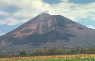
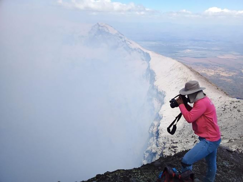
Activity during January through August 2022 was relatively calm, according to INETER; gas-and-steam emissions and seismicity persisted throughout the reporting period (figure 45). Monitoring data reported by INETER consistently included the average sulfur dioxide levels (tons/day) and the total number of earthquakes per month, a small number of which were volcano-tectonic events (table 9). Tremor remained within 100-150 RSAM (Real-Time Seismic Amplitude Measurements), sometimes reaching up to 400 units.
Table 9. Monthly sulfur dioxide measurements and seismicity reported at San Cristóbal during January-August 2022. Courtesy of INETER.
| Month | Average SO2 | Total earthquakes | Volcano-tectonic (VT) earthquakes |
| Jan 2022 | -- | 4,965 | 0 |
| Feb 2022 | 266 t/d | 26,707 | 4 |
| Mar 2022 | 528 t/d | 15,344 | 14 |
| Apr 2022 | 360 t/d | 12,785 | 16 |
| May 2022 | 242 t/d | 24,267 | 9 |
| Jun 2022 | 725 t/d | 59,540 | 2 |
| Jul 2022 | 371 t/d | 32,647 | 11 |
| Aug 2022 | 958 t/d | 19,098 | 3 |
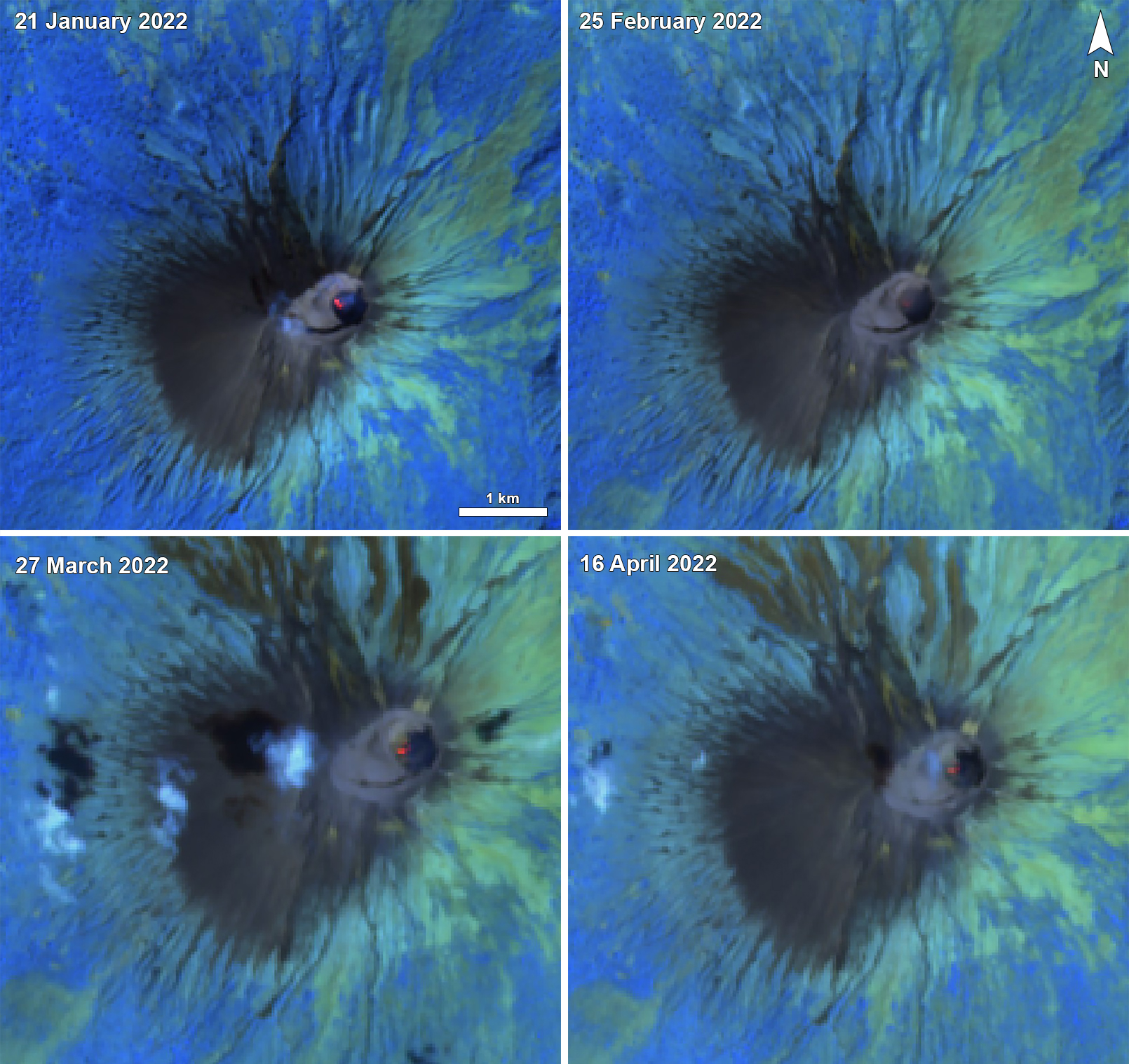
According to the MIROVA (Middle InfraRed Observation of Volcanic Activity) graph, only three instances of thermal hot spots were detected; once during early October 2021, once during early March 2022, and once during late April 2022. Small hotspots were visible at the summit crater during January through April 2022 in infrared satellite data from Sentinel-2 (figure 46).
On 10 February 2022 an increase in degassing-type earthquakes was noted, and five days later, on 15 February, the number of earthquakes dropped, coincident with several small gas-and-ash explosions. Temperature measurements using thermal images showed that gas-and-steam emissions from the southern wall of the crater were 59°C in February. On 3 March INETER reported several explosions. Throughout the rest of the month, activity was relatively low and consisted of 15,358 seismic events, 14 of which were volcano-tectonic. Continuous sulfur dioxide emissions were also recorded.
During April and May, INETER reported continued seismicity, registering 12,785 seismic events during April, 16 of which were volcano-tectonic. Low thermal activity was detected in infrared satellite data, and gas-and-steam emissions, including sulfur dioxide emissions, persisted. Similar low activity was reported during May, consisting mostly of 24,267 seismic events, 9 of which were volcano-tectonic, and sulfur dioxide emissions.
Relatively low activity continued during June, though seismicity remained at normal levels. There were 59,540 seismic events registered, two of which were volcano-tectonic. Sulfur dioxide emissions continued. According to a news article, INETER reported that at 0751 on 26 June a moderate explosion produced a gas-and-steam plume that rose 1.5 km above the crater rim and drifted WSW. A minor amount of ash fell in the communities of La Grecias 3 and Las Grecias 4 (12 km WSW), and the city of El Viejo (18 km WSW). RSAM data also spiked during the explosion and returned to normal levels after the event.
Geological Summary. The San Cristóbal volcanic complex, consisting of five principal volcanic edifices, forms the NW end of the Marrabios Range. The symmetrical 1745-m-high youngest cone, named San Cristóbal (also known as El Viejo), is Nicaragua's highest volcano and is capped by a 500 x 600 m wide crater. El Chonco, with several flank lava domes, is located 4 km W of San Cristóbal; it and the eroded Moyotepe volcano, 4 km NE of San Cristóbal, are of Pleistocene age. Volcán Casita, containing an elongated summit crater, lies immediately east of San Cristóbal and was the site of a catastrophic landslide and lahar in 1998. The Plio-Pleistocene La Pelona caldera is located at the eastern end of the complex. Historical eruptions from San Cristóbal, consisting of small-to-moderate explosive activity, have been reported since the 16th century. Some other 16th-century eruptions attributed to Casita volcano are uncertain and may pertain to other Marrabios Range volcanoes.
Information Contacts: Instituto Nicaragüense de Estudios Territoriales (INETER), Apartado Postal 2110, Managua, Nicaragua (URL: http://www.ineter.gob.ni/); MIROVA (Middle InfraRed Observation of Volcanic Activity), a collaborative project between the Universities of Turin and Florence (Italy) supported by the Centre for Volcanic Risk of the Italian Civil Protection Department (URL: http://www.mirovaweb.it/); Sentinel Hub Playground (URL: https://www.sentinel-hub.com/explore/sentinel-playground); Viva Nicaragua, Reparto El Carmen, Estatua Montoya 1C. Sur, 1C. Este, 50mts. Sur. Managua, Nicaragua (URL: https://www.vivanicaragua.com.ni/2022/06/26/sociales/volcan-san-cristobal-explosion-gases/).


