Report on Barren Island (India) — October 2023
Bulletin of the Global Volcanism Network, vol. 48, no. 10 (October 2023)
Managing Editor: Benjamin Andrews.
Edited by Kadie L. Bennis.
Barren Island (India) Strong thermal activity during April 2023
Please cite this report as:
Global Volcanism Program, 2023. Report on Barren Island (India) (Bennis, K.L., and Andrews, B., eds.). Bulletin of the Global Volcanism Network, 48:10. Smithsonian Institution.
Barren Island
India
12.278°N, 93.858°E; summit elev. 354 m
All times are local (unless otherwise noted)
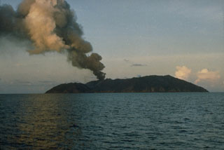
Barren Island, located between Sumatra and Burma (Myanmar), is part of a N-S-trending volcanic arc. The caldera is open to the sea on the W and was created during a major explosive eruption in the late Pleistocene that produced pyroclastic flow and surge deposits. Recorded eruptions date back to 1787, that have changed the morphology of the pyroclastic cone in the center of the caldera; lava flows that fill much of the caldera floor have reached the sea along the western coast. The current eruption period began in December 2022 and has recently consisted of thermal activity (BGVN 48:04). This report describes similar activity during April through September 2023, based on various satellite data.
Strong thermal activity was detected during much of April, based on the MIROVA (Middle InfraRed Observation of Volcanic Activity) graph (figure 60). Then, during May, the frequency and power of the thermal anomalies decreased. By June, only two low-power anomalies were detected, followed by one in late July, and three during August. According to the MODVOLC thermal alert algorithm, a total of 17 hotspots were detected throughout the reporting period, all of which occurred during April: 1, 2, 3, 7, 8, 10, 13, 14, 22, 23, and 26 April. Strong thermal anomalies were detected in infrared satellite imagery on 20 and 30 April; some incandescent material was visible on the NE, N and S flanks (figure 61). According to the Darwin VAAC, continuous ash plumes were identified in satellite images during 0620-1250 on 1 May and rose to 4.6 km altitude and drifted NW.
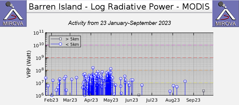 |
Figure 60. Strong and frequent thermal activity was detected at Barren Island during April 2023, which later decreased in frequency in May, according to this MIROVA graph (Log Radiative Power). Only two low-power thermal anomalies were detected during June, one in late July, and three during August. Courtesy of MIROVA. |
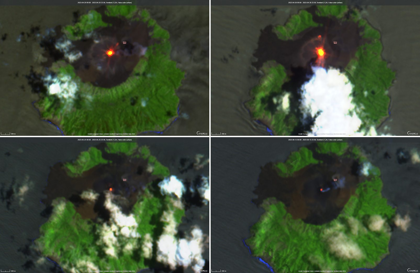 |
Figure 61. Thermal anomalies of varying intensities were visible in Barren Island’s crater on 20 April 2023 (top left), 30 April 2023 (top right), 25 May 2023 (bottom left), and 13 June 2023 (bottom right), as shown in these infrared satellite images (bands B12, B11, B4). The anomalies on 20 and 30 April are particularly intense and incandescent material is visible on the NE and S flanks, respectively. Courtesy of Copernicus Browser. |
Weaker thermal anomalies were also visible in infrared satellite imagery on 5, 10, 15, and 25 April, 15, 20, and 25 May, 4 and 19 June, and 8, 13, and 18 August. The Suomi NPP/VIIRS sensor data showed a total of 162 thermal anomalies detected over 47 days on 1-18 and 20-30 April, 1-4, 6-9, 16-17, 21, 24-25, and 27-29 May, and 2 and 24 June.
Geological Summary. Barren Island, a possession of India in the Andaman Sea about 135 km NE of Port Blair in the Andaman Islands, is the only historically active volcano along the N-S volcanic arc extending between Sumatra and Burma (Myanmar). It is the emergent summit of a volcano that rises from a depth of about 2250 m. The small, uninhabited 3-km-wide island contains a roughly 2-km-wide caldera with walls 250-350 m high. The caldera, which is open to the sea on the west, was created during a major explosive eruption in the late Pleistocene that produced pyroclastic-flow and -surge deposits. Historical eruptions have changed the morphology of the pyroclastic cone in the center of the caldera, and lava flows that fill much of the caldera floor have reached the sea along the western coast.
Information Contacts: Darwin Volcanic Ash Advisory Centre (VAAC), Bureau of Meteorology, Northern Territory Regional Office, PO Box 40050, Casuarina, NT 0811, Australia (URL: http://www.bom.gov.au/info/vaac/); MIROVA (Middle InfraRed Observation of Volcanic Activity), a collaborative project between the Universities of Turin and Florence (Italy) supported by the Centre for Volcanic Risk of the Italian Civil Protection Department (URL: http://www.mirovaweb.it/); Hawai'i Institute of Geophysics and Planetology (HIGP) - MODVOLC Thermal Alerts System, School of Ocean and Earth Science and Technology (SOEST), Univ. of Hawai'i, 2525 Correa Road, Honolulu, HI 96822, USA (URL: http://modis.higp.hawaii.edu/); Copernicus Browser, Copernicus Data Space Ecosystem, European Space Agency (URL: https://dataspace.copernicus.eu/browser/); NASA Worldview (URL: https://worldview.earthdata.nasa.gov/).