Report on San Cristobal (Nicaragua) — December 1976
Natural Science Event Bulletin, vol. 1, no. 15 (December 1976)
Managing Editor: David Squires.
San Cristobal (Nicaragua) Fume cloud still large in December
Please cite this report as:
Global Volcanism Program, 1976. Report on San Cristobal (Nicaragua) (Squires, D., ed.). Natural Science Event Bulletin, 1:15. Smithsonian Institution. https://doi.org/10.5479/si.GVP.NSEB197612-344020
San Cristobal
Nicaragua
12.702°N, 87.004°W; summit elev. 1745 m
All times are local (unless otherwise noted)
The fume cloud . . . was still very large in December, but the SO2 content of the gas had declined since the summer.
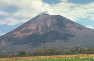
Geological Summary. The San Cristóbal volcanic complex, consisting of five principal volcanic edifices, forms the NW end of the Marrabios Range. The symmetrical 1745-m-high youngest cone, named San Cristóbal (also known as El Viejo), is Nicaragua's highest volcano and is capped by a 500 x 600 m wide crater. El Chonco, with several flank lava domes, is located 4 km W of San Cristóbal; it and the eroded Moyotepe volcano, 4 km NE of San Cristóbal, are of Pleistocene age. Volcán Casita, containing an elongated summit crater, lies immediately east of San Cristóbal and was the site of a catastrophic landslide and lahar in 1998. The Plio-Pleistocene La Pelona caldera is located at the eastern end of the complex. Historical eruptions from San Cristóbal, consisting of small-to-moderate explosive activity, have been reported since the 16th century. Some other 16th-century eruptions attributed to Casita volcano are uncertain and may pertain to other Marrabios Range volcanoes.
Information Contacts: R. Stoiber, Dartmouth College.

