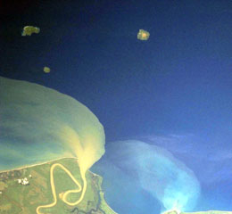
Report on Kadovar (Papua New Guinea) — November 1977
Natural Science Event Bulletin, vol. 2, no. 11 (November 1977)
Managing Editor: David Squires.
Kadovar (Papua New Guinea) Few changes in the main thermal area; no volcano-seismic activity
Please cite this report as:
Global Volcanism Program, 1977. Report on Kadovar (Papua New Guinea) (Squires, D., ed.). Natural Science Event Bulletin, 2:11. Smithsonian Institution. https://doi.org/10.5479/si.GVP.NSEB197711-251002
Kadovar
Papua New Guinea
3.608°S, 144.588°E; summit elev. 365 m
All times are local (unless otherwise noted)
"Volcanologists have made three detailed investigations at Kadovar since the report in July. On each occasion, temperatures were measured, gases and gas condensates were collected, and seismic recording was carried out; a magnetic resurvey was made during the most recent inspection. Dates and personnel were: 18-19 August, V.F. Dent; 30 September, C.O. McKee; 13-14 November, C.O. McKee and D. Norris. On 14 September, photographs were taken during an aerial inspection.
"The main thermal area was much the same size as before, apart from some expansion at the SW corner, and spanned about 250 m upslope, and about 130 m maximum around the slope. It is now much more sharply defined and clear because of progressive fall of dead vegetation. Overall vapor emission seemed much less than in earlier periods, and was more concentrated in a few main areas, with fewer of the weak but widespread vents evident in early 1977. The original main fumarole may be a little reduced in intensity, although its temperature has not declined, remaining near 100°C. No measured temperatures exceeded 100°C, although the upper part of the main zone has become hotter, approaching 100°C. Vapor emission was still most profuse in the upper part.
"No volcano-seismic activity has been recorded during the report period, and although significant relative changes in total magnetic field have taken place, no simple pattern is apparent."
Geological Summary. The 2-km-wide island of Kadovar is the emergent summit of a Bismarck Sea stratovolcano of Holocene age. It is part of the Schouten Islands, and lies off the coast of New Guinea, about 25 km N of the mouth of the Sepik River. Prior to an eruption that began in 2018, a lava dome formed the high point of the andesitic volcano, filling an arcuate landslide scarp open to the south; submarine debris-avalanche deposits occur in that direction. Thick lava flows with columnar jointing forms low cliffs along the coast. The youthful island lacks fringing or offshore reefs. A period of heightened thermal phenomena took place in 1976. An eruption began in January 2018 that included lava effusion from vents at the summit and at the E coast.
Information Contacts: R. Cooke, RVO.

