Report on Ambrym (Vanuatu) — April 1979
Scientific Event Alert Network Bulletin, vol. 4, no. 4 (April 1979)
Managing Editor: David Squires.
Ambrym (Vanuatu) More information on February eruption and acid rain
Please cite this report as:
Global Volcanism Program, 1979. Report on Ambrym (Vanuatu) (Squires, D., ed.). Scientific Event Alert Network Bulletin, 4:4. Smithsonian Institution. https://doi.org/10.5479/si.GVP.SEAN197904-257040
Ambrym
Vanuatu
16.25°S, 168.12°E; summit elev. 1334 m
All times are local (unless otherwise noted)
The following report, written by A. Macfarlane using information from J-L. Saos, supplements the previous report.
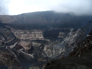
"An increase in activity from Benbow Crater (in the SW portion of Ambrym's caldera) involving the copious emission of cinders, lapilli, and gases was first noted on 7 February. On the night of 10-11 February, ash and gas columns apparently combined with local rainstorms to produce a fallout of dilute sulfuric acid, which affected an area of some 90 km across SW Ambrym Island between and inland of the coastal villages of Baiap and Calinda (about 16 and 10 km SSW of Benbow Crater). The most extreme effects were observed in the Lalinda-Port Vato area (a 5 km zone along the coast) where there was extensive burning of pastures and yellowing of cash crops such as cocoa and coconut palms. In addition, the local population suffered from gastric upsets and from burning of the skin by contact with the acid rainwater. The local water supply was contaminated to the extent that pH values in cisterns had decreased to 5.2-5.5 when subsequently measured and were probably even lower at the time of the acid rains.
"Owing to heavy cloud cover, it has not been possible to determine whether these eruptions mark a significant change in the configuration of vents within Benbow Crater."
Geological Summary. Ambrym, a large basaltic volcano with a 12-km-wide caldera, is one of the most active volcanoes of the New Hebrides Arc. A thick, almost exclusively pyroclastic sequence, initially dacitic then basaltic, overlies lava flows of a pre-caldera shield volcano. The caldera was formed during a major Plinian eruption with dacitic pyroclastic flows about 1,900 years ago. Post-caldera eruptions, primarily from Marum and Benbow cones, have partially filled the caldera floor and produced lava flows that ponded on the floor or overflowed through gaps in the caldera rim. Post-caldera eruptions have also formed a series of scoria cones and maars along a fissure system oriented ENE-WSW. Eruptions have apparently occurred almost yearly during historical time from cones within the caldera or from flank vents. However, from 1850 to 1950, reporting was mostly limited to extra-caldera eruptions that would have affected local populations.
Information Contacts: A. Macfarlane, Geological Survey, Vanuatu; J.-L. Saos, Dept. of Mineral Resources and Rural Water Supply, Vanuatu.

