Report on Karkar (Papua New Guinea) — October 1979
Scientific Event Alert Network Bulletin, vol. 4, no. 10 (October 1979)
Managing Editor: David Squires.
Karkar (Papua New Guinea) Small explosions through crater lake continue
Please cite this report as:
Global Volcanism Program, 1979. Report on Karkar (Papua New Guinea) (Squires, D., ed.). Scientific Event Alert Network Bulletin, 4:10. Smithsonian Institution. https://doi.org/10.5479/si.GVP.SEAN197910-251030
Karkar
Papua New Guinea
4.647°S, 145.976°E; summit elev. 1839 m
All times are local (unless otherwise noted)
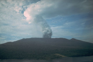
"Observations from the Kinim Observatory at the NW coast of Karkar, 11 km from the 1979 crater (figure 2), indicated that no strong explosive activity occurred during October. Usually a small to moderate white vapour cloud crowned the summit.
"Inspection trips were made 12-15 and 26-29 October. Activity in the 1979 crater continued to consist of small, fountain-like ejections of dark material through the crater lake. The sources of ejections define an approximately E-W zone across the centre of the crater floor. Most ejections rose to a maximum of 30 m above the lake surface. Vent diameters are estimated to be 10-20 m. The entire surface of the lake 'steamed' profusely during both inspection visits, and a small to moderate white vapour cloud was produced. Occasionally the vapour cloud rose to 600-800 m above the crater rim. H2S and SO2 gases were detected.
"White and pale yellow sublimates have been deposited strongly on the N crater wall, and areas of mainly white deposits were scattered on the S and W walls. A pink tint was present in some deposits on the N wall. Temperatures in a fumarolic area on the W part of the caldera floor have dropped to 75-83°C, after remaining at 85-96°C between April and August.
"Seismic activity consisted of discrete volcanic events and one or two periods of tremor per hour. The tremor bursts usually lasted 3-4 minutes. Tilt and gravity observations showed no significant changes."
Geological Summary. Karkar is a 19 x 25 km forest-covered island that is truncated by two nested summit calderas. The 5.5 km outer caldera was formed during one or more eruptions, the last of which occurred 9,000 years ago. The steep-walled 300-m-deep, 3.2 km diameter, inner caldera was formed sometime between 1,500 and 800 years ago. Cones are present on the N and S flanks of this basaltic-to-andesitic volcano; a linear array of small cones extends from the northern rim of the outer caldera nearly to the coast. Recorded eruptions date back to 1643 from Bagiai, a pyroclastic cone constructed within the inner caldera, the floor of which is covered by young, mostly unvegetated andesitic lava flows.
Information Contacts: C. McKee, RVO.

