Report on Krafla (Iceland) — March 1980
Scientific Event Alert Network Bulletin, vol. 5, no. 3 (March 1980)
Managing Editor: David Squires.
Krafla (Iceland) Lava extrustion accompanies major deflation-rifting event
Please cite this report as:
Global Volcanism Program, 1980. Report on Krafla (Iceland) (Squires, D., ed.). Scientific Event Alert Network Bulletin, 5:3. Smithsonian Institution. https://doi.org/10.5479/si.GVP.SEAN198003-373080
Krafla
Iceland
65.715°N, 16.728°W; summit elev. 800 m
All times are local (unless otherwise noted)
"After a small deflation event in early February Krafla showed a slow but continuous inflation until 16 March, when a new deflation and rifting took place, accompanied by an eruption. At about 1515 the continuously recording tiltmeters showed very rapid deflation and at the same time the seismometers showed intense volcanic tremor.
"The eruption started at about 1620 and the beginning was observed by two NVI staff members doing geodimeter work a few kilometers N of the eruption site. Most of the eruption, which produced very fluid basaltic lava, took place during the first two hours and the final flow faded about 2230 the same night.
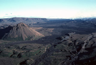
"Eight separate lava flows were erupted, covering a total area of about 1.3 km2 with average thickness of about 2 m. The total length of the active fissure is about 4.5 km and the longest continuous eruptive section about 800 m. The northernmost lava extends about 2 km N of the eruption site of September 1977. This fissure, active in April and September 1977, erupted again, but the southernmost new lava came from the fissure active in December 1975.
"Preliminary chemical analyses show a pattern similar to that observed earlier, with more evolved basalt erupted towards the S but less evolved to the N.
"The zone of new rifting, about 15 km long and 1-2 km wide, extends right through the Krafla caldera. Preliminary estimates indicate about 1 m widening of this zone. Most of the rifting apparently took place during the first hours of the deflation but the maximum earthquake activity took place towards the evening in the S parts of the rifted zone towards Námafjall.
"The maximum subsidence over the magma chambers is estimated at 40 to 50 cm and the rate of deflation was greater than that observed in any previous deflation event.
"Inflation resumed early on 17 March at a rate exceeding any previous inflation rate. The rate is still higher than usual and about half the land subsidence was already recovered on 1 April."
Geological Summary. The Krafla volcanic system in the Northern Volcanic Zone (NVZ) of Iceland is about 100 km long, consisting of a fissure swarm and a central volcano with a 7 x 9 km caldera formed about 110,000 years ago that deposited a rhyolitic welded tuff. It has been moderately active in the Holocene, over three distinct eruptive periods; the current one has lasted about 2,800 years with six volcano-tectonic episodes, each with one or more basaltic fissure eruptions. Lava volumes (DRE) have been in the 0.1-1 km3 range. The Hverfjall and Ludent tuff rings east of Myvatn were erupted along the fissure system. Myvatn lake formed during the eruption of the older Laxarhraun lava flow from the Ketildyngja shield volcano of the Fremrinamur volcanic system about 3,800 years before present (BP); The present Myvatn lake is constrained by the roughly 2,000 years BP younger Laxarhraun lava flow from the Krafla volcanic system. The abundant pseudocraters that form a prominent part of the Myvatn landscape were created when the younger Laxarhraun lava flow entered the lake. The last eruption took place in 1975-1984 CE when nine small basaltic fissure eruptions produced 0.25 km3 of lava.
Information Contacts: K. Grönvold, NVI.

